MyTopo
Fowler South Carolina US Topo Map
Couldn't load pickup availability
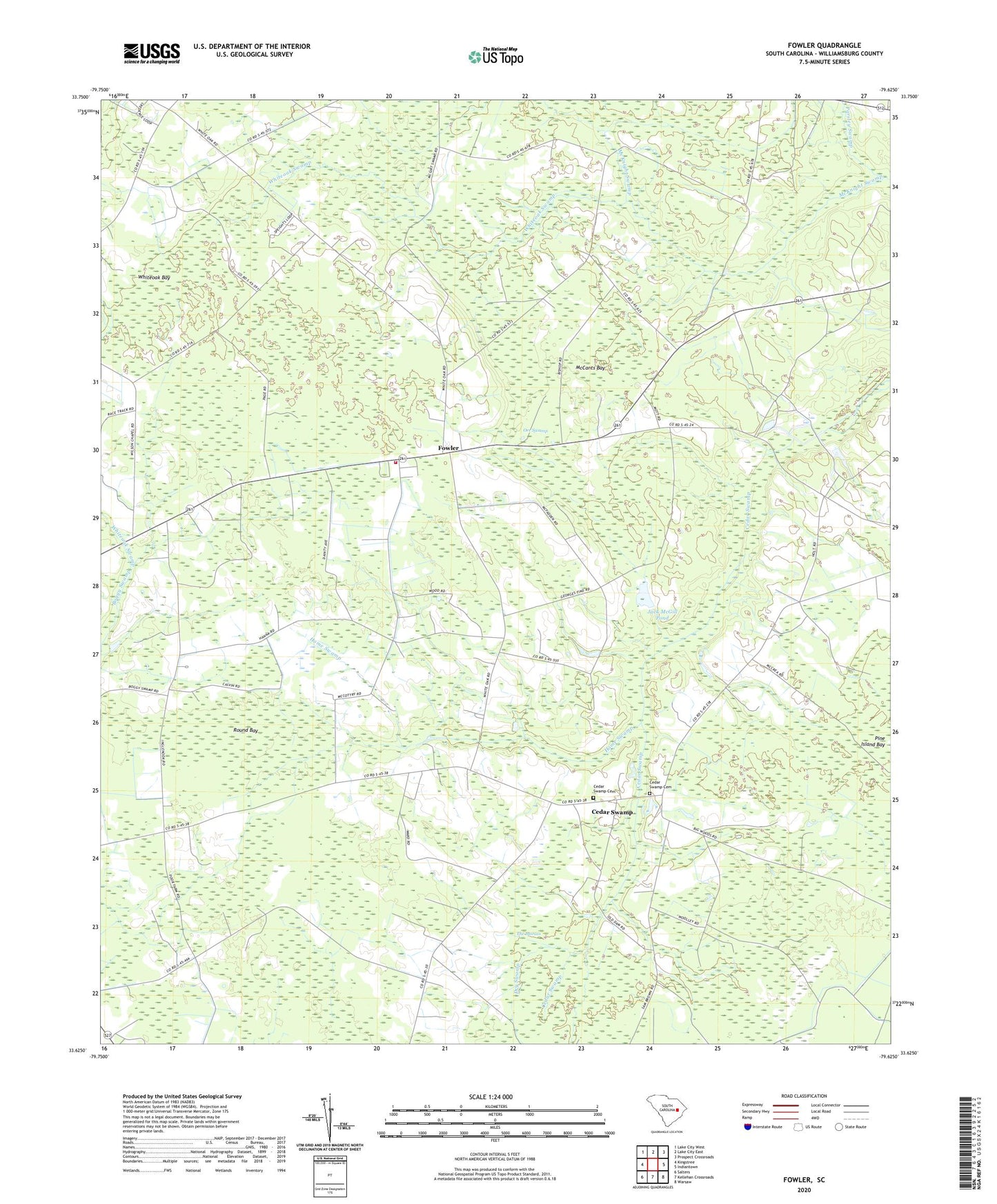
2020 topographic map quadrangle Fowler in the state of South Carolina. Scale: 1:24000. Based on the newly updated USGS 7.5' US Topo map series, this map is in the following counties: Williamsburg. The map contains contour data, water features, and other items you are used to seeing on USGS maps, but also has updated roads and other features. This is the next generation of topographic maps. Printed on high-quality waterproof paper with UV fade-resistant inks.
Quads adjacent to this one:
West: Kingstree
Northwest: Lake City West
North: Lake City East
Northeast: Prospect Crossroads
East: Indiantown
Southeast: Warsaw
South: Kellehan Crossroads
Southwest: Salters
Contains the following named places: Beulah Church, Beulah School, Cedar Grove Church, Cedar Swamp, Cedar Swamp Baptist Church, Cedar Swamp Cemetery, Cedar Swamp Methodist Church, Cedar Swamp School, Cooper Fire Tower, Dry Swamp, Elijah Church, Fowler, Fowler School, Hickory Hill Church, Hickory Hill School, Home Swamp, Inglenook School, Jack McGill Pond, Kennedyville Church, King School, McCants Bay, Orr Swamp, Pine Island Bay, Round Bay, Saint James Church, Saint Luke Church, Saint Michael Church, Saint Michael School, Saint Paul Church, Saint Pauls Church, South Carolina Noname 45004 D-3094 Dam, Spring Branch School, Whiteoak Bay, Whiteoak Swamp, Williamsburg County Fire Department Station 3