MyTopo
Kingstree South Carolina US Topo Map
Couldn't load pickup availability
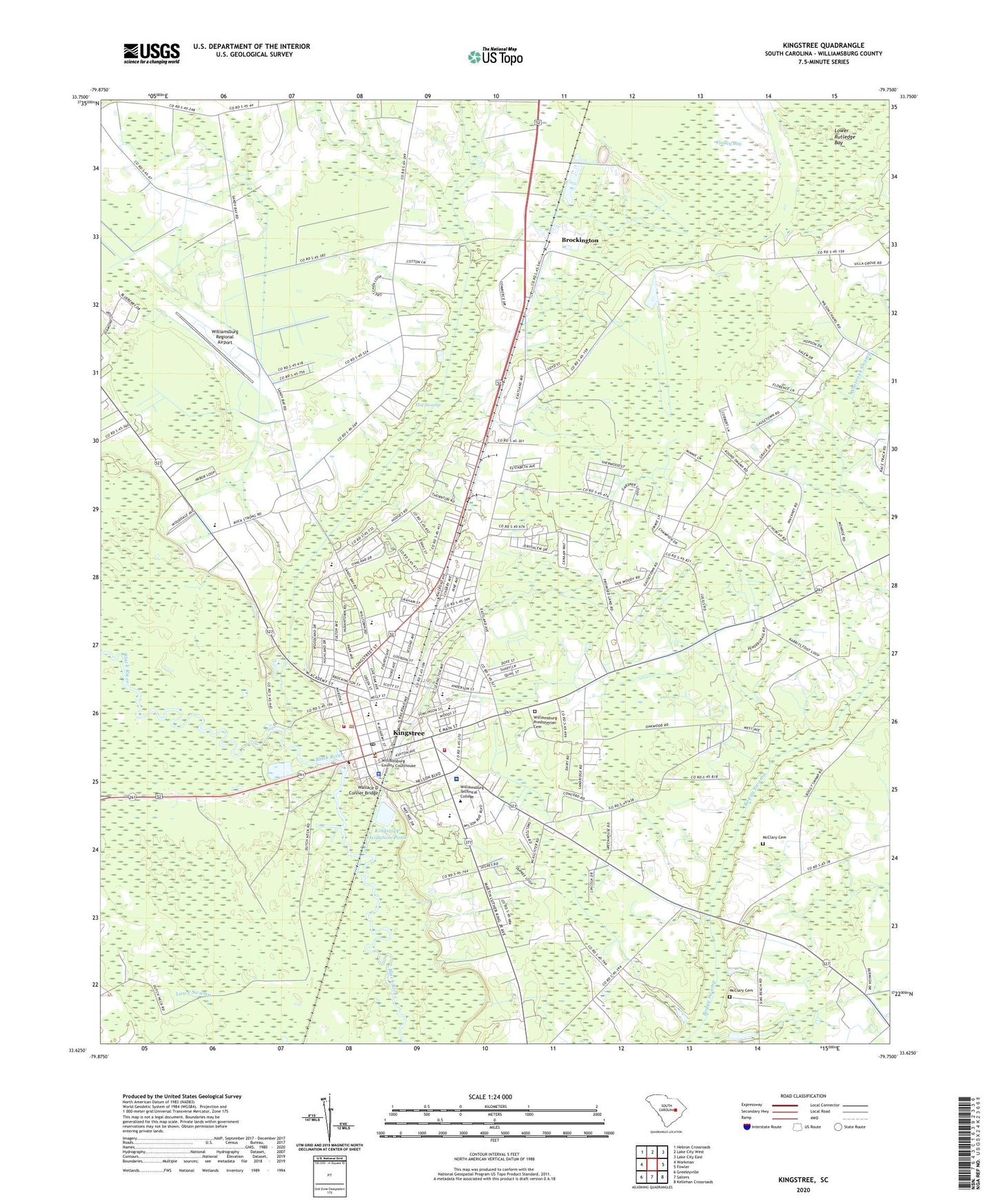
2024 topographic map quadrangle Kingstree in the state of South Carolina. Scale: 1:24000. Based on the newly updated USGS 7.5' US Topo map series, this map is in the following counties: Williamsburg. The map contains contour data, water features, and other items you are used to seeing on USGS maps, but also has updated roads and other features. This is the next generation of topographic maps. Printed on high-quality waterproof paper with UV fade-resistant inks.
Quads adjacent to this one:
West: Workman
Northwest: Hebron Crossroads
North: Lake City West
Northeast: Lake City East
East: Fowler
Southeast: Kellehan Crossroads
South: Salters
Southwest: Greeleyville
This map covers the same area as the classic USGS quad with code o33079f7.
Contains the following named places: Adams Life Link Ambulance, Allen Chapel, Allen Chapel School, Beulah School, Broad Swamp School, Brockington, Cane Branch Church, Cane Branch School, Church of God, Church of God and True Holiness, Evangelistic Temple Wat Church, Findley Bay, First Baptist Church, First Old Mount Zion African Methodist Episcopal Church, Flat Swamp, Greater Bethel African Methodist Episcopal Church, Holiness Church, Kelley Memorial Hospital, Kershaw Memorial Library, Kings Tree Plaza Shopping Center, Kingstree, Kingstree Baptist Church, Kingstree City Hall, Kingstree Division, Kingstree Elementary School, Kingstree Fire Department, Kingstree Historic District, Kingstree Junior High School, Kingstree Oxidation Pond, Kingstree Oxidation Pond Dam D-3086, Kingstree Police Department, Kingstree Post Office, Kingstree Presbyterian Church, Kingstree Senior High School, Kingstree Square Shopping Center, Kingstree Town Hall, Kingstree United Methodist Church, Kingstree Wastewater Treatment Plant, Lower Rutledge Bay, McClary Cemetery, Midway Church, Mount Moriah Church, Mount Zion Church, Mount Zion United Methodist Church, Nexsen, Saint Albans Episcopal Church, Saint Anns Catholic Church, Saint Johns Holiness Church, Saint Marys Holiness Church, Saint Pauls School, Sandridge Church, Sandy Bay Church, Sandy Bay School, Second Baptist Church, Shaw School, Siloam Baptist Church, South Carolina Highway Patrol, The King's Academy, The Living Word Christian School, Thomas School, Tomlinson High School, Town of Kingstree, W M Anderson Primary School, Wallace D Conner Bridge, Wayside School, WDKD-AM (Kingstree), Whiteoak School, Williamsburg County Courthouse, Williamsburg County Disaster Preparedness Agency, Williamsburg County Fire Department Headquarters, Williamsburg County Jail, Williamsburg County Library, Williamsburg County Sheriff's Department, Williamsburg County Sheriff's Office, Williamsburg Presbyterian Cemetery, Williamsburg Presbyterian Church, Williamsburg Regional Airport, Williamsburg Regional Hospital, Williamsburg Technical College, Williamsburg Technical College Library, Wilsons Chapel, WKSP-AM (Kingstree), Woodland Acres, WWKT-FM (Kingstree), ZIP Code: 29556