MyTopo
Georgetown North South Carolina US Topo Map
Couldn't load pickup availability
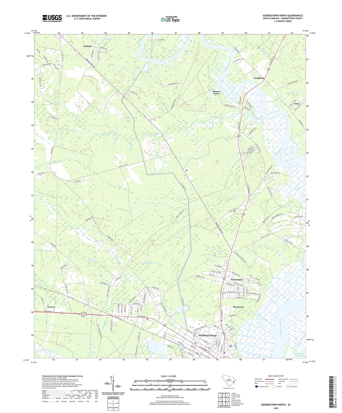
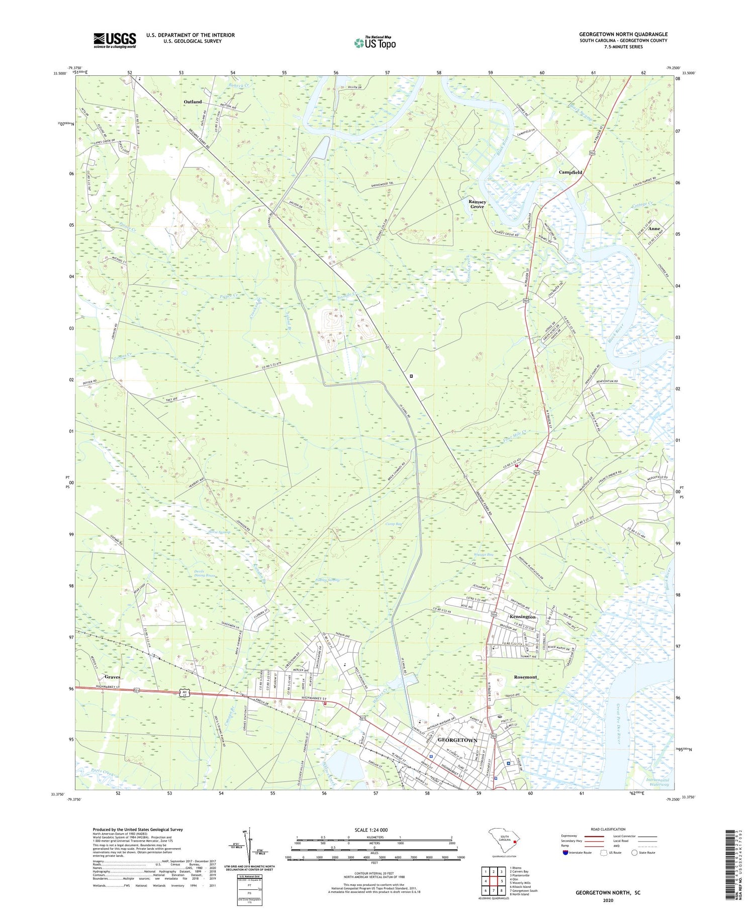
2020 topographic map quadrangle Georgetown North in the state of South Carolina. Scale: 1:24000. Based on the newly updated USGS 7.5' US Topo map series, this map is in the following counties: Georgetown. The map contains contour data, water features, and other items you are used to seeing on USGS maps, but also has updated roads and other features. This is the next generation of topographic maps. Printed on high-quality waterproof paper with UV fade-resistant inks.
Quads adjacent to this one:
West: Olin
Northwest: Rhems
North: Carvers Bay
Northeast: Plantersville
East: Waverly Mills
Southeast: North Island
South: Georgetown South
Southwest: Kilsock Island
Contains the following named places: Anne, Arnett African Methodist Episcopal Church, Baruchs Arts Center, Beneventum Plantation, Boheck Creek, Brown's Ferry Elementary School, Bynum Education Center, Calvary Original Free Will Baptist School, Camp Bay, Campfield, Caring Cross Ferry, Colonial Estates, Cottage Creek, Country Club Estates, Crooked Branch, Dans Creek Church, Dans Creek School, Devils Dining Room, Eastside Free Will Baptist Church of Pentecost, Four Mile Creek, Friendship Church, Georgetown, Georgetown Career Center, Georgetown City Hall, Georgetown County, Georgetown County Detention Center, Georgetown County Emergency Management Division, Georgetown County Fire Department Station 10, Georgetown County Sheriff's Office, Georgetown Division, Georgetown Fire Department Station 10, Georgetown Fire Department Station 11, Georgetown Golf and Country Club, Georgetown High School, Georgetown Middle School, Georgetown Police Department, Georgetown Presbyterian Church, Georgetown School District Office, Georgetown Senior Center, Georgetown Sewage One Pond Dam D-3588, Georgetown Sewage Two Pond Dam D-3589, Georgetown Square Shopping Center, Graves, Graves Southern Baptist Church, Graves Station School, Greenfield Plantation, Greens Creek, Horse Swamp, Inland Branch, Johnson Chapel, Johnson Corner, Kensington, Kensington Elementary School, Kensington Park, Kensington Plantation, Lakewood Baptist Church, Lane Creek School, Lanes Creek, Lark Hill Plantation, Mansfield Plantation, McDonald Elementary School, McDonald Park, Morningside of Georgetown, Mount Sinai Church, Mount Zion Church, Oatland, Pawley Swamp, Peru School, Plantation Plaza, Prince Creek, Pringle Heights, Ramsey Grove, Rosemont, Rosemont School, Saint Paul Church, Sixmile Creek, South Carolina Highway Patrol Troop 5 Post C, Springwood Plantation, Tidelands Georgetown Memorial Hospital, Tyson Look Out Tower, Waccamaw Endoscopy Center, Waterfored Estates, Wayside Wayside Park, WGTN-AM (Georgetown), William C Bynum School, Windsor Plantation, Winyah Village Shopping Center, Wraggs Bay, ZIP Code: 29440