MyTopo
North Island South Carolina US Topo Map
Couldn't load pickup availability
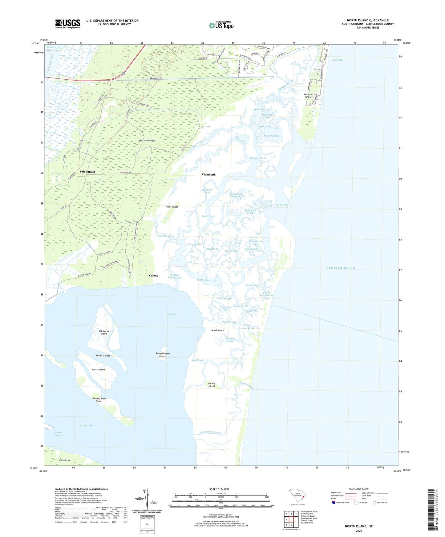
2024 topographic map quadrangle North Island in the state of South Carolina. Scale: 1:24000. Based on the newly updated USGS 7.5' US Topo map series, this map is in the following counties: Georgetown. The map contains contour data, water features, and other items you are used to seeing on USGS maps, but also has updated roads and other features. This is the next generation of topographic maps. Printed on high-quality waterproof paper with UV fade-resistant inks.
Quads adjacent to this one:
West: Georgetown South
Northwest: Georgetown North
North: Waverly Mills
Northeast: Magnolia Beach
South: Santee Point
Southwest: Minim Island
This map covers the same area as the classic USGS quad with code o33079c2.
Contains the following named places: Baruch-North Island Reserve, Bass Hole Bay, Bass Hole Creek, Bellefield Plantation, Big Marsh Island, Bly Creek, Bobs Garden Creek, Boor Creek, Bread and Butter Creek, Caines, Clambank, Clambank Creek, Clifton Plantation, Collins Island, Cooks Creek, Cottonpatch Creek, Crab Haul Creek, Cutoff Creek, De Bordieu, De Bordieu Colony, Debidue Creek, Debidue Island, DeBordieu, DeBordieu Colony Census Designated Place, Denny Corner, Dividing Creek, Double Prong Creek, Duck Creek, Friendfield, Friendship Plantation, Friendship Presbyterian Church, Goat Island, Haulover Creek, Hobcaw Barony Nature Center, Jones Creek, Little Jones Creek, Little Wood Creek, Malady Bush Island, Marsh Island, Marsh Islands, Mud Bay, Mud Creek, Nancy Creek, No Mans Friend Creek, Noble Slough, North Inlet, North Island, Old Man Creek, Oyster Bay, Perry Creek, Pumpkinseed Islands, Sawmill Creek, Sea Creek Bay, Sign Creek, Sixty Bass Creek, Town Creek, Waccamaw Neck, Winyah Bay, Wood Creek, Yahany Inlet