MyTopo
Carvers Bay South Carolina US Topo Map
Couldn't load pickup availability
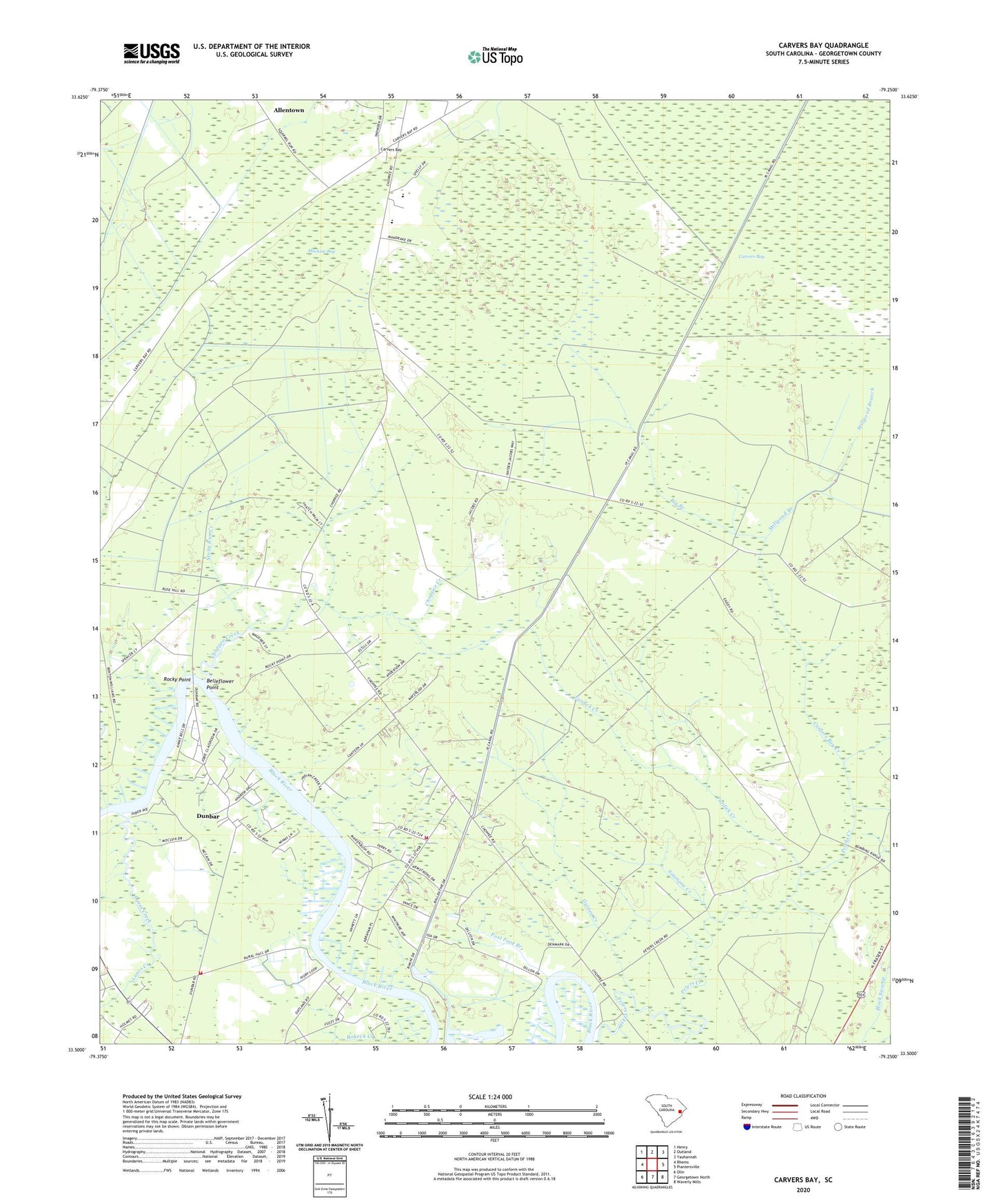
2024 topographic map quadrangle Carvers Bay in the state of South Carolina. Scale: 1:24000. Based on the newly updated USGS 7.5' US Topo map series, this map is in the following counties: Georgetown. The map contains contour data, water features, and other items you are used to seeing on USGS maps, but also has updated roads and other features. This is the next generation of topographic maps. Printed on high-quality waterproof paper with UV fade-resistant inks.
Quads adjacent to this one:
West: Rhems
Northwest: Henry
North: Outland
Northeast: Yauhannah
East: Plantersville
Southeast: Waverly Mills
South: Georgetown North
Southwest: Olin
This map covers the same area as the classic USGS quad with code o33079e3.
Contains the following named places: Annie Village Church, Annie Village School, Annieville, Belleflower Point, Big Branch, Black River House One Pond Dam D-3591, Black River House Two Pond Dam D-3590, Black Swamp, Carvers Bay, Carvers Bay Creek, Carvers Bay High School, Carvers Bay Middle School, Choppee Creek, Choppee High School, Choppee Middle School, Dunbar, Dunbar Census Designated Place, Dunbar Landing, Dunbar School, Fardick Creek, Georgetown Fire Department Station 12, Georgetown Fire Department Station 3, Guinea Creek, Hopewell Church, Lanes Creek, Machine Bay, Millpond Branch, New Zion Church, Peters Creek, Post Foot, Post Foot Branch, Post Foot Landing, Rock Point Park, Rocky Point, Roland Hall Plantation, Saint Luke Senior Center, Saint Marys Church, Simmons Creek, Stony Run Creek