MyTopo
Plantersville South Carolina US Topo Map
Couldn't load pickup availability
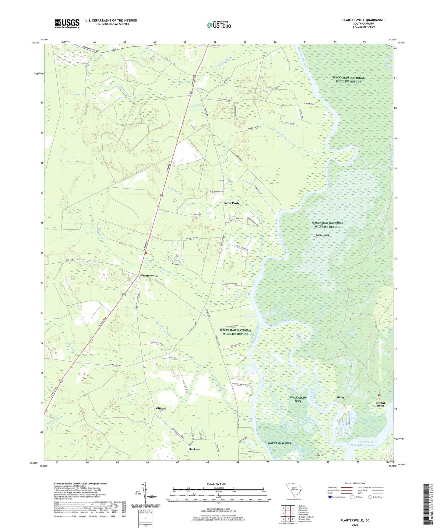
2024 topographic map quadrangle Plantersville in the state of South Carolina. Scale: 1:24000. Based on the newly updated USGS 7.5' US Topo map series, this map is in the following counties: Georgetown, Horry. The map contains contour data, water features, and other items you are used to seeing on USGS maps, but also has updated roads and other features. This is the next generation of topographic maps. Printed on high-quality waterproof paper with UV fade-resistant inks.
Quads adjacent to this one:
West: Carvers Bay
Northwest: Outland
North: Yauhannah
Northeast: Bucksville
East: Brookgreen
Southeast: Magnolia Beach
South: Waverly Mills
Southwest: Georgetown North
This map covers the same area as the classic USGS quad with code o33079e2.
Contains the following named places: Bates Hill Plantation, Belin, Belle Reve Plantation, Birdfield School, Broton Lake, Bull Island, Chapel Creek, Chicora Wood Plantation, Cooter Creek, Cypress Creek, Exchange Plantation, Georgetown County Rural Fire Department Station 6, Georgetown Fire Department Station 8, Gilliard, Glenmore Plantation, Guendalose Creek, Hasty Point Plantation, Holly Grove Plantation, Horseshoe Lake, Indian Lake, Joe Bay, Lower Topsaw Landing, Mount Arena Plantation, Mount Carmel Church, Mount Rena, Mount Tabor, Mount Tabor Church, Mount Zion Church, Myersville School, New Bethel Baptist Church, Pawleys Creek, Plantersville, Plantersville Division, Plantersville Elementary School, Plantersville Senior Center, Pole Castle Branch, Prince Frederick Chapel, Prince Frederick Church, Rose Bank Plantation, Ruinsville, Ruinville Plantation, Saint Mark School, Saint Pauls, Saint Pauls Branch, Sandy Island, Sandy Island School, Thoroughfare Creek, Upper Topsaw Landing, Waccamaw National Wildlife Refuge, ZIP Code: 29585