
MyTopo
Hendersonville South Carolina US Topo Map
Couldn't load pickup availability
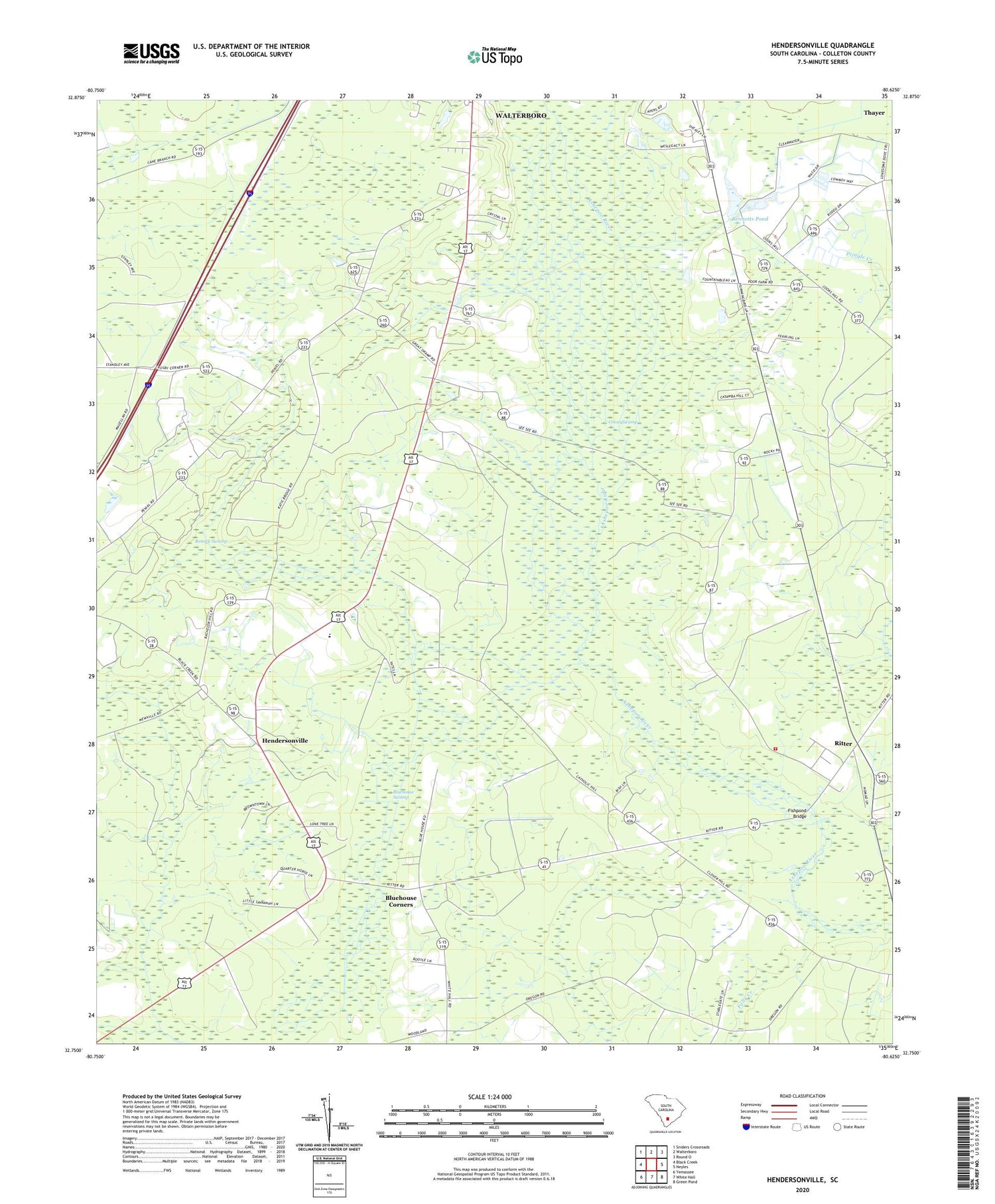
2020 topographic map quadrangle Hendersonville in the state of South Carolina. Scale: 1:24000. Based on the newly updated USGS 7.5' US Topo map series, this map is in the following counties: Colleton. The map contains contour data, water features, and other items you are used to seeing on USGS maps, but also has updated roads and other features. This is the next generation of topographic maps. Printed on high-quality waterproof paper with UV fade-resistant inks.
Quads adjacent to this one:
West: Black Creek
Northwest: Sniders Crossroads
North: Walterboro
Northeast: Round O
East: Neyles
Southeast: Green Pond
South: White Hall
Southwest: Yemassee
Contains the following named places: Abraham Church, Bachelor Hill Church, Bennetts Pond, Bennetts Pond Dam D-0643, Bluehouse Corners, Bluehouse Swamp, Catholic Hill, Catholic Hill Church, Catholic Hill School, Colleton County, Colleton Fire Department Station 22, Dogwood Hills Country Club, Ebenezer School, Fishpond Bridge, Great Swamp, Great Swamp Church, Hendersonville, Hendersonville Baptist Church, Hendersonville Elementary School, Hendersonville School, Pemel School, Peniel Church, Peniel School, Piney Grove Church, Remick Swamp, Ritter, Ritter School, Thayer


