MyTopo
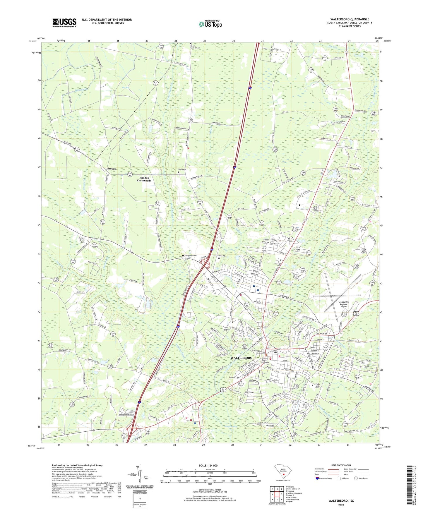
Walterboro South Carolina US Topo Map
Couldn't load pickup availability
2024 topographic map quadrangle Walterboro in the state of South Carolina. Scale: 1:24000. Based on the newly updated USGS 7.5' US Topo map series, this map is in the following counties: Colleton. The map contains contour data, water features, and other items you are used to seeing on USGS maps, but also has updated roads and other features. This is the next generation of topographic maps. Printed on high-quality waterproof paper with UV fade-resistant inks.
Quads adjacent to this one:
West: Sniders Crossroads
Northwest: Williams
North: Saint George SW
Northeast: Canadys
East: Round O
Southeast: Neyles
South: Hendersonville
Southwest: Black Creek
This map covers the same area as the classic USGS quad with code o32080h6.
Contains the following named places: Bethel Presbyterian Church, Bethel United Methodist Church, Big Bay, Black Street Elementary School, Church of God and Prophecy, City of Walterboro, Colleton Ambulatory Surgery Center, Colleton Annex Learning Center, Colleton County Courthouse, Colleton County Education Center, Colleton County Emergency Preparedness Agency, Colleton County High School, Colleton County Memorial Library, Colleton County Sheriff's Office, Colleton Elementary School, Colleton Fire Department Headquarters, Colleton Fire Department Station 1, Colleton Fire Department Station 19, Colleton Fire Department Station 24, Colleton Fire Department Station 26, Colleton Fire Department Station 27, Colleton Medical Center, Colleton Middle School, Colleton Museum, Colleton Place, Colleton Square Shopping Center, Cypress Pond Church, Doctors Creek, Doctors Creek Cemetery, Doctors Creek Church, Edgewood Baptist Church, Elbow School, Evergreen Cemetery, Evergreen Church, First Baptist Church, First Baptist Kindergarten, First Christian Church, Forest Circle Middle School, Forest Hills Elementary School, Good Shepherd Lutheran Church, Grace Cemetery, Grace Church, Greater Saint James Holiness Church, Hampton Street Elementary School, Hickory Valley Historic District, Ireland Creek, Ivanhoe Shopping Center, Jones Swamp Creek, Jones Swamp Holiness Church, Liveoak Cemetery, Lowcountry Regional Airport, Millers Ford, Mount Carmel Cemetery, Mount Carmel School, Oak Grove School, Perry Creek, Rhodes Crossroads, Roadside School, Saint Judes Episcopal Church, Sand Hill Baptist Church, Slave Relic Museum, Smokes Corners, South Carolina Highway Patrol Troop 6 Post B, Stokes, Stokes School, Stone Branch School, The Church of Jesus Christ of Latter Day Saints, Thunderbolt Career and Technology Center, University of South Carolina Salkehatchie - Walterboro Campus, University of South Carolina Salkehatchie East Gymnasium, University of South Carolina Salkehatchie East Liberal Arts Building, University of South Carolina Salkehatchie East Library Building, University of South Carolina Salkehatchie East Main Building, University of South Carolina Salkehatchie East Science Building, WALD-FM (Walterboro), Walterboro, Walterboro Army Air Field, Walterboro Division, Walterboro Fire Department, Walterboro Fire Department Substation, Walterboro Historic District, Walterboro Plaza Shopping Center, Walterboro Police Department, Walterboro Post Office, Walterboro Wastewater Treatment Facility, Wesley United Methodist Church, Wolf Creek, Wolf Creek School, WPOG-AM (Walterboro), Zion Baptist Church, Zion Cemetery, ZIP Code: 29488


