MyTopo
Black Creek South Carolina US Topo Map
Couldn't load pickup availability
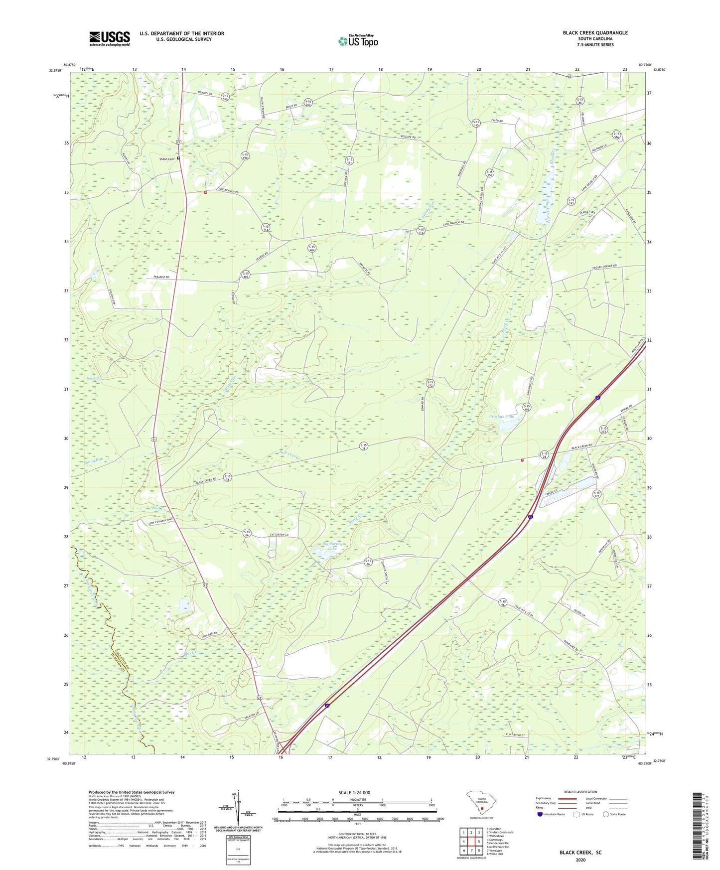
2024 topographic map quadrangle Black Creek in the state of South Carolina. Scale: 1:24000. Based on the newly updated USGS 7.5' US Topo map series, this map is in the following counties: Colleton, Hampton. The map contains contour data, water features, and other items you are used to seeing on USGS maps, but also has updated roads and other features. This is the next generation of topographic maps. Printed on high-quality waterproof paper with UV fade-resistant inks.
Quads adjacent to this one:
West: Cummings
Northwest: Islandton
North: Sniders Crossroads
Northeast: Walterboro
East: Hendersonville
Southeast: White Hall
South: Yemassee
Southwest: McPhersonville
This map covers the same area as the classic USGS quad with code o32080g7.
Contains the following named places: Bertha School, Big Gate School, Big Survey Lake, Big Survey Lake Dam D-2547, Black Creek, Black Creek Church, Bull Creek, Cane Branch Lookout Tower, Cane Branch School, Caney Branch School, Cavern Branch School, Colleton Fire Department Station 29, Colleton Fire Department Station 8, Crosbys Pond, Crosbys Pond Dam D-2546, Fire Hill School, Hendersonville Division, Heyward Church, Heyward School, Marys Church, New Hope School, Newville School, Polly Bottom School, Sandy Run, Shiloh Cemetery, Shiloh Church