MyTopo
Round O South Carolina US Topo Map
Couldn't load pickup availability
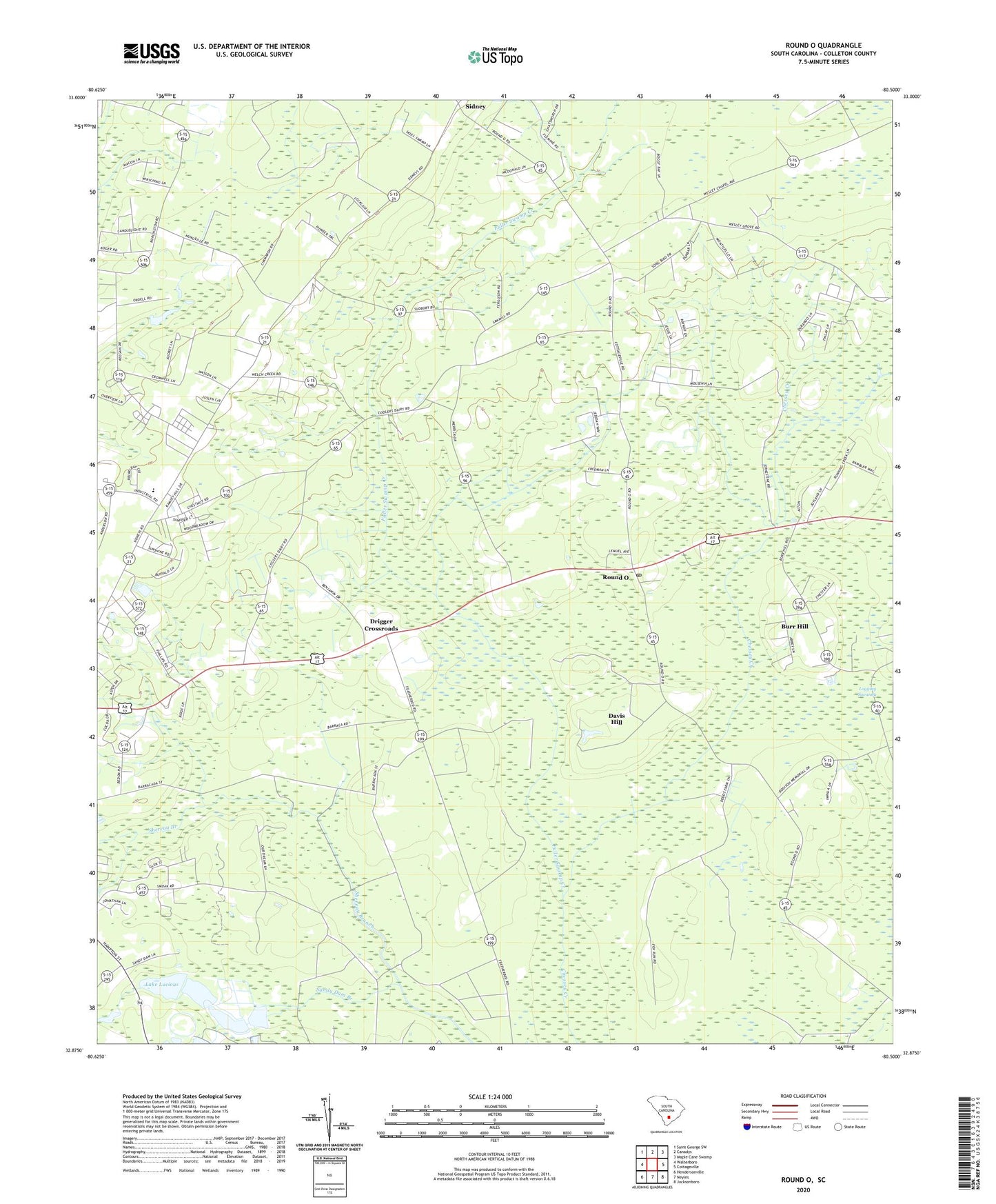
2024 topographic map quadrangle Round O in the state of South Carolina. Scale: 1:24000. Based on the newly updated USGS 7.5' US Topo map series, this map is in the following counties: Colleton. The map contains contour data, water features, and other items you are used to seeing on USGS maps, but also has updated roads and other features. This is the next generation of topographic maps. Printed on high-quality waterproof paper with UV fade-resistant inks.
Quads adjacent to this one:
West: Walterboro
Northwest: Saint George SW
North: Canadys
Northeast: Maple Cane Swamp
East: Cottageville
Southeast: Jacksonboro
South: Neyles
Southwest: Hendersonville
This map covers the same area as the classic USGS quad with code o32080h5.
Contains the following named places: Allen Creek, Bedons Baptist Church, Bedons School, Bethel Church, Bethlehem Church, Bethlehem School, Burr Hill, Burr Hill School, Calvary Church, Canaan Church, Davis Hill, Drigger Crossroads, Fishbourne Reservoir D-2386 Dam, Fishburne Plantation, Fuller School, Fuller Swamp Creek, Hall School, Hiotts, Holiness Tabernacle Church, Koger School, Lake Lucious, Little Rock School, Mount Sina Church, Northside Elementary School, Old Bethel School, Peoples Church, Peoples School, Reservoir Pond, Round O, Round O Post Office, Sandy Dam Church, Shereau Branch, Sidney, Snipe School, South Carolina Noname 15007 D-2384 Dam, South Carolina Noname 15008 D-2385 Dam, Welch Green School, Wesley Church, Wesley School, ZIP Code: 29474