MyTopo
Joanna South Carolina US Topo Map
Couldn't load pickup availability
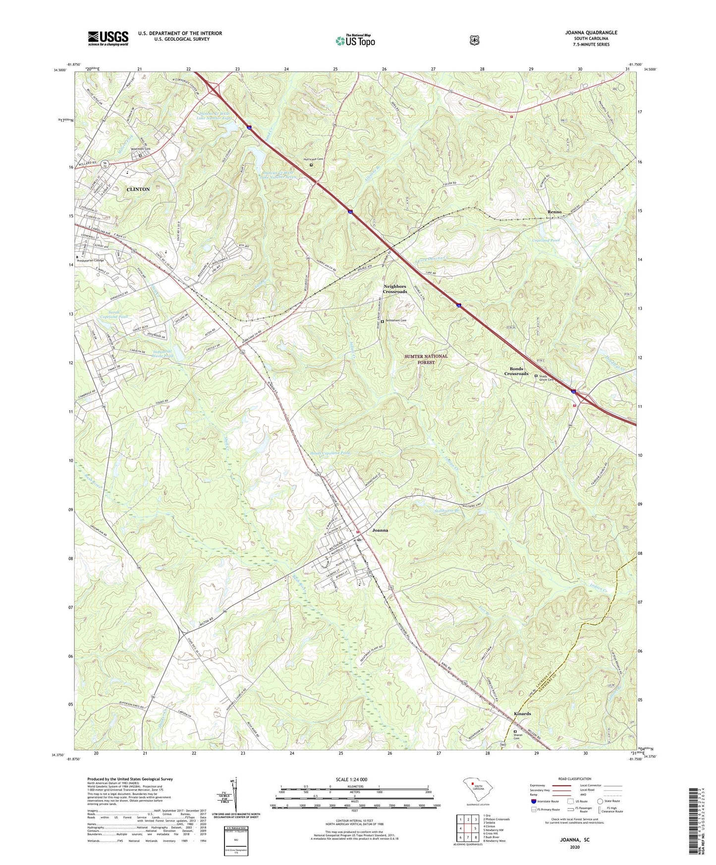
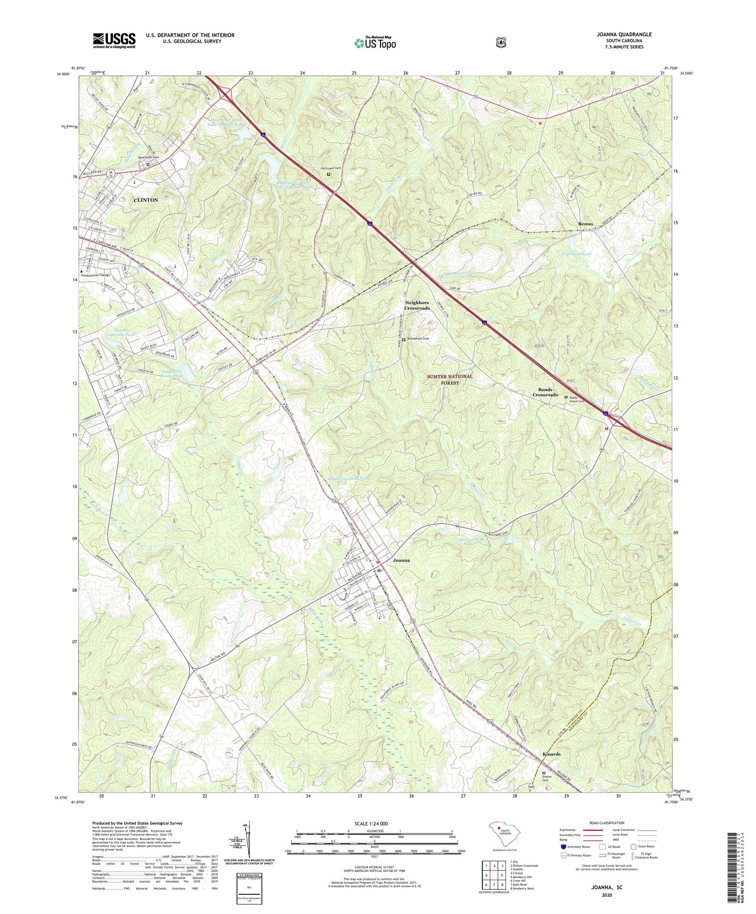
2020 topographic map quadrangle Joanna in the state of South Carolina. Scale: 1:24000. Based on the newly updated USGS 7.5' US Topo map series, this map is in the following counties: Laurens, Newberry. The map contains contour data, water features, and other items you are used to seeing on USGS maps, but also has updated roads and other features. This is the next generation of topographic maps. Printed on high-quality waterproof paper with UV fade-resistant inks.
Quads adjacent to this one:
West: Clinton
Northwest: Ora
North: Philson Crossroads
Northeast: Sedalia
East: Newberry NW
Southeast: Newberry West
South: Bush River
Southwest: Cross Hill
Contains the following named places: All Saints Episcopal Church, Assembly of God Church, Bethlehem Cemetery, Bethlehem Church, Bonds Crossroads, Bonds Crossroads Pentecostal Holiness CHurch, City of Clinton, Clinton High School, Clinton Industrial Park Dam D-3000, Community Cash Shopping Plaza, Copeland Pond, Copeland Pond Dam D-3006, Copeland School, Davidson Street Baptist Church, Dover, Duncan Creek WCD Dam Number Eight, Duncan Creek WCD Dam Number Seven D-3005, Duncan Creek WCD Lake Number Eight, Duncan Creek WCD Lake Number Seven, Eastside Elementary School, Elze Church, Epworth United Methodist Church, First Assembly of God Church, First Baptist Church, First Presbyterian Church, Florida Street School, Fort Branch, Heath Copeland Pond, Heath Copeland Pond Dam D-3001, Hopewell Church, Hopewell Community House, Hurricane Cemetery, Hurricane Church, Hurricane School, Industrial Waste Pond, Joanna, Joanna Census Designated Place, Joanna Church of God, Joanna Division, Joanna Fire Department Station 1, Joanna Fire Department Station 3 - Shady Grove, Kinards, Kinards School, Laurens County Emergency Medical Services Station 6, Laurens County Fire Department Renno Station 1, Mount Moriah Church, Mount Zion Church, Mount Zion School, Neighbors Crossroads, Pine Haven Park, Renno, Renno School, Rosemont Cemetery, Saint Boniface Catholic Church, Sarah Copeland Pond, Sarah Copeland Pond Dam D-2998, Sardis Methodist Church, Shady Grove Cemetery, Shady Grove Church, Shady Grove School, Sharon Cemetery, Sharon Methodist Church, Shell Creek, Smallwood, Stillhouse Branch, Tip Top Hunt Camp, Tip Top Lookout, Tip Top Lookout Tower, Wadsworth Number 2 School, Wadsworth School, Webb Memorial Pentecostal Church, Whitten Center, Whitten Village Training School, Woodson School, ZIP Codes: 29325, 29351