MyTopo
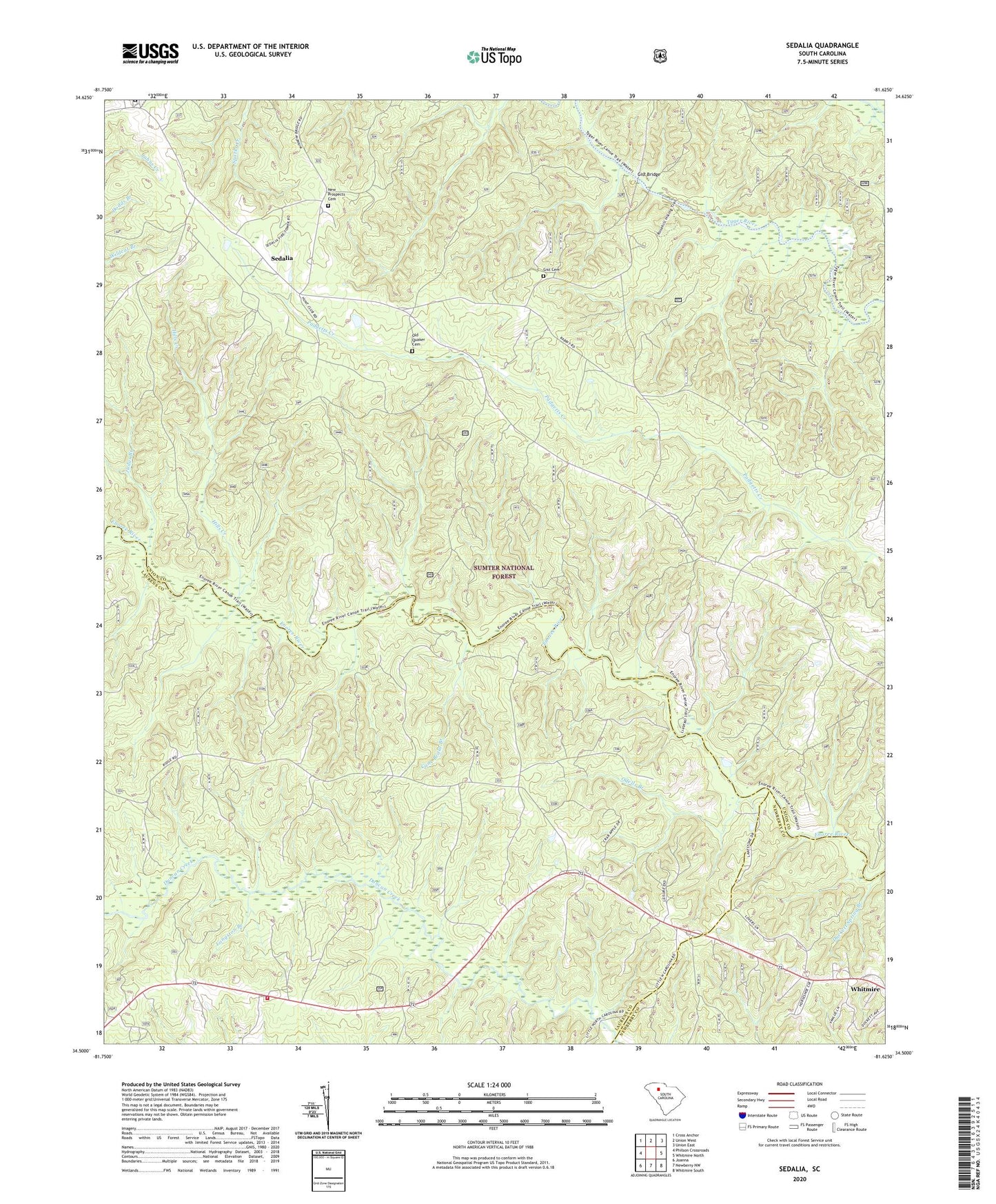
Sedalia South Carolina US Topo Map
Couldn't load pickup availability
Also explore the Sedalia Forest Service Topo of this same quad for updated USFS data
2024 topographic map quadrangle Sedalia in the state of South Carolina. Scale: 1:24000. Based on the newly updated USGS 7.5' US Topo map series, this map is in the following counties: Union, Laurens, Newberry. The map contains contour data, water features, and other items you are used to seeing on USGS maps, but also has updated roads and other features. This is the next generation of topographic maps. Printed on high-quality waterproof paper with UV fade-resistant inks.
Quads adjacent to this one:
West: Philson Crossroads
Northwest: Cross Anchor
North: Union West
Northeast: Union East
East: Whitmire North
Southeast: Whitmire South
South: Newberry NW
Southwest: Joanna
This map covers the same area as the classic USGS quad with code o34081e6.
Contains the following named places: Adams Ford, Black Buck Hunt Camp, Browns Ferry, Canaan School, Cane Brake Branch, Carver School, Cross Keys Division, Duckett Spring Branch, Enoree Presbyterian Church, Flint Hill Church, Galilee Baptist Church, Gist Bridge, Gist Bridge Boat Ramp, Gist Cemetery, Gist Mill, Hickory Nut Hunt Camp, Hills Creek, Jones Ferry, Judas Branch, Knights Mill, Langston Branch, Laurens County Fire Department Renno Station 2, New Hope Church, New Hope School, New Prospects Cemetery, Odell Church, Odells Branch, Odels Ford, Old Quaker Cemetery, Padgetts Creek Baptist Church, Quaker Church, Ridge Road Hunt Camp, Rose Hill Plantation, Rose Hill State Park, Sedalia, Sedalia Lookout Tower, Sedalia School, Sedalia Tower Hunt Camp, Shady Grove, Spring Hill Church, Spring Hill School, Wrights Mill