MyTopo
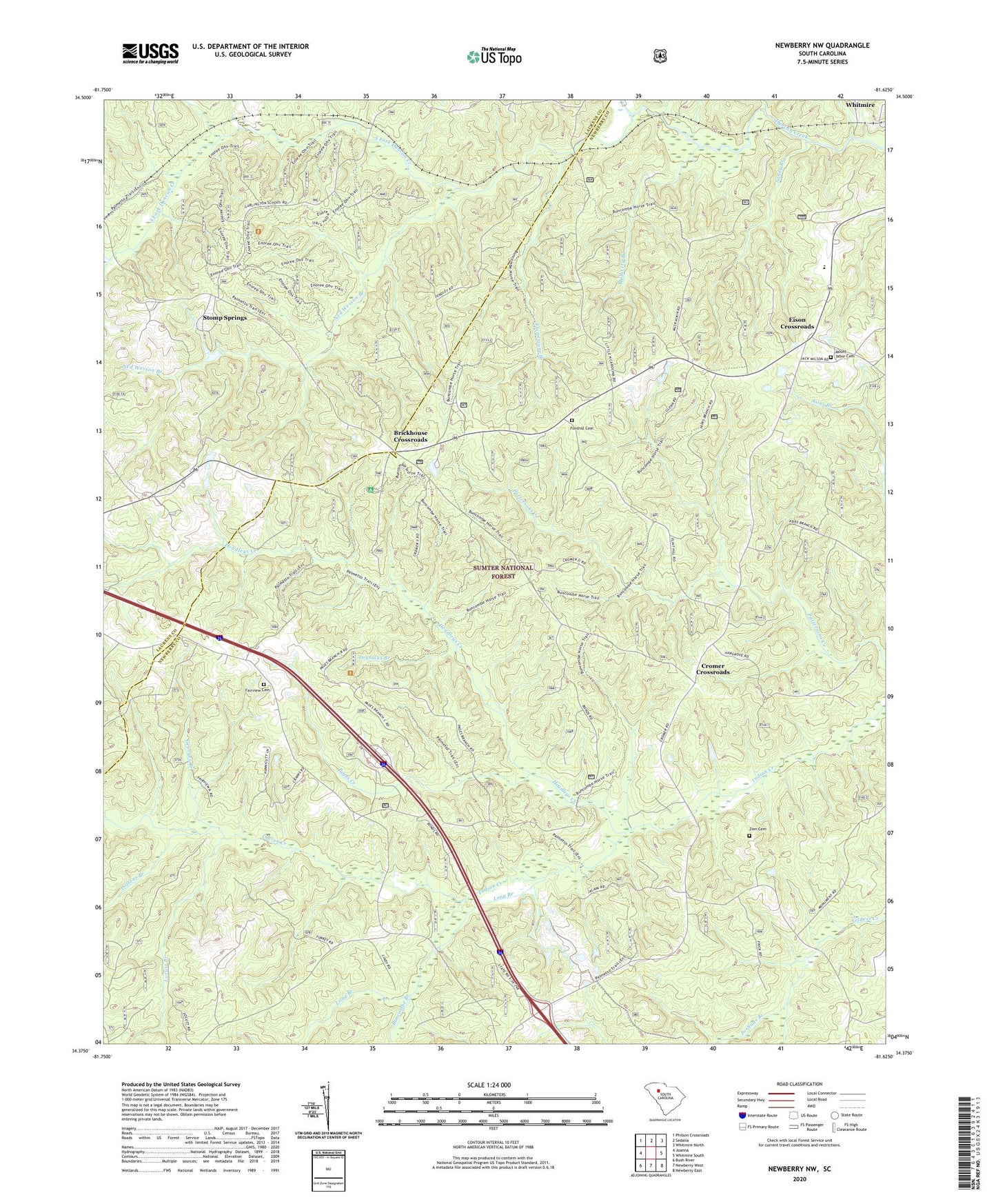
Newberry NW South Carolina US Topo Map
Couldn't load pickup availability
Also explore the Newberry NW Forest Service Topo of this same quad for updated USFS data
2024 topographic map quadrangle Newberry NW in the state of South Carolina. Scale: 1:24000. Based on the newly updated USGS 7.5' US Topo map series, this map is in the following counties: Newberry, Laurens. The map contains contour data, water features, and other items you are used to seeing on USGS maps, but also has updated roads and other features. This is the next generation of topographic maps. Printed on high-quality waterproof paper with UV fade-resistant inks.
Quads adjacent to this one:
West: Joanna
Northwest: Philson Crossroads
North: Sedalia
Northeast: Whitmire North
East: Whitmire South
Southeast: Newberry East
South: Newberry West
Southwest: Bush River
This map covers the same area as the classic USGS quad with code o34081d6.
Contains the following named places: Brick House Campground, Brickhouse Crossroads, Buncombe Branch, Cedar Grove Church, Cedar Grove School, Cromer Crossroads, Cromer School, Drysacks Branch, Eison Crossroads, Fairview Cemetery, Fairview Church, Flannigans Branch, Flint Hill Church, Flint Hill School, Flinthill Cemetery, Garlington, Garlington School, Georges Branch, Gilliam Chapel School, Headleys Creek, Joshuas Branch, Locust Branch, Loftons Branch, Long Branch, Mount Table School, Mount Tabor Cemetery, Mount Tabor Church, Mulberry Branch, Ned Wesson Branch, Peges Creek, Sandy Branch, South Fork Duncan Creek, Stomp Springs, Tabernacle Church, Tabernacle School, Zion Cemetery, Zion Church