MyTopo
Kilsock Island South Carolina US Topo Map
Couldn't load pickup availability
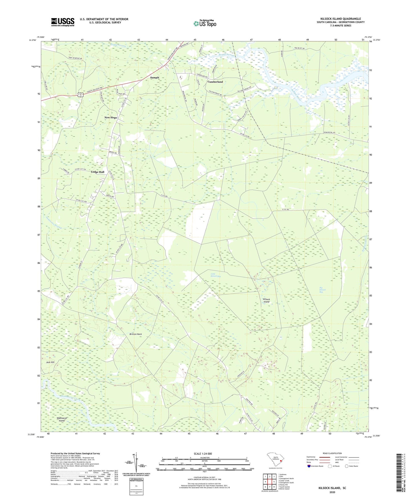
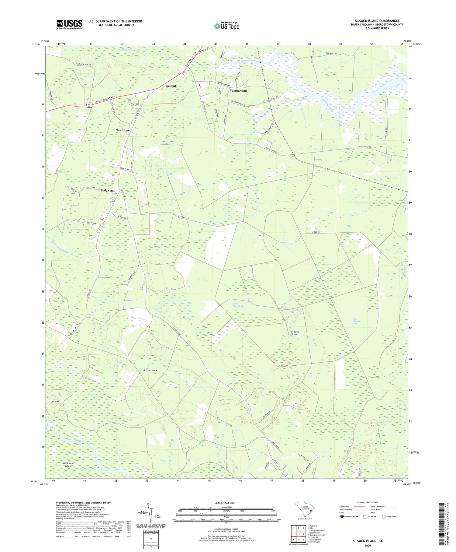
2020 topographic map quadrangle Kilsock Island in the state of South Carolina. Scale: 1:24000. Based on the newly updated USGS 7.5' US Topo map series, this map is in the following counties: Georgetown. The map contains contour data, water features, and other items you are used to seeing on USGS maps, but also has updated roads and other features. This is the next generation of topographic maps. Printed on high-quality waterproof paper with UV fade-resistant inks.
Quads adjacent to this one:
West: Cedar Creek
Northwest: Andrews
North: Olin
Northeast: Georgetown North
East: Georgetown South
Southeast: Minim Island
South: South Santee
Southwest: Honey Hill
Contains the following named places: Big Kilsock Bay, Boggy Swamp, Britt Branch, Britton Neck, Cedar Creek, Cumberland, Cumberland Church, Cumberland School, Foster Corner, Friendship Church, Kilsock Island, Little Kilsock Bay, Lodge Hall, New Hope, New Hope Church, New Hope School, Saint Paul Church, Sampit, Sampit Church, Sampit Elementary School, Sampit Lookout Tower, Sampit Park, Spring Gully, Woodstock Plantation