MyTopo
South Santee South Carolina US Topo Map
Couldn't load pickup availability
Also explore the South Santee Forest Service Topo of this same quad for updated USFS data
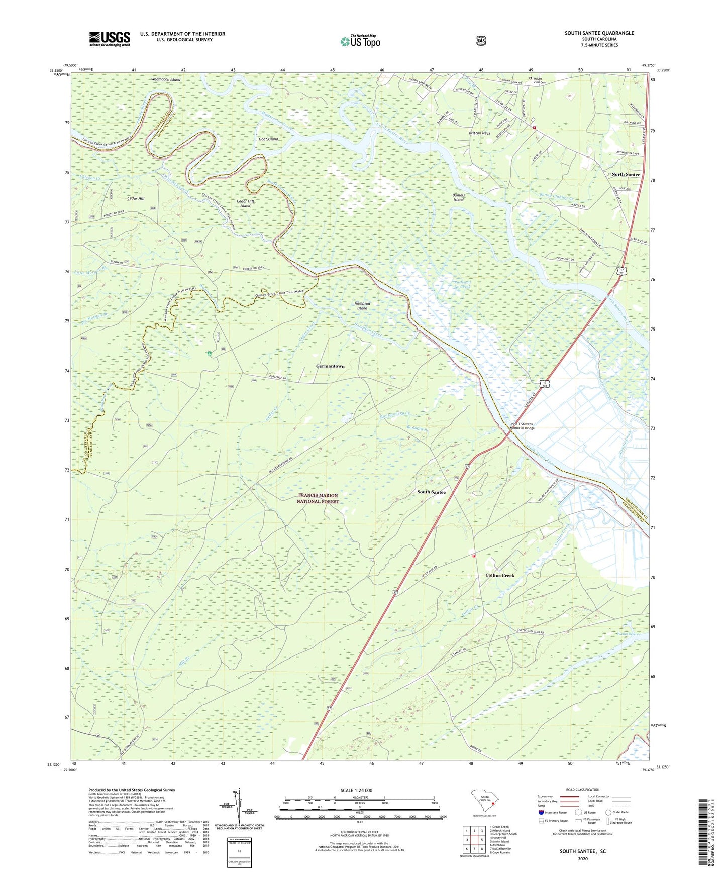
2024 topographic map quadrangle South Santee in the state of South Carolina. Scale: 1:24000. Based on the newly updated USGS 7.5' US Topo map series, this map is in the following counties: Charleston, Georgetown, Berkeley. The map contains contour data, water features, and other items you are used to seeing on USGS maps, but also has updated roads and other features. This is the next generation of topographic maps. Printed on high-quality waterproof paper with UV fade-resistant inks.
Quads adjacent to this one:
West: Honey Hill
Northwest: Cedar Creek
North: Kilsock Island
Northeast: Georgetown South
East: Minim Island
Southeast: Cape Romain
South: McClellanville
Southwest: Awendaw
This map covers the same area as the classic USGS quad with code o33079b4.
Contains the following named places: Awendaw Fire District Station 6, Big Morgan Branch, Bonny Clabber Creek, Bouman Branch, Cedar Creek, Cedar Hill, Cedar Hill Island, Chicken Creek, Collins Creek, Crow Hill, Daniels Island, Elmwood Hunt Camp, Fairfield Plantation, Fawn Hill School, Garfish Creek, Georgetown Fire Department Station 2, Germantown, Germantown Church, Germanville School, Goat Island, Hampton Creek, Hampton Island, Hampton Plantation, Hampton Plantation State Park, Harrietta Plantation, Hopsewee Plantation, John T Stevens Memorial Bridge, Little Morgan Branch, Lynches Ferry, Mazycks Ferry, Montgomery Creek, Moss Swamp School, Mount Zion Cemetery, Mount Zion Church, Mount Zion School, North Santee, Pole Branch, Push and Go Creek, Saint James Church, Sampit-North Santee Division, Santee Park, Santee River, Santee School, Singleton African Methodist Episcopal Church, South Santee, Wadmacon Creek, Wambaw Corner, Wambaw Creek, Washo Reserve, Water Horn Ferry, Waterhorn Historical Area, Wedge Plantation