MyTopo
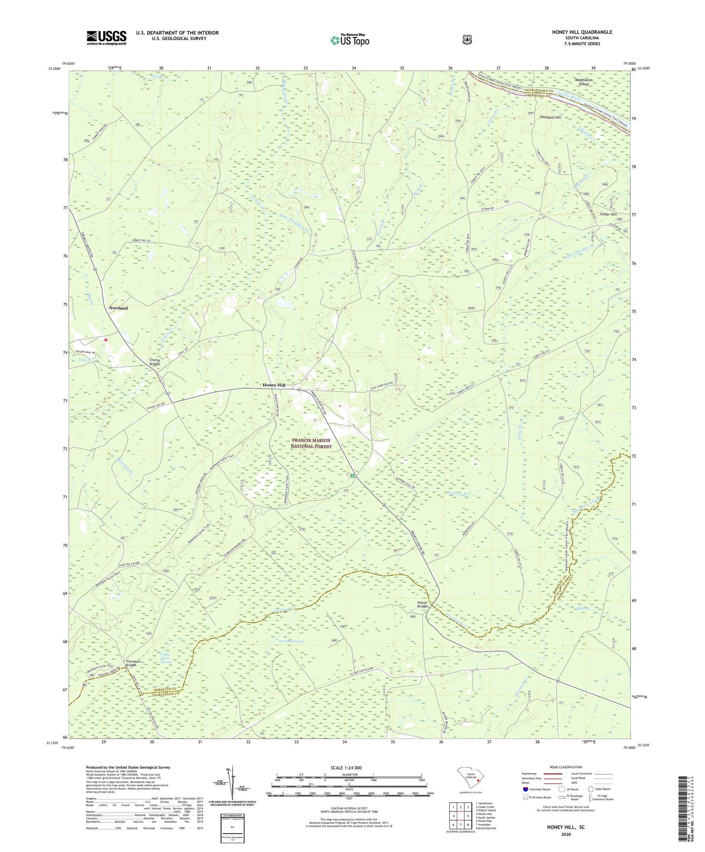
Honey Hill South Carolina US Topo Map
Couldn't load pickup availability
Also explore the Honey Hill Forest Service Topo of this same quad for updated USFS data
2024 topographic map quadrangle Honey Hill in the state of South Carolina. Scale: 1:24000. Based on the newly updated USGS 7.5' US Topo map series, this map is in the following counties: Berkeley, Charleston, Georgetown. The map contains contour data, water features, and other items you are used to seeing on USGS maps, but also has updated roads and other features. This is the next generation of topographic maps. Printed on high-quality waterproof paper with UV fade-resistant inks.
Quads adjacent to this one:
West: Shulerville
Northwest: Jamestown
North: Cedar Creek
Northeast: Kilsock Island
East: South Santee
Southeast: McClellanville
South: Awendaw
Southwest: Ocean Bay
This map covers the same area as the classic USGS quad with code o33079b5.
Contains the following named places: Bay Branch, Beaman Branch, Buck Branch, Cane Branch, Charley Bridges, Charlie Bridges, Coffee Creek Swamp, Coffey Bridges, Green Bay, Honey Hill, Honey Hill Hunt Camp, Honey Hill Lookout Tower, Honey Hill School, June Pond Strand, Keepers Branch, Mechaw Creek, Mill Branch, Mount Zion Church, Newland, Palmer Bridges, Pitch Landing, Pleasant Hill, Pleasant Hill Landing, Pole Branch, Red Bluff Creek, Shulerville Fire Department, Thompson Bridges, Thompson Corner, Velvet Branch, Vigilant Church, Vigilant School, Wambaw Creek Wilderness, Wambaw Swamp, Wanbaw Creek Wilderness, Washington School, Wesley Church, Wesley School