MyTopo
Lake Wylie South Carolina US Topo Map
Couldn't load pickup availability
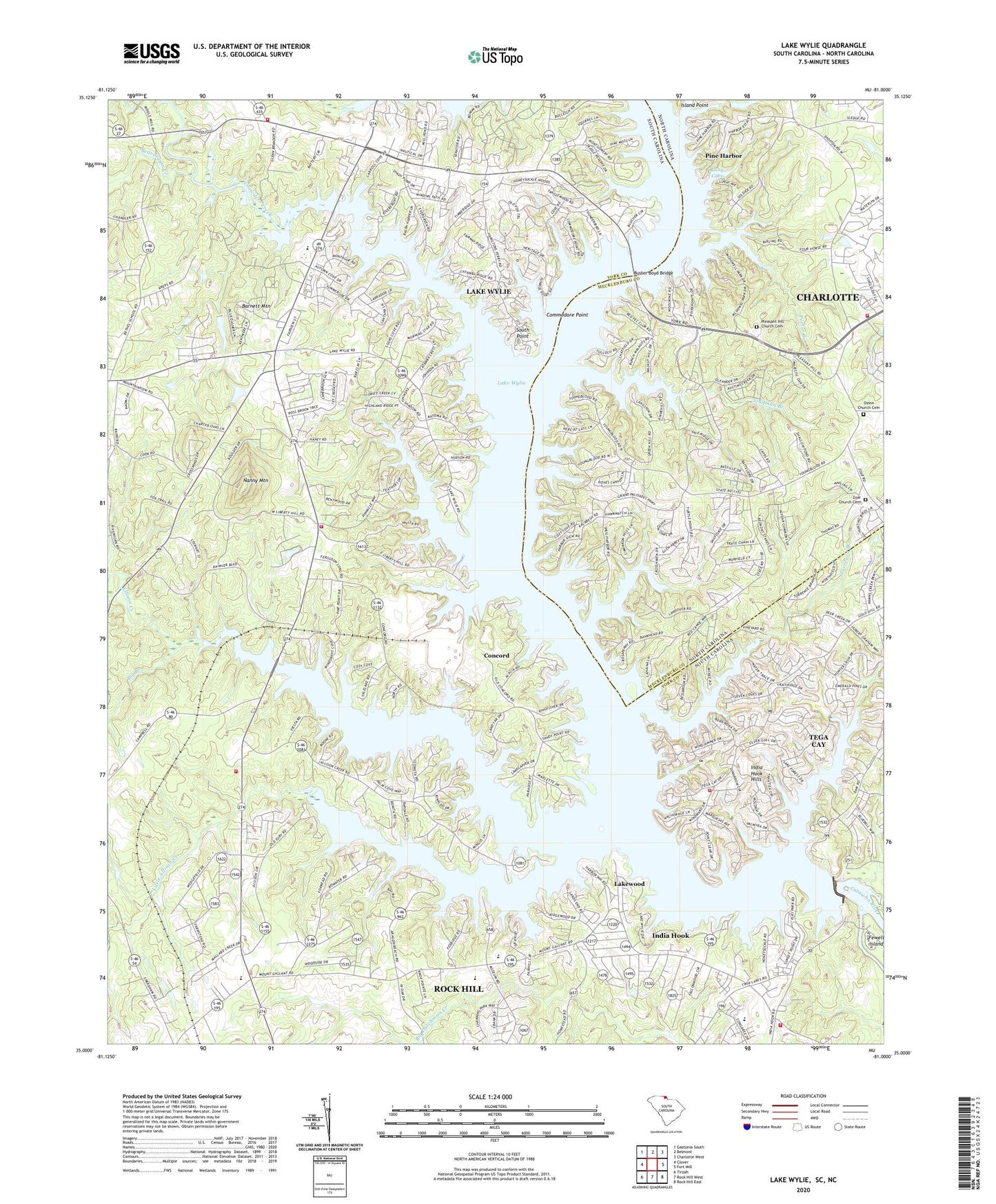
2020 topographic map quadrangle Lake Wylie in the states of South Carolina, North Carolina. Scale: 1:24000. Based on the newly updated USGS 7.5' US Topo map series, this map is in the following counties: York, Mecklenburg. The map contains contour data, water features, and other items you are used to seeing on USGS maps, but also has updated roads and other features. This is the next generation of topographic maps. Printed on high-quality waterproof paper with UV fade-resistant inks.
Quads adjacent to this one:
West: Clover
Northwest: Gastonia South
North: Belmont
Northeast: Charlotte West
East: Fort Mill
Southeast: Rock Hill East
South: Rock Hill West
Southwest: Tirzah
Contains the following named places: Allison Creek, Allison Creek Presbyterian Church, Bali Beach Park, Bar-Fly Corporation Airport, Barnett Mountain, Beaverdam Creek, Belmont, Bethel Community Center, Bethel Fire Department Station 1, Bethel Mission, Bethel Volunteer Fire Department Station 2, Big Branch, Buster Boyd Bridge, Camp Steere, Camp Thunderbird, Catawba Camp, Catawba Ridge, Cedarwood, Charlotte Fire Department Station 37, China Grove Church, China Grove School, City of Tega Cay, Commodore Point, Concord, Crowders Creek, Fairway Bridge, Fewell Island, Five Points, Ford Pond Dam D-3675, Forest Acres, Heritage Woods, Hickory Hill, Hollyberry Woods, Honeysuckle Woods, India Hook, India Hook Census Designated Place, India Hook Hills, India Hook School, India Hook United Methodist Church, Island Point, Island View Landing, Lake Wylie, Lake Wylie Census Designated Place, Lakewood, Lakewood Acres, Lakewood Baptist Church, Liberty Hill Church, Liberty Hill School, Little Allison Creek, Long Cove, Long Island, Masons Ferry, McDowell Park, Mill Creek School, Moores Landing, Mount Gallant Elementary School, Nanny Mountain, Newport Fire Department Indian Hook, Newport Fire Department Station 4, Oakgrove, Oakwood, Ozion Church, Ozion Church Cemetery, Pine Grove Church, Pine Harbor, Pitcairn Cove Beach Park, Pleasant Hill, Pleasant Hill Church, Pleasant Hill Church Cemetery, Porter Branch, River Hills - Lake Wylie Emergency Medical Services, River Hills Church, River Hills Plantation, River Pines, Scherer Memorial Presbyterian Church, South Point, Studman Branch, Sunrise Point, Tega Cay, Tega Cay Fire Department, Thomas Pond Dam D-3676, Thorns Ferry, Timber Ridge, Torrence Branch, Township 3-Steele Creek, Union Church, Wylie Dam, York County Nature Museum, Zoar Church, Zoar Church Cemetery