MyTopo
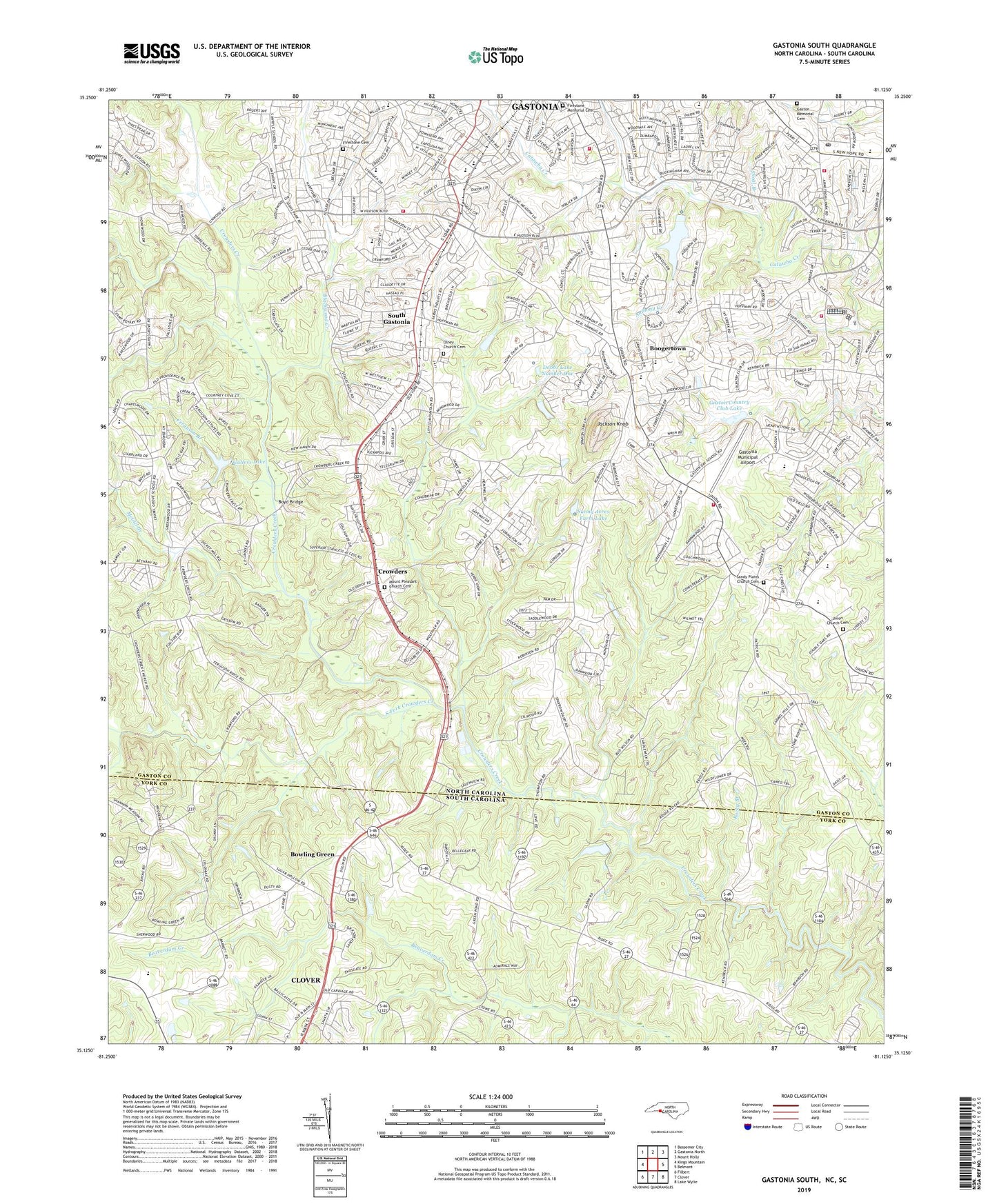
Gastonia South North Carolina US Topo Map
Couldn't load pickup availability
2022 topographic map quadrangle Gastonia South in the states of North Carolina, South Carolina. Scale: 1:24000. Based on the newly updated USGS 7.5' US Topo map series, this map is in the following counties: Gaston, York. The map contains contour data, water features, and other items you are used to seeing on USGS maps, but also has updated roads and other features. This is the next generation of topographic maps. Printed on high-quality waterproof paper with UV fade-resistant inks.
Quads adjacent to this one:
West: Kings Mountain
Northwest: Bessemer City
North: Gastonia North
Northeast: Mount Holly
East: Belmont
Southeast: Lake Wylie
South: Clover
Southwest: Filbert
Contains the following named places: Anthony Creek, Ashbrook High School, Bess Elementary School, Blackwood Creek, Blackwood Park, Boogertown, Bowling Green, Bowling Green Church, Bowling Green School, Boyd Bridge, Calvary Church, Chapel Grove Church, Chapel Grove School, City of Gastonia, Crowders, Crowders Creek Church, Davis Park, Delta Shopping Center, Dobbs Lake Dam Number One, Dobbs Lake Number One, Edson Shopping Center, Fallcrest, Ferguson Branch, Firestone Cemetery, Firestone Memorial Cemetery, Forest Brook, Forest Brook Shopping Center, Forest Heights Elementary School, Gaston Country Club Lake, Gaston Country Club Lake Dam, Gaston Day School, Gaston Memorial Cemetery, Gastonia City Fire Department Station 3, Gastonia City Fire Department Station 4, Gastonia City Fire Department Station 5, Gastonia City Fire Department Station 7, Gastonia Country Club, Gastonia Municipal Airport, Gastonia Municipal Golf Course, Gastonia National Golf Course, Gullers Lake, Gullers Lake Dam, H H Beam Elementary School, Heather Lake, Heather Lake Dam, Huss High School, Jackson Knob, Lake Wood, Lingerfeldt Elementary School, Linwood Park, McGill Branch, Mount Pisgah Church, Mount Pleasant Church, Mount Pleasant Church Cemetery, New Hope Post Office, Olney Church, Olney Church Cemetery, Pisgah Church, Pleasant Grove Church, Pleasant Ridge School, Rizzy Ridge Airport, Robinson School, Robinwood Church, Robinwood Crossing Shopping Center, Robinwood Lake, Robinwood Lake Dam, Rocky Branch, Sandy Plains Church, Sandy Plains Church Cemetery, Sherwood School, Shoal Branch, South Crowders Creek, South Fork Crowders Creek, South Gastonia, Southwest Junior High School, Sunny Acres Farm Dam, Sunny Acres Farm Lake, Township of Gastonia, Union Church, Union Church Cemetery, Union Road Church, Union Road Volunteer Fire Department Station 51, Weeping Mary Church, Wesley Park, WGAS-AM (South Gastonia), Yorkwood, Zion Hill School, ZIP Codes: 28052, 28056