MyTopo
Lamar South Carolina US Topo Map
Couldn't load pickup availability
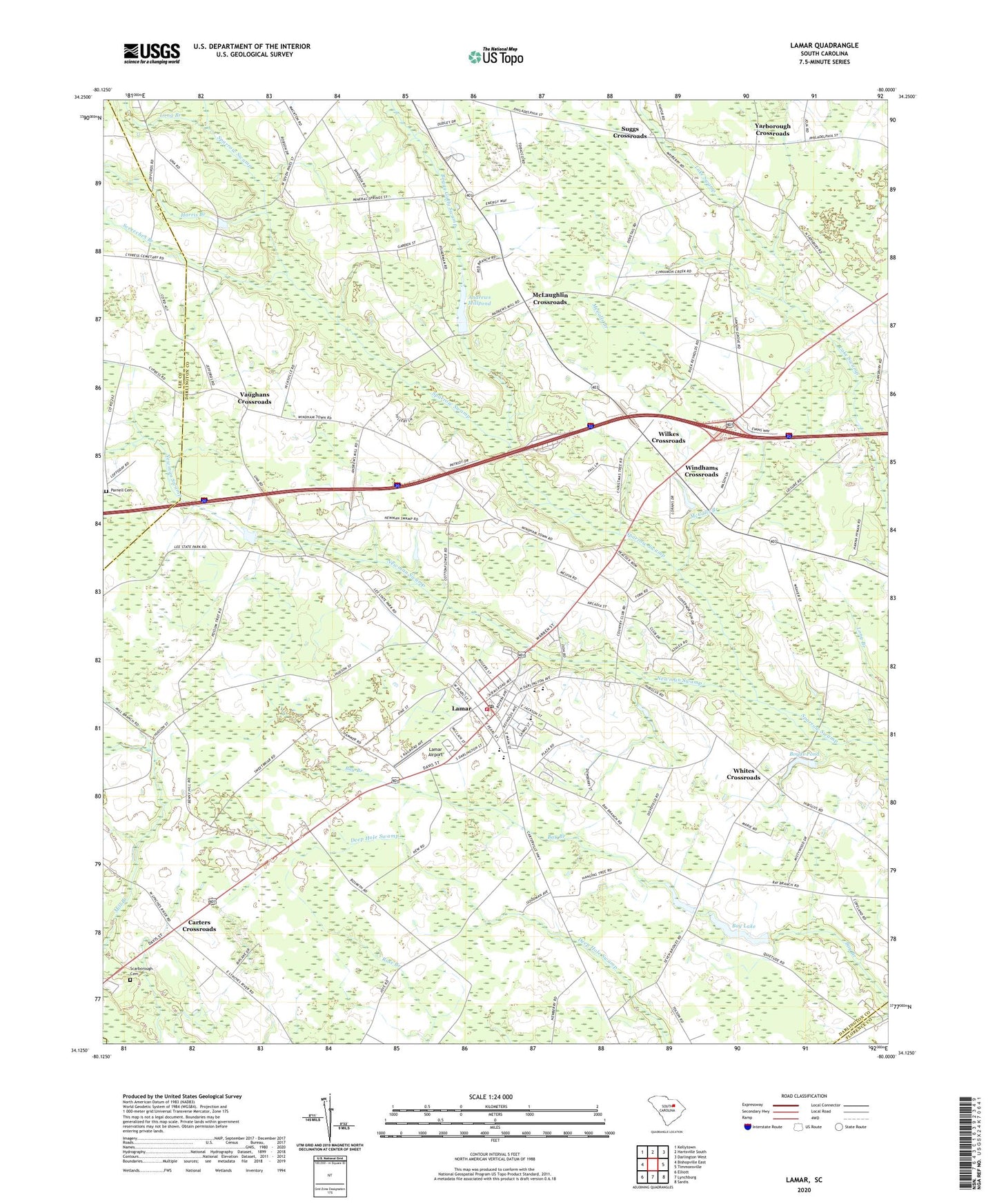
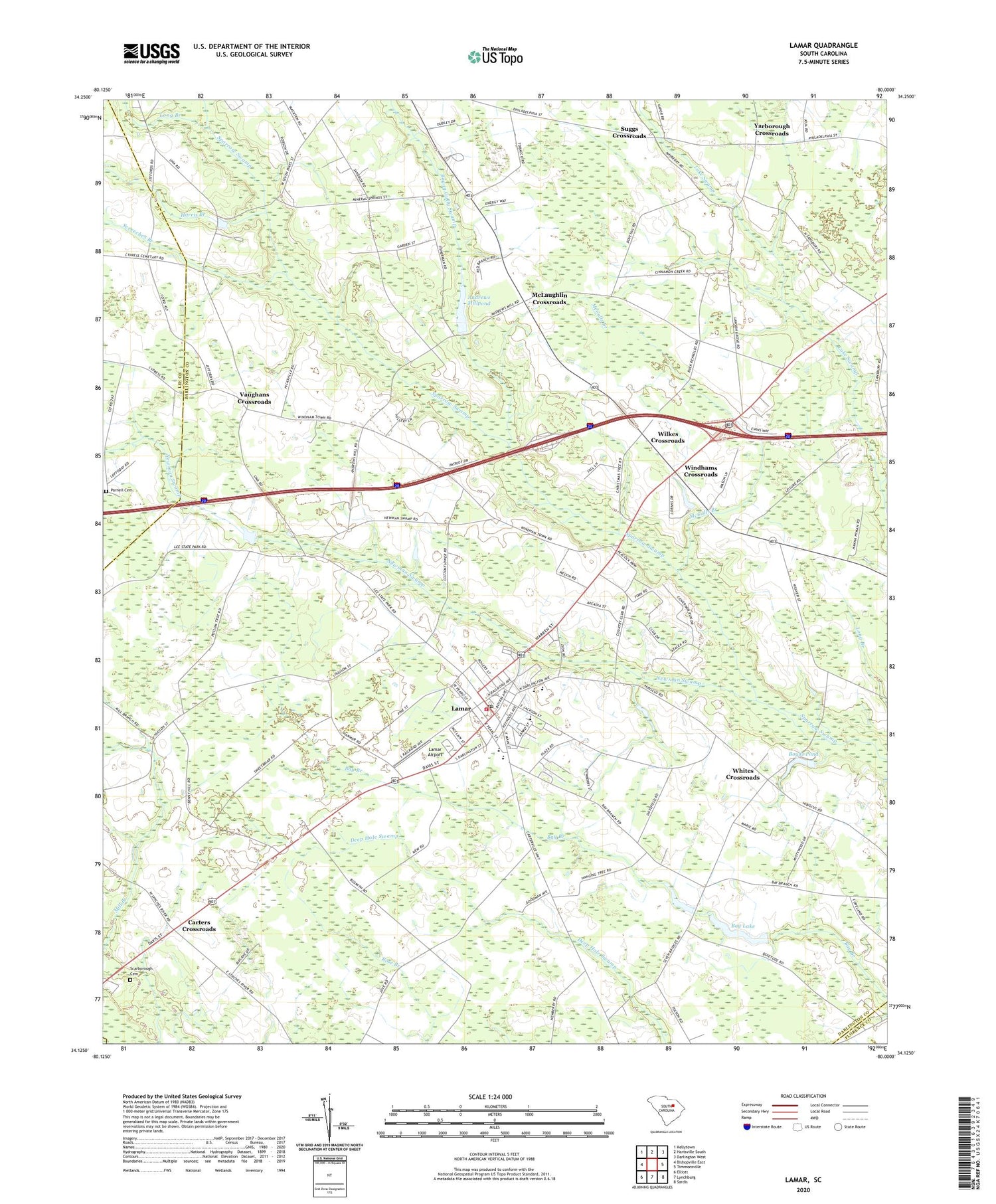
2020 topographic map quadrangle Lamar in the state of South Carolina. Scale: 1:24000. Based on the newly updated USGS 7.5' US Topo map series, this map is in the following counties: Darlington, Lee, Florence. The map contains contour data, water features, and other items you are used to seeing on USGS maps, but also has updated roads and other features. This is the next generation of topographic maps. Printed on high-quality waterproof paper with UV fade-resistant inks.
Quads adjacent to this one:
West: Bishopville East
Northwest: Kellytown
North: Hartsville South
Northeast: Darlington West
East: Timmonsville
Southeast: Sardis
South: Lynchburg
Southwest: Elliott
Contains the following named places: A L Howell Dam D-3525, Andrews Mill, Andrews Millpond, Asbury Church, Asbury School, Bay Lake, Boggy Gully Swamp, Boyds Pond, Carters Crossroads, Elim Church, Galilee School, Harris Branch, Joe Jeffords Pond Dam D-3526, Lake Swamp Division, Lamar, Lamar Academy, Lamar Airport, Lamar Division, Lamar Elementary School, Lamar High School, Lamar Police Department, Long Branch, McCalls Branch, McLaughlin Crossroads, Mount Tabor School, New Savannah Grove Church, Newman Swamp, Newman Swamp Church, Newman Swamp School, Newman Swamp Southern Methodist Church, Oats Church, Parnell Cemetery, Philadelphia Church, Philadelphia School, Quietude School, Saint Marks Church, Saint Marks School, Scarborough Cemetery, Screeches Branch, Sity Oxidization Pond D-3527 Dam, South Carolina Noname 16019 D-3528 Dam, Spaulding Elementary School, Spaulding High School, Suggs Crossroads, Town of Lamar, Town of Lamar Fire Department, Vaughans Crossroads, Whites Crossroads, Wilkes Crossroads, Windhams Crossroads, Windlamtown School, Yarborough Crossroads, Zion Church, ZIP Code: 29069