MyTopo
Leeds South Carolina US Topo Map
Couldn't load pickup availability
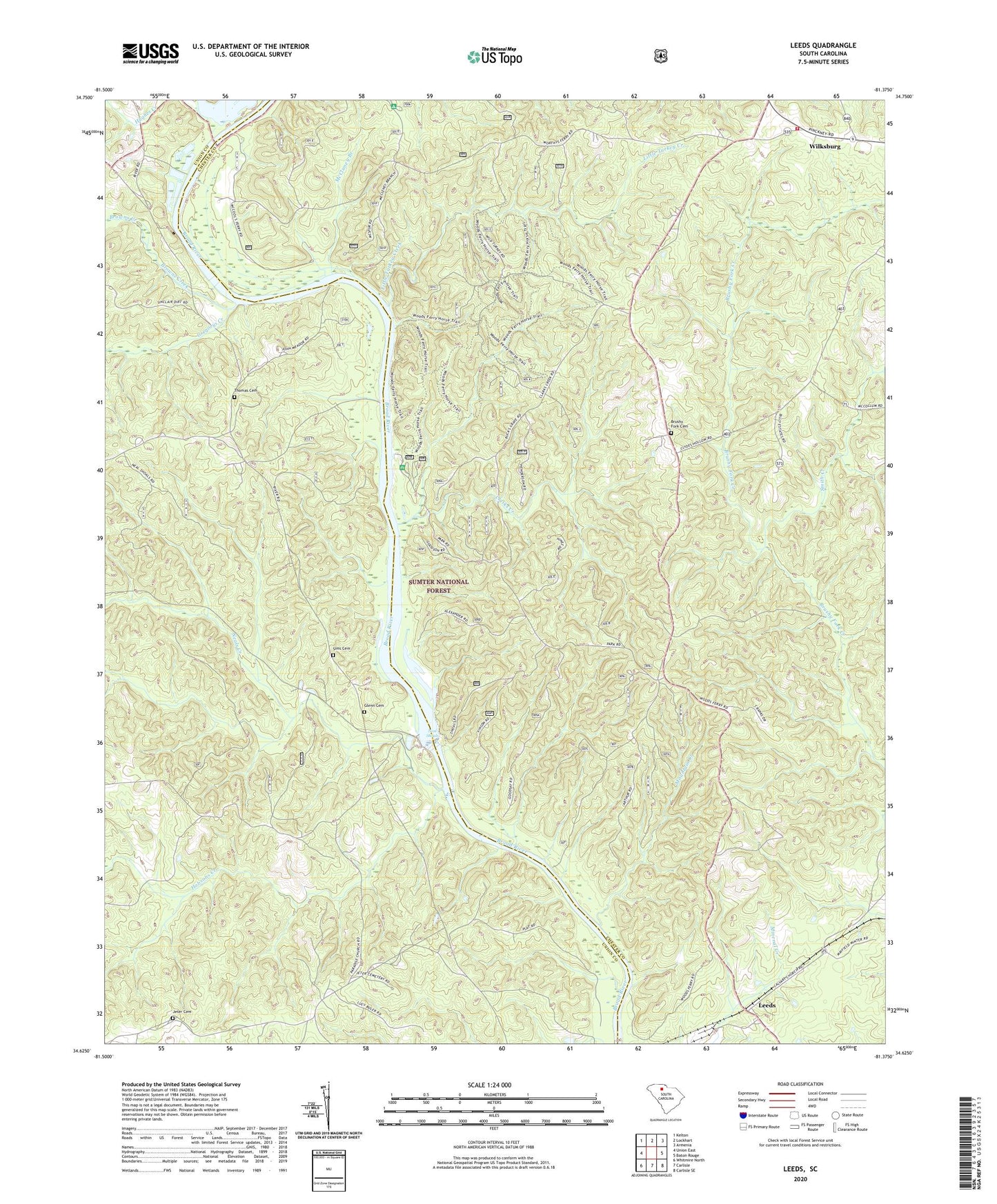
2020 topographic map quadrangle Leeds in the state of South Carolina. Scale: 1:24000. Based on the newly updated USGS 7.5' US Topo map series, this map is in the following counties: Chester, Union. The map contains contour data, water features, and other items you are used to seeing on USGS maps, but also has updated roads and other features. This is the next generation of topographic maps. Printed on high-quality waterproof paper with UV fade-resistant inks.
Quads adjacent to this one:
West: Union East
Northwest: Kelton
North: Lockhart
Northeast: Armenia
East: Baton Rouge
Southeast: Carlisle SE
South: Carlisle
Southwest: Whitmire North
Contains the following named places: Broad River Campground, Browns Creek, Brushy Fork Cemetery, Clarks Creek, Colemans Creek, Ebenezer Baptist Church, Evergreen Church, Evergreen School, Fairview Church, Glenn Cemetery, Gregorys Creek, Hobsons Creek, Hughes Creek, Jeter Cemetery, Leeds, Leeds Campground, Leeds Lookout Tower, Leeds Rifle Range, Leeds School, Little Turkey Creek, Lyles Ferry, McCluney Branch, McDaniels Pond, McDaniels Pond Dam Number Two, Meador School, Mount Olive Baptist Church, Mountain Creek, Neal Shoals, Neal Shoals Dam, Neal Shoals Reservoir, Neals Creek, Ophelias Dam, Paradise African Methodist Episcopal Church, Paradise School, Pilgrim School, Piney Grove, Piney Grove Church, Red Hill Church, Red Point, Sims Cemetery, Smith Creek, South Carolina Noname 12026 D-1436 Dam, Thomas Cemetery, Vanderford Branch, West Chester Fire Department, Wilksburg, Wilksburg Baptist Church, Wilksburg School, Woods Ferry, Woods Ferry Recreation Area, Worthys Ferry, Zion Pilgrim Church, Zion Pilgrim Missionary Baptist Church Graveyard