MyTopo
Little River South Carolina US Topo Map
Couldn't load pickup availability
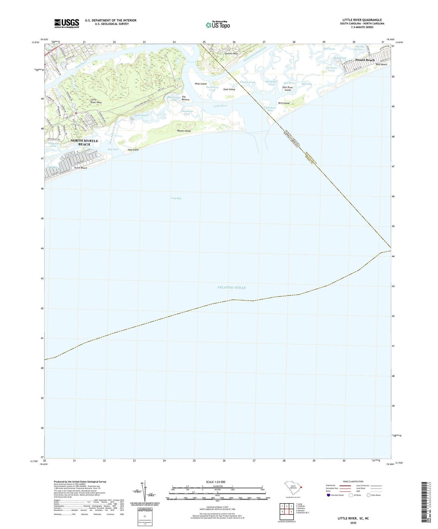
2024 topographic map quadrangle Little River in the states of South Carolina, North Carolina. Scale: 1:24000. Based on the newly updated USGS 7.5' US Topo map series, this map is in the following counties: Horry, Brunswick. The map contains contour data, water features, and other items you are used to seeing on USGS maps, but also has updated roads and other features. This is the next generation of topographic maps. Printed on high-quality waterproof paper with UV fade-resistant inks.
Quads adjacent to this one:
West: Wampee
Northwest: Longs
North: Calabash
Northeast: Shallotte
East: Shallotte OE S
This map covers the same area as the classic USGS quad with code o33078g5.
Contains the following named places: Bald Beach, Bird Island, Blane Creek, Bonaparte Creek, Bull Creek, Cherry Grove Camp, Clayton Creek, Corkins Neck, Crickett Cove Yacht Club, Dead Backwater, Dunn Sound, Dunn Sound Creek, East River, East River Island, Eden Saltworks Creek, First Baptist Church, Fox Creek, Futch Beach, Goat Island, Hog Inlet, Hog Island, Horry County Fire Department Station 2, Horse Ford Creek, Lighthouse One Hundred Nineteen, Lighthouse One Hundred Seventeen, Lighthouse One Hundred Sixteen, Lighthouse Six, Lighthouse Thirty-three, Lighthouse Twelve, Lighthouse Twenty-three, Little River, Little River Inlet, Little River Neck, Mad Inlet, Mink Island, North Myrtle Beach Fire Rescue Department Station 4 Tidewater, Ocean Harbour Golf Links, Riverside Campground, Salt Boiler Creek, Sheephead Creek, The Battery, The Old Home Place, Waties Island