
MyTopo
Lucknow South Carolina US Topo Map
Couldn't load pickup availability
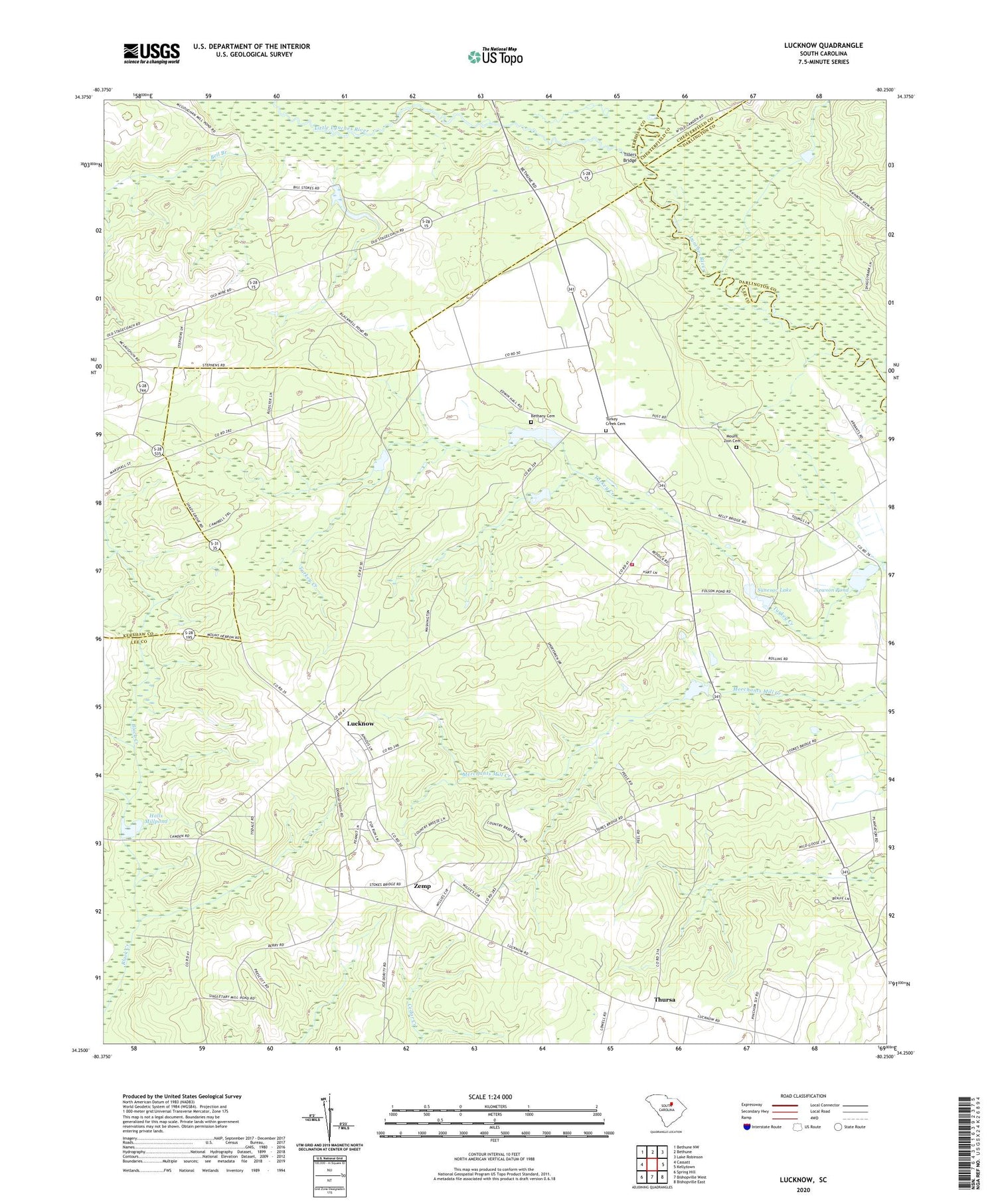
2020 topographic map quadrangle Lucknow in the state of South Carolina. Scale: 1:24000. Based on the newly updated USGS 7.5' US Topo map series, this map is in the following counties: Lee, Kershaw, Darlington, Chesterfield. The map contains contour data, water features, and other items you are used to seeing on USGS maps, but also has updated roads and other features. This is the next generation of topographic maps. Printed on high-quality waterproof paper with UV fade-resistant inks.
Quads adjacent to this one:
West: Cassatt
Northwest: Bethune NW
North: Bethune
Northeast: Lake Robinson
East: Kellytown
Southeast: Bishopville East
South: Bishopville West
Southwest: Spring Hill
Contains the following named places: Bell Branch, Benjamin Chapel, Bethany Cemetery, Black Creek, Clyburns Pond, Concord Church, Halls Millpond, Hancocks Pond, Hancocks Pond Dam D-1720, Harmony Church, High Hill Church, Lee County Rural Fire Department Turkey Creek Station, Little Lynches River, Little Zion Baptist Church, Lucknow, Lucknow School, Mount Zion Cemetery, Mount Zion Church, Mount Zion School, New Hope Church, New Hope School, Newsomville School, Newson Pond, Pate View School, Saint Mathews School, Saint Matthews Church, Saint Matthews School, Sandy Grove Park, Shaws Mission School, South Carolina Noname 31007 D-2419 Dam, South Carolina Noname 31009 D-2412 Dam, South Carolina Noname 31015 D-2413 Dam, Stokes Bridge, Sunesac Lake, Sunesac Lake Dam D-2417, Thursa, Tillers Bridge, Tillers Ferry, Tillersville, Turkey Creek Cemetery, Turkey Creek Church, Turkey Creek Presbyterian Church, Turkey Creek School, Watsons Mill, WXMA-FM (Bishopville), Zemp


