MyTopo
Maple Cane Swamp South Carolina US Topo Map
Couldn't load pickup availability
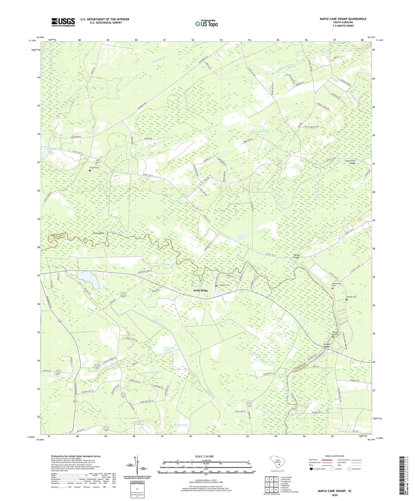
2020 topographic map quadrangle Maple Cane Swamp in the state of South Carolina. Scale: 1:24000. Based on the newly updated USGS 7.5' US Topo map series, this map is in the following counties: Dorchester, Colleton. The map contains contour data, water features, and other items you are used to seeing on USGS maps, but also has updated roads and other features. This is the next generation of topographic maps. Printed on high-quality waterproof paper with UV fade-resistant inks.
Quads adjacent to this one:
West: Canadys
Northwest: Saint George
North: Harleyville
Northeast: Pringletown
East: Ridgeville
Southeast: Clubhouse Crossroads
South: Cottageville
Southwest: Round O
Contains the following named places: Boston Branch, Bryant Temple Church, Cane Island, Cold Water Branch, Colleton County Fire - Rescue Maple Cane, Dorchester County, Edisto Church, Enoch Station School, Enon Station Church, Ferguson Cemetery, Four Hole Special Church, Four Hole Swamp, Givhan Ferry, Givhans Bridge, Givhans Ferry Cemetery, Givhans Ferry State Park, Harleys Bridge, Holly Ridge, Horse Ford Bridge, Horse Pen Branch, Johnson Cemetery, Little Rock Church, Maple Cane Church, Maple Cane Swamp, Mas Old Field Landing, Muck Church, Muckenfuss Cemetery, Poorly Branch, Powderhorn Creek, Rehoboth Church, Rehoboth School, Rumph Cemetery, Rumphs Pond, Rumphs Pond Dam D-2549, Russell Lake Landing, Saint Joans Church, Saint John United Methodist Church, Sand Ridge Church, Sand Ridge School, Sheridan School, WKQB-FM (Saint George), Zion Church, Zion School