MyTopo
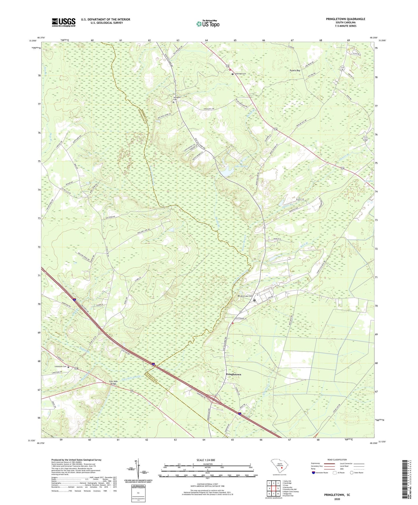
Pringletown South Carolina US Topo Map
Couldn't load pickup availability
2024 topographic map quadrangle Pringletown in the state of South Carolina. Scale: 1:24000. Based on the newly updated USGS 7.5' US Topo map series, this map is in the following counties: Dorchester, Berkeley. The map contains contour data, water features, and other items you are used to seeing on USGS maps, but also has updated roads and other features. This is the next generation of topographic maps. Printed on high-quality waterproof paper with UV fade-resistant inks.
Quads adjacent to this one:
West: Harleyville
Northwest: Holly Hill
North: Sandridge
Northeast: Cross
East: Summerville NW
Southeast: Summerville
South: Ridgeville
Southwest: Maple Cane Swamp
This map covers the same area as the classic USGS quad with code o33080b3.
Contains the following named places: Bethel Church, Deep Branch, Elmore School, Four Hole Bridge, Four Hole Bridge Revolutionary Post, Four Hole School, Hope, Hope Graded School, House of God Church, Lake Merkel, Limestone Cemetery, Limestone Church, MacDougall Correctional Institution, Marshall Branch, Merkel Branch, Mims Lake Cemetery, Mizell School, Mount Pisgah, Mount Pisgah Church, Mount Zion Church, Mudville School, Pisgah School, Pringletown, Rock Branch, Sandridge Baptist Church, Sandridge Cemetery, Sandridge Fire Department Company 11, Sandridge Fire Department Pringletown Station, Santee Branch, South Carolina Noname 08021 D-3463 Dam, South Carolina Noname 08027 D-3464 Dam, Spring Hill, Spring Hill Church, Springhill Cemetery, Tupelo Bay, Walnut Branch