MyTopo
Cottageville South Carolina US Topo Map
Couldn't load pickup availability
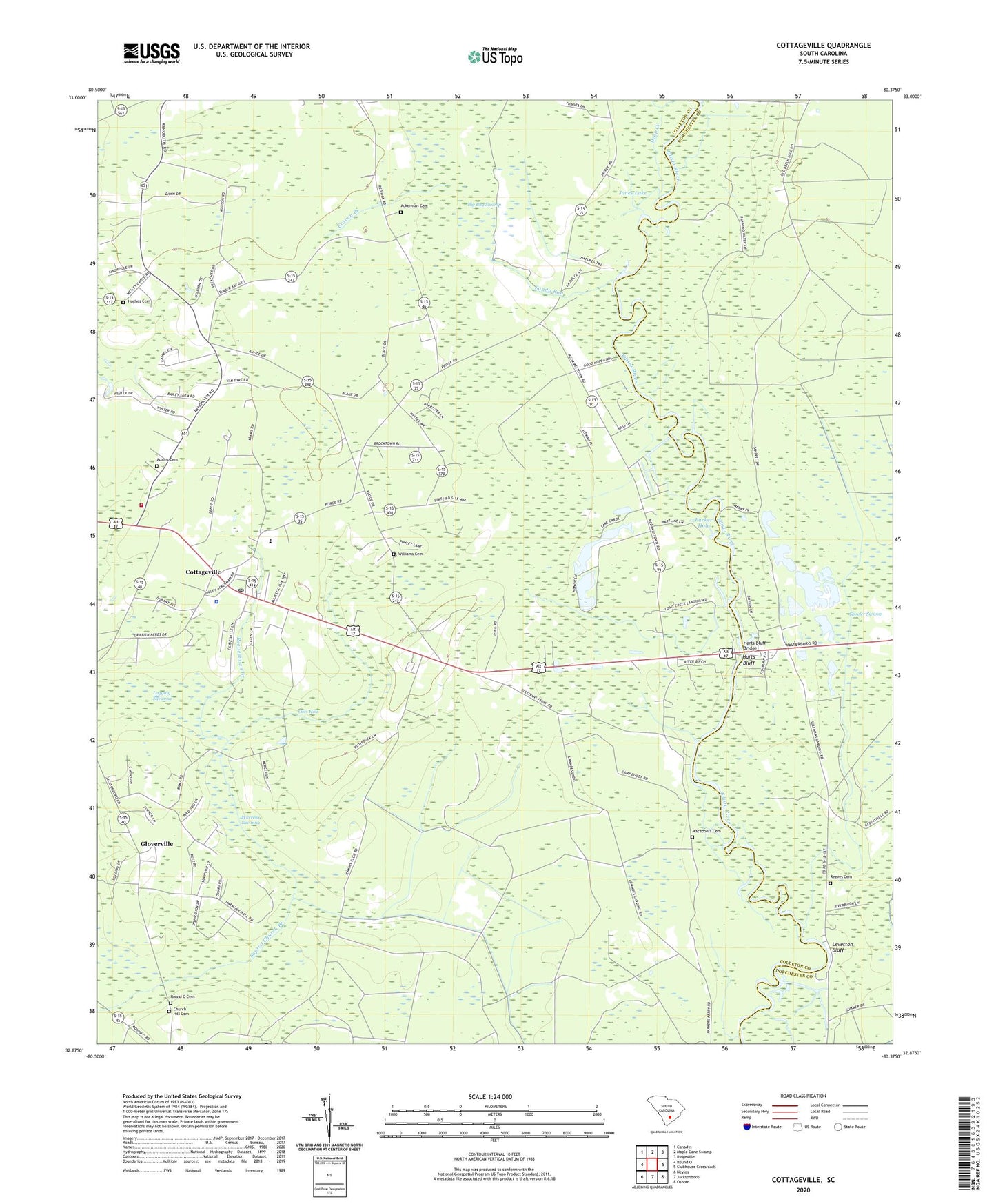
2024 topographic map quadrangle Cottageville in the state of South Carolina. Scale: 1:24000. Based on the newly updated USGS 7.5' US Topo map series, this map is in the following counties: Colleton, Dorchester. The map contains contour data, water features, and other items you are used to seeing on USGS maps, but also has updated roads and other features. This is the next generation of topographic maps. Printed on high-quality waterproof paper with UV fade-resistant inks.
Quads adjacent to this one:
West: Round O
Northwest: Canadys
North: Maple Cane Swamp
Northeast: Ridgeville
East: Clubhouse Crossroads
Southeast: Osborn
South: Jacksonboro
Southwest: Neyles
This map covers the same area as the classic USGS quad with code o32080h4.
Contains the following named places: Ackerman Cemetery, Adams Cemetery, Big Bay Swamp, Big Swamp, Camp Buddy, Church Hill Cemetery, Colleton Fire Department Station 9, Cottageville, Cottageville Baptist Church, Cottageville Church, Cottageville Division, Cottageville Elementary School, Cottageville Fire Department, Cottageville Lookout Tower, Cottageville Police Department, Cottageville Post Office, Craven Branch, Deep Creek, Gloverville, Gloverville School, Goodhope Landing, Harts Bluff, Harts Bluff Bridge, Hickory Hill Church, Hughes Cemetery, Jericho Church, Jericho School, Jones Lake, Kelsey Cove Landing, Leveston Bluff, Logging Savanna, Long Creek Landing, Macedonia Cemetery, Macedonia Church, Metz Store, Norman Landing, Oats Hole, Parker Hole, Prices Landing, Red Oak Church, Red Oak Corner, Redoak School, Reeves Cemetery, Reevestown Branch, Rehoboth School, Round O Cemetery, Sandhill School, Sandy Run, Spooler Swamp, Springhill Church, Sullivans Church, Sullivans Ferry, Sullivans Ferry Crossroads, Town of Cottageville, Warrens Savanna, Williams Cemetery, ZIP Code: 29435