
MyTopo
Martin South Carolina US Topo Map
Couldn't load pickup availability
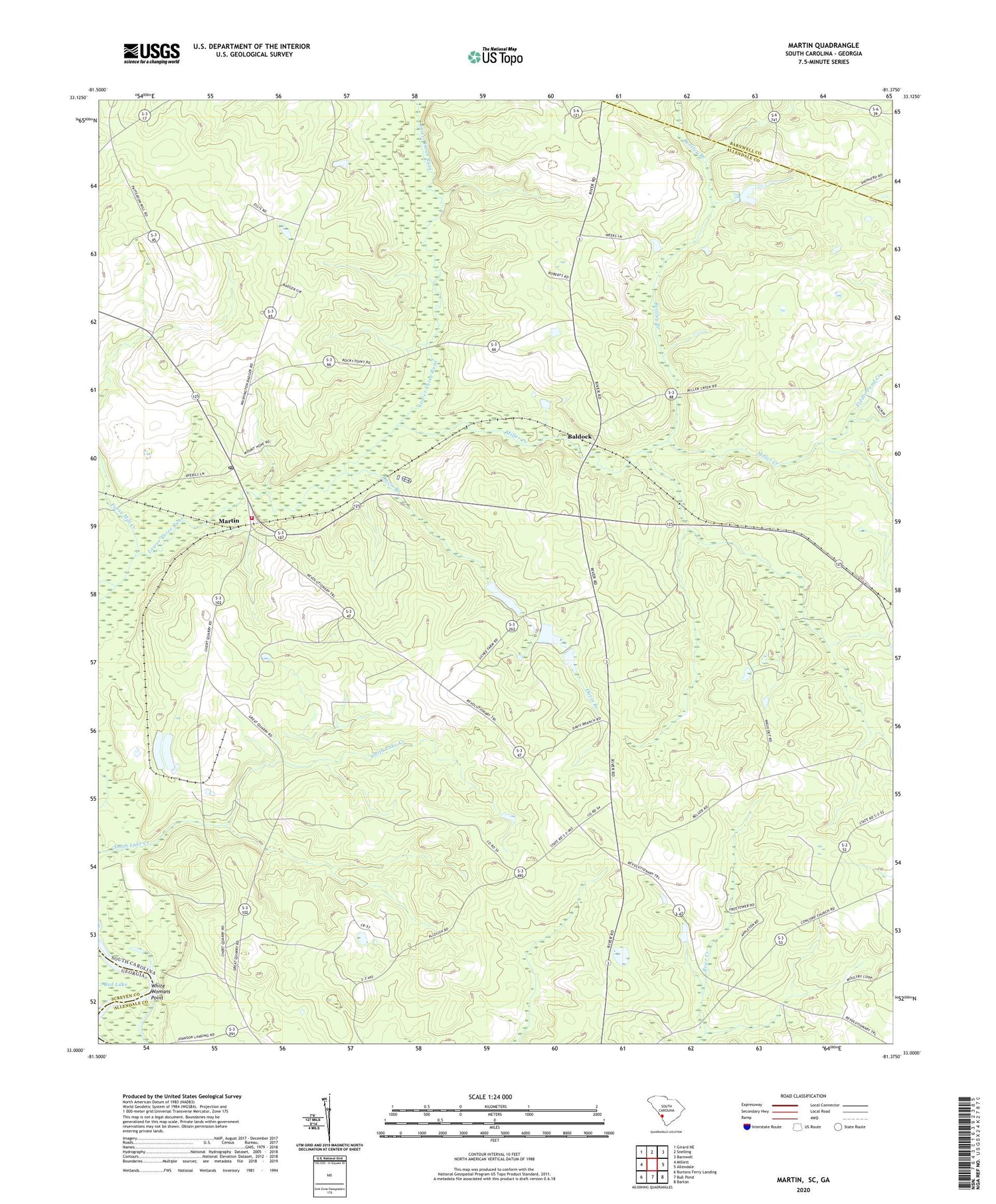
2020 topographic map quadrangle Martin in the states of South Carolina, Georgia. Scale: 1:24000. Based on the newly updated USGS 7.5' US Topo map series, this map is in the following counties: Allendale, Barnwell, Screven. The map contains contour data, water features, and other items you are used to seeing on USGS maps, but also has updated roads and other features. This is the next generation of topographic maps. Printed on high-quality waterproof paper with UV fade-resistant inks.
Quads adjacent to this one:
West: Millett
Northwest: Girard NE
North: Snelling
Northeast: Barnwell
East: Allendale
Southeast: Barton
South: Bull Pond
Southwest: Burtons Ferry Landing
Contains the following named places: Allendale Division, Allendale Fire Department Station 400, Appleton Lookout Tower, Baldock, Baldock School, Beautiful Gate Church, Bentley Branch, Bentley Branch Church, Bentley Church, Bentleys Church, Beulah Church, Browns Mill, Catawba Pond Number One D-2574 Dam, Cato Mill School, Culbertsons Pond Dam D-2577, Davis Branch, Doe Pond Church, Fiddle Pond Creek, Furse Mill Creek, Gill Crossroads, Gillette Church, Jack Wood School, Jackwood Pond School, Lower Three Runs Church, Martin, Martin Post Office, Martin School, Miller Creek, Mount Hope Church, Mount Sinai Church, Smith Lake Creek, Tabernacle Church, Thankful Church, White Womans Point, Zion Hill Church


