MyTopo
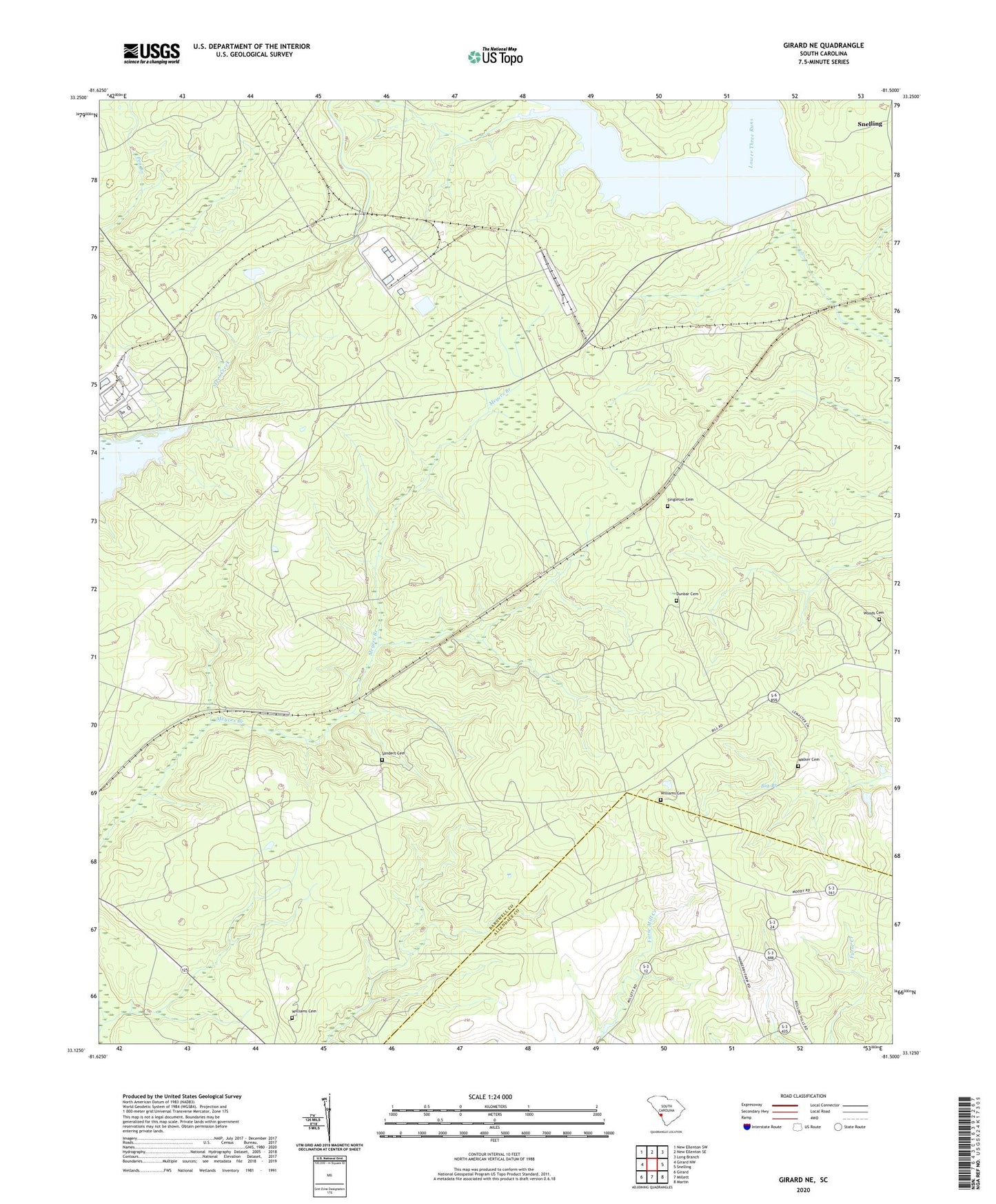
Girard NE South Carolina US Topo Map
Couldn't load pickup availability
Also explore the Girard NE Forest Service Topo of this same quad for updated USFS data
2024 topographic map quadrangle Girard NE in the state of South Carolina. Scale: 1:24000. Based on the newly updated USGS 7.5' US Topo map series, this map is in the following counties: Barnwell, Allendale. The map contains contour data, water features, and other items you are used to seeing on USGS maps, but also has updated roads and other features. This is the next generation of topographic maps. Printed on high-quality waterproof paper with UV fade-resistant inks.
Quads adjacent to this one:
West: Girard NW
Northwest: New Ellenton SW
North: New Ellenton SE
Northeast: Long Branch
East: Snelling
Southeast: Martin
South: Millett
Southwest: Girard
This map covers the same area as the classic USGS quad with code o33081b5.
Contains the following named places: Ashley Grove School, Donora, Dunbar Cemetery, Dunbarton, Dunbarton Fire Tower, Gum Pond Church, Gum Pond School, Kline-Snelling Division, Meyers Mill, Meyers Mill Siding, Mission Church, Neds Branch Church, Neds Branch School, Par Pond, Pleasant Mount Church, Roundtree School, Sanders Cemetery, Singleton Cemetery, Spring Branch Church, Spring Branch School, Steel Creek Church, Thomas Grove Church, Thomas Grove School, Walker Cemetery, Williams Cemetery, Woods Cemetery, ZIP Code: 29836