MyTopo
Minim Island South Carolina US Topo Map
Couldn't load pickup availability
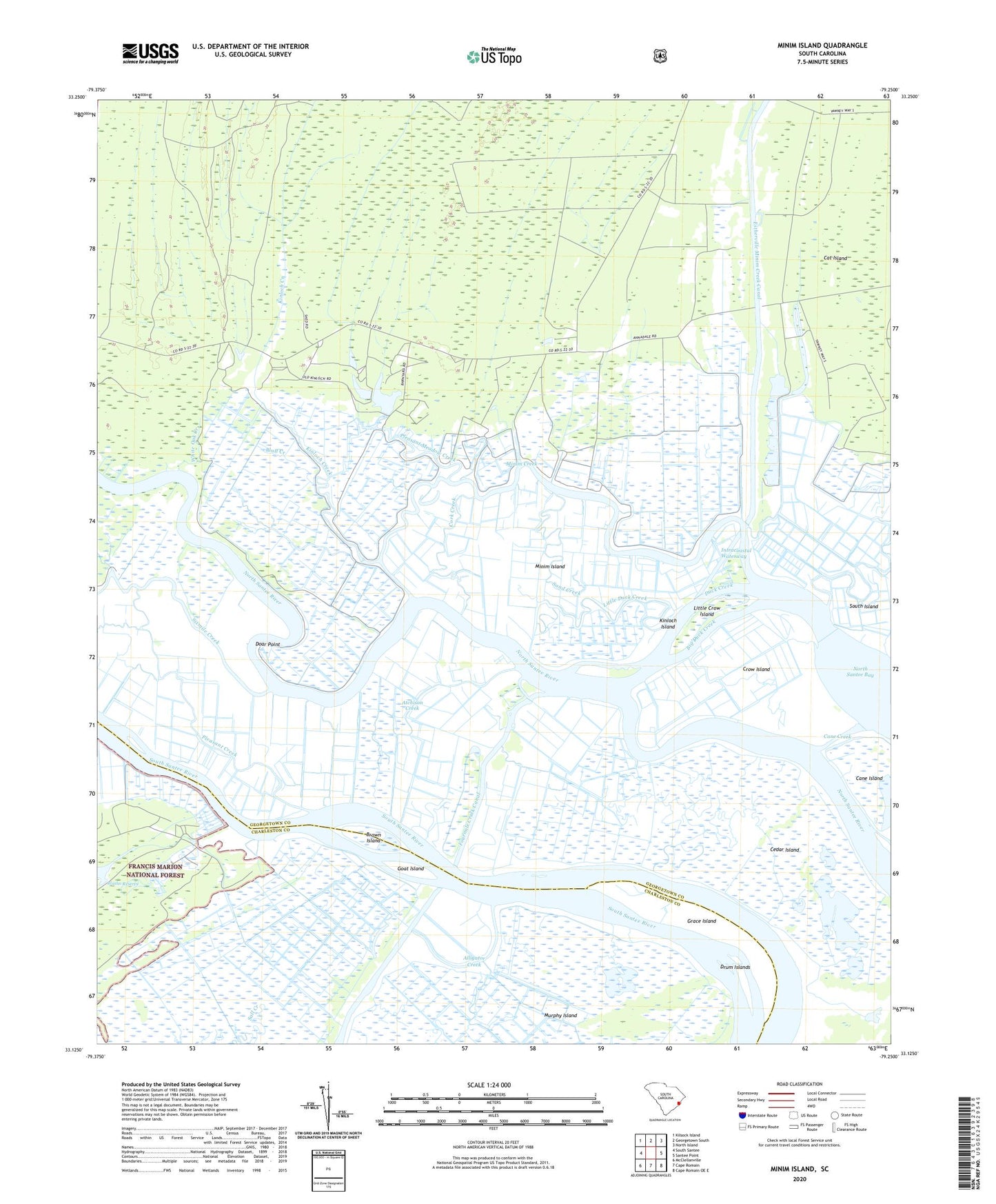
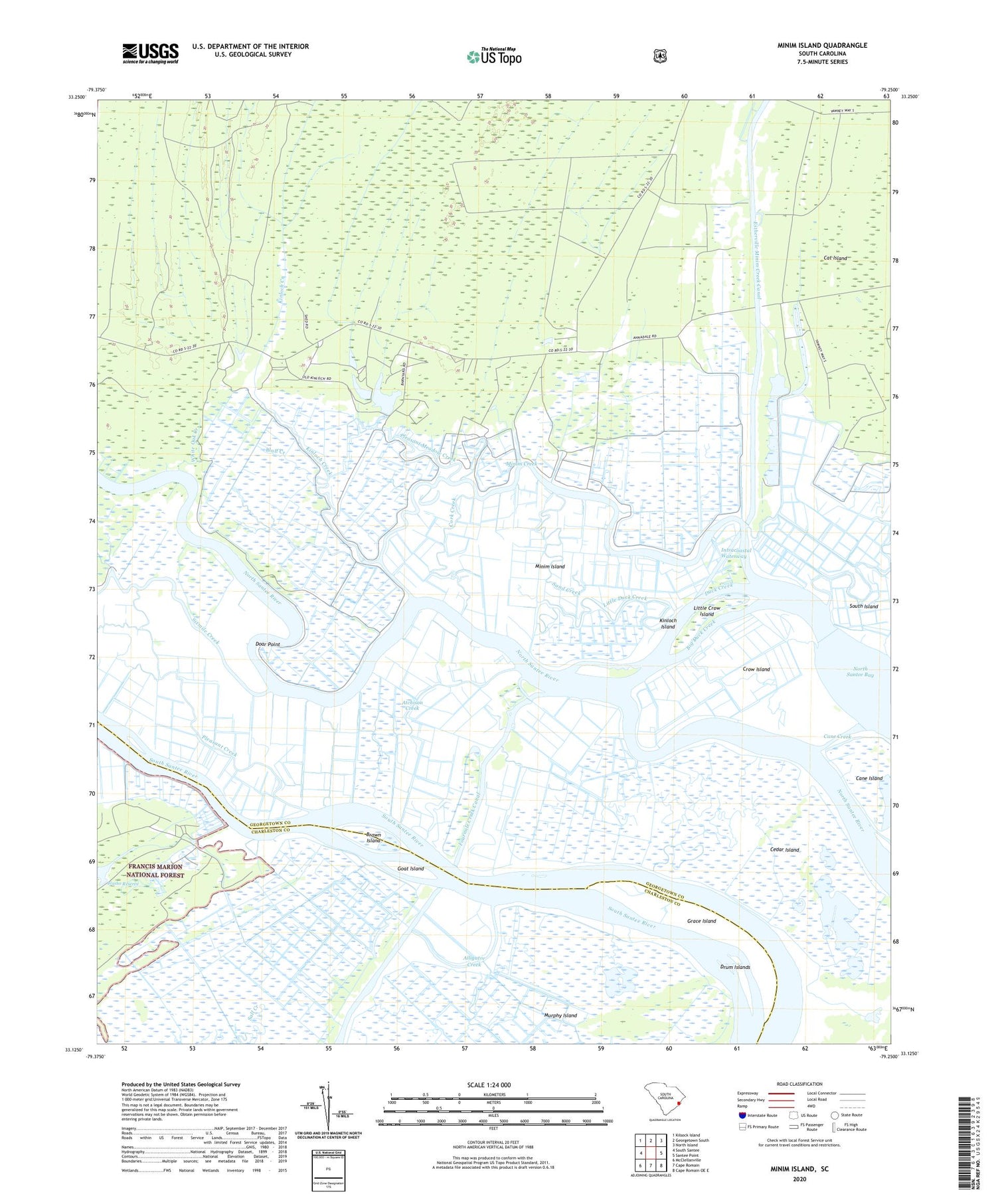
2020 topographic map quadrangle Minim Island in the state of South Carolina. Scale: 1:24000. Based on the newly updated USGS 7.5' US Topo map series, this map is in the following counties: Georgetown, Charleston. The map contains contour data, water features, and other items you are used to seeing on USGS maps, but also has updated roads and other features. This is the next generation of topographic maps. Printed on high-quality waterproof paper with UV fade-resistant inks.
Quads adjacent to this one:
West: South Santee
Northwest: Kilsock Island
North: Georgetown South
Northeast: North Island
East: Santee Point
Southeast: Cape Romain OE E
South: Cape Romain
Southwest: McClellanville
Contains the following named places: Alligator Creek, Annandale Plantation, Atchison Creek, Bethel Church, Big Duck Creek, Black Out Plantation, Bluff Creek, Brown Island, Cane Creek, Cane Island, Cat Island Plantation, Cedar Island, Cork Creek, Crow Island, Doar Plantation, Doar Point, Drum Islands, Duck Creek, Estherville Minim Creek Canal, Fourmile Creek Canal, Goat Island, Grace Island, Hide Out Plantation, Kinloch Creek, Kinloch Island, Kinloch Plantation, Little Crow Island, Little Duck Creek, Minim Creek, Minim Island, Pleasant Creek, Pleasant Meadow Creek, Ravenel Plantation, Rice Hope Church, Rice Hope Plantation, Richfield School, Saint James Church, Sand Creek, Santee Coastal Reserve, Santee Gun Club, Sixmile Creek, Sturgeon Island, White Oak Creek