MyTopo
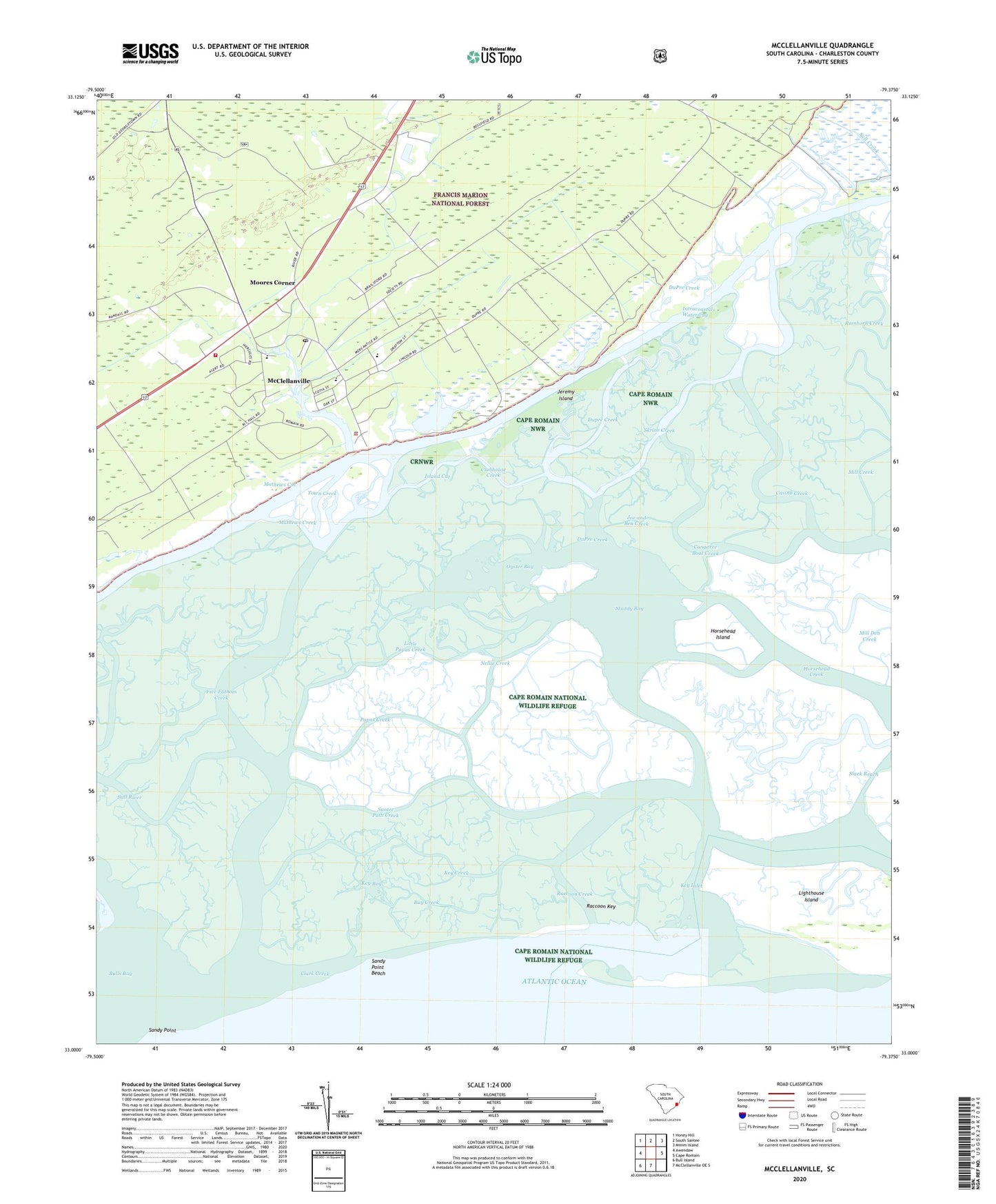
McClellanville South Carolina US Topo Map
Couldn't load pickup availability
Also explore the McClellanville Forest Service Topo of this same quad for updated USFS data
2024 topographic map quadrangle McClellanville in the state of South Carolina. Scale: 1:24000. Based on the newly updated USGS 7.5' US Topo map series, this map is in the following counties: Charleston. The map contains contour data, water features, and other items you are used to seeing on USGS maps, but also has updated roads and other features. This is the next generation of topographic maps. Printed on high-quality waterproof paper with UV fade-resistant inks.
Quads adjacent to this one:
West: Awendaw
Northwest: Honey Hill
North: South Santee
Northeast: Minim Island
East: Cape Romain
South: McClellanville OE S
Southwest: Bull Island
This map covers the same area as the classic USGS quad with code o33079a4.
Contains the following named places: Awendaw Fire Department Station 5, Awendaw Fire District Station 4, Bay Creek, Bull River, Cape Romain Wilderness, Casino Creek, Chain Gang Camp Number 5, Charleston County Public Library McClellanville Branch, Charleston County Sheriff's Office Substation, Clark Creek, Clubhouse Creek, Congaree Boat Creek, Devils Den Creek, Dupre Creek, DuPre Creek, Five Fathom Creek, Horsehead Creek, Horsehead Island, Island Cut, Jeremy Creek, Jeremy Island, Joe and Ben Creek, Key Bay, Key Creek, Key Inlet, Lighthouse Island, Lincoln High School, Little Papas Creek, Little Sett Creek, Mathews Creek, Mathews Cut, McClellanville, McClellanville Historic District, McClellanville Lookout Tower, McClellanville Magistrate Office, McClellanville Middle School, Mill Creek, Mill Den Creek, Moores Corner, Muddy Bay, Needles Eye Creek, Nellie Creek, Ormand Hall Creek, Oyster Bay, Papas Creek, Raccoon Creek, Raccoon Key, Ramhorn Creek, Rhems Church, Saint Peters Church, Sall Creek, Sandy Point, Sandy Point Beach, Santee Path Creek, Sett Creek, Silver Hill Plantation, Skrine Creek, Slack Reach, South Creek, The Beach, The Village Museum, Town Creek, Town of McClellanville, United States Forest Service Wambaugh, Wambaw District Ranger Office, ZIP Code: 29458