MyTopo
Newberry East South Carolina US Topo Map
Couldn't load pickup availability
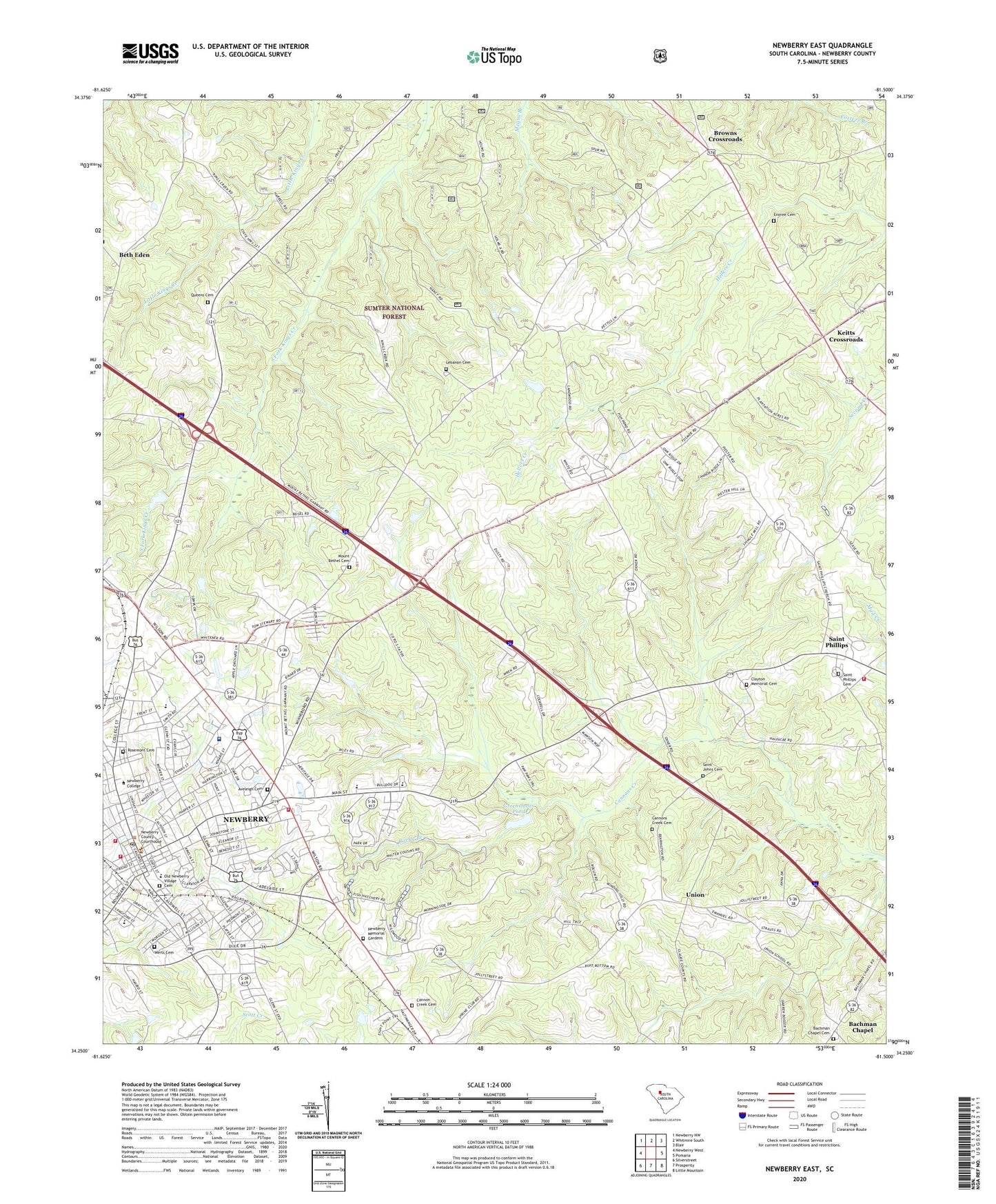
2020 topographic map quadrangle Newberry East in the state of South Carolina. Scale: 1:24000. Based on the newly updated USGS 7.5' US Topo map series, this map is in the following counties: Newberry. The map contains contour data, water features, and other items you are used to seeing on USGS maps, but also has updated roads and other features. This is the next generation of topographic maps. Printed on high-quality waterproof paper with UV fade-resistant inks.
Quads adjacent to this one:
West: Newberry West
Northwest: Newberry NW
North: Whitmire South
Northeast: Blair
East: Pomaria
Southeast: Little Mountain
South: Prosperity
Southwest: Silverstreet
Contains the following named places: Aveleigh Cemetery, Aveleigh Presbyterian Church, Bachman Chapel, Bachman Chapel Cemetery, Bachman Chapel Lutheran Church, Beth Eden, Beth Eden Luthern Church, Beth Eden School, Bethel Community School, Bethlehem Baptist Church, Boundary Street School, Browns Crossroads, By-Lo Shopping Center, Caldwell Street Historic District, Calvary Church, Calvary Presbyterian Church, Cannon Creek Cemetery, Cannons Creek Cemetery, Cannons Creek Church, Cannons Creek-Prosperity Church, Central Methodist Church, City of Newberry, Clayton Memorial Cemetery, Clayton Memorial Church, College Street Historic District, Devils Cross Roads, Drayton Street School, East Side Baptist Church, Enoree Cemetery, Enoree Church, First Baptist Church, Four County State Fish Hatchery, Gallman Elementary School, Garmany Unity Church, Greenslades Pond, Greenslades Pond D-1670 Dam, Harrington Street Historic District, Holms Rock Quarry, Johnstone Academy, Keitts Crossroads, Keller Memorial Library, Lebanon Cemetery, Lebanon Church, Leitzsey School, Lutheran Church of the Redeemer, Lynchs Woods Park, Main Street Historic District, Metropolitan Church, Miller Chapel African Methodist Episcopal Church, Mollohon Mill, Mount Bethel, Mount Bethel Cemetery, Mount Bethel Church, Mount Bethel School, Newberry, Newberry Associate Reformed Presbyterian Church, Newberry City Fire Department, Newberry City Hall, Newberry College, Newberry College Historic District, Newberry County, Newberry County Courthouse, Newberry County Emergency Medical Services, Newberry County Memorial Hospital, Newberry County Memorial Hospital Heliport, Newberry County Rescue Squad, Newberry County Rural Fire Department Friendly, Newberry High School, Newberry Historic District, Newberry Memorial Gardens, Newberry Methodist Church, Newberry Post Office, Newberry Vocational Center, Newberry-Saluda Regional Library, Old Newberry Village Cemetery, Pleasant Grove Church, Price Poultry Farm, Queen Memorial Church, Queens Cemetery, Rock Hill School, Rocky Branch, Rose Spring School, Rosemont Cemetery, Saint Johns Cemetery, Saint Johns Church, Saint Johns Lutheran Church, Saint Lukes Episcopal Church, Saint Lukes Episcopal Mission, Saint Mathews Church, Saint Phillips, Saint Phillips Cemetery, Saint Phillips Fire Department, Saint Phillips Lutheran Church, Saint Phillips School, South Carolina Highway Patrol Troop 2 Post A, Southeast Newberry, Speers Street School, Union, Union School, Werts Cemetery, West Boundary Street Historic District, WKDK-AM (Newberry), WKMG-AM (Newberry), WNMX-FM (Newberry)