MyTopo
Magnolia Beach South Carolina US Topo Map
Couldn't load pickup availability
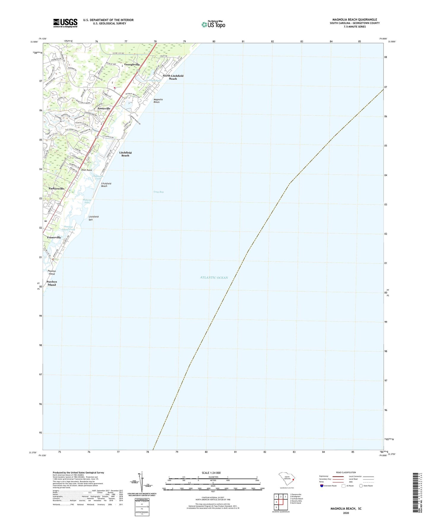
2024 topographic map quadrangle Magnolia Beach in the state of South Carolina. Scale: 1:24000. Based on the newly updated USGS 7.5' US Topo map series, this map is in the following counties: Georgetown. The map contains contour data, water features, and other items you are used to seeing on USGS maps, but also has updated roads and other features. This is the next generation of topographic maps. Printed on high-quality waterproof paper with UV fade-resistant inks.
Quads adjacent to this one:
West: Waverly Mills
Northwest: Plantersville
North: Brookgreen
Northeast: Surfside Beach
Southwest: North Island
This map covers the same area as the classic USGS quad with code o33079d1.
Contains the following named places: Annieville, Camp Baskerville, Clubhouse Creek, Flagg Pond, Georgieville, Holy Cross Faith Memorial School, Inlet Point, Litchfield Beach, Litchfield Beach Census Designated Place, Litchfield Books Post Office, Litchfield by the Sea, Litchfield Golf and Country Club, Litchfield Retreat, Litchfield Spit, Magnolia Beach, Midway Fire Department Station 81, Midway Inlet, North Litchfield Beach, Parkersville, Pawleys Island, Pawleys Island Creek, Pawleys Island Historic District, Pawleys Island Police Department, Pawleys Island Post Office, Pawleys Pier, Saint Pauls Waccamau United Methodist Church, Saint Peter Lutheran Church, Salt Marsh Cove, The Lakes at Litchfield, Town of Pawleys Island, Waccamaw Intermediate School, Waccamaw Middle School