MyTopo
Ocean Bay South Carolina US Topo Map
Couldn't load pickup availability
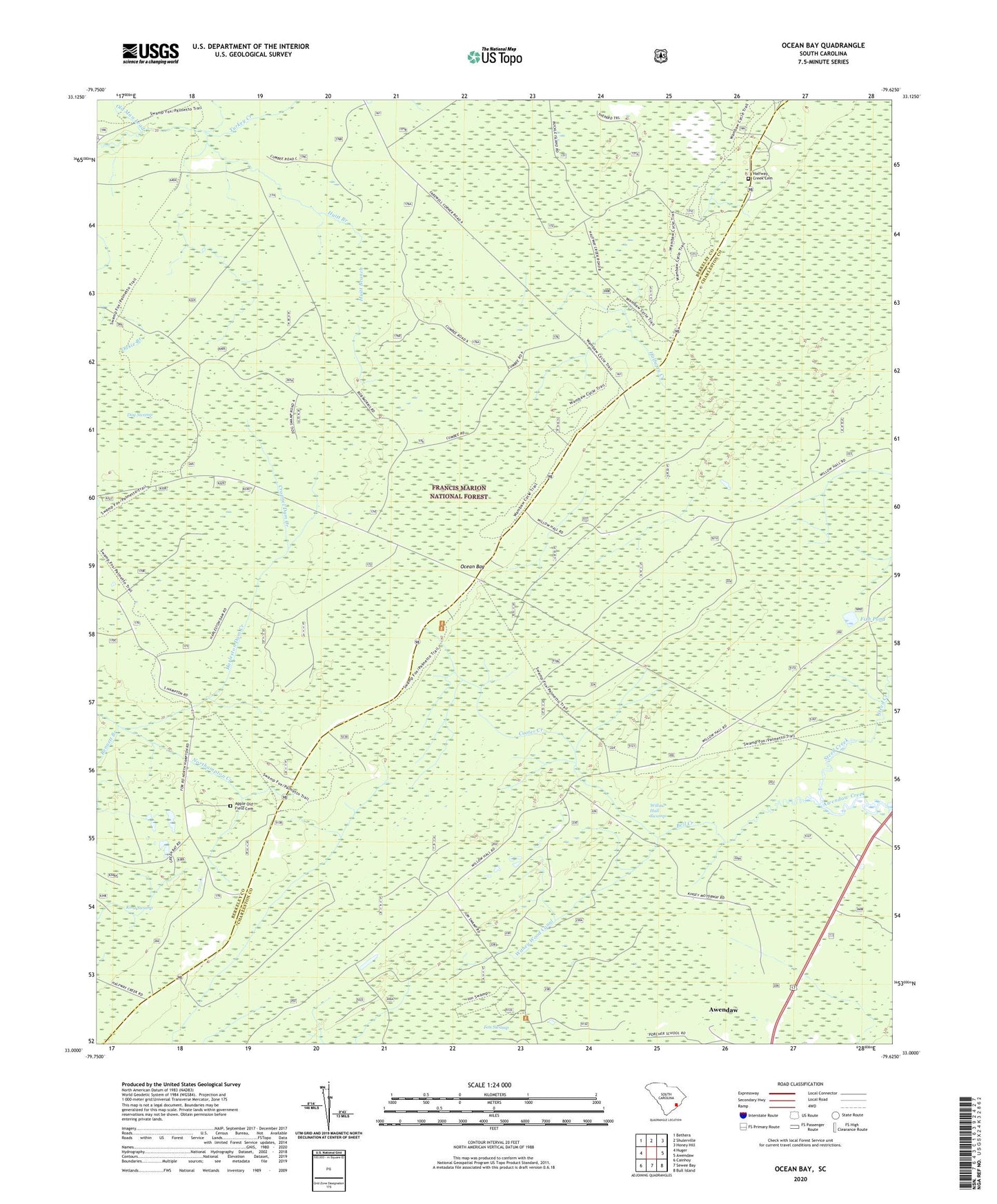
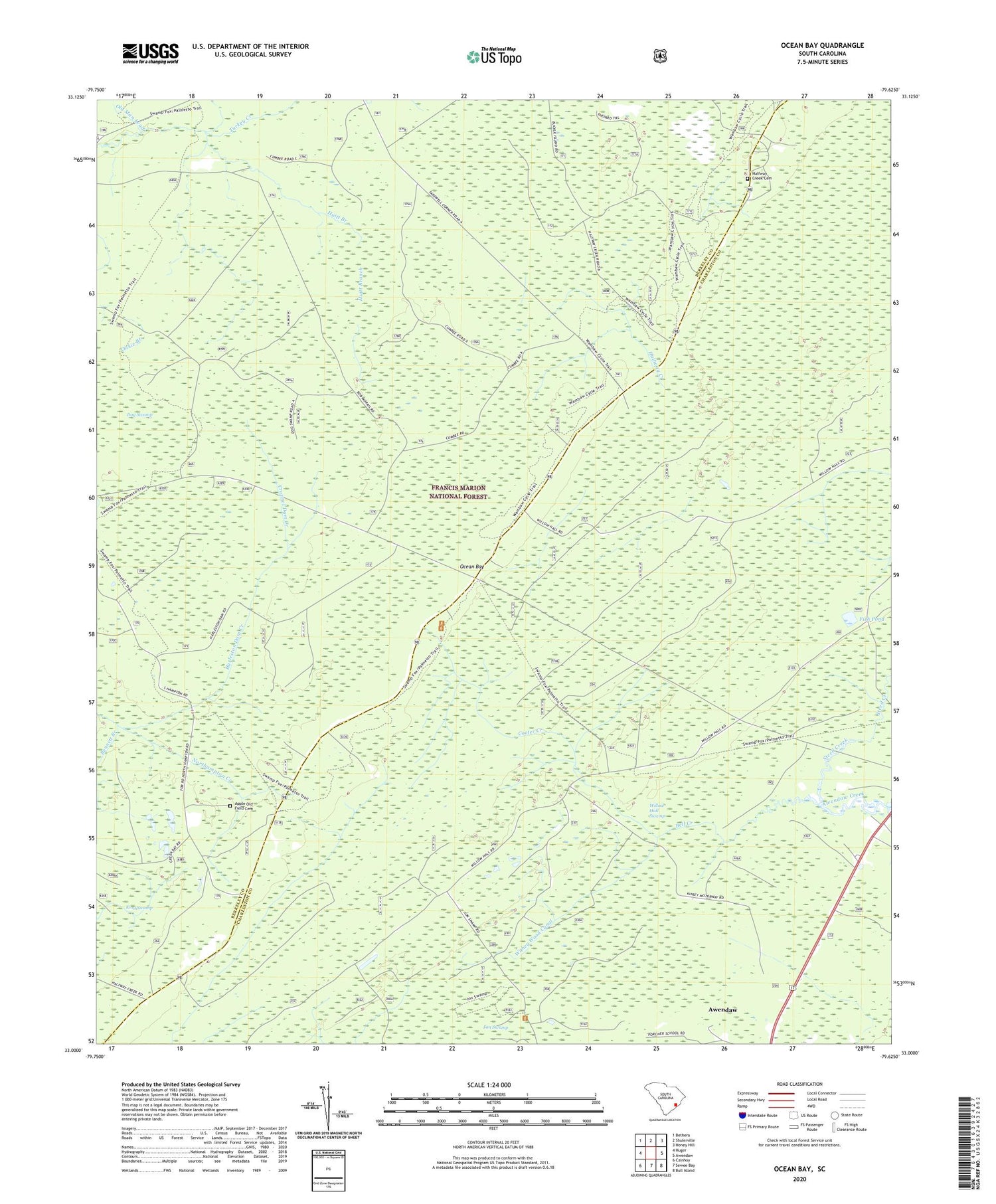
2020 topographic map quadrangle Ocean Bay in the state of South Carolina. Scale: 1:24000. Based on the newly updated USGS 7.5' US Topo map series, this map is in the following counties: Berkeley, Charleston. The map contains contour data, water features, and other items you are used to seeing on USGS maps, but also has updated roads and other features. This is the next generation of topographic maps. Printed on high-quality waterproof paper with UV fade-resistant inks.
Quads adjacent to this one:
West: Huger
Northwest: Bethera
North: Shulerville
Northeast: Honey Hill
East: Awendaw
Southeast: Bull Island
South: Sewee Bay
Southwest: Cainhoy
Contains the following named places: Apple Old Field Cemetery, Awendaw Church, Bates Still, Bell Creek, Bennett Branch, Cooter Creek, Cropnel Dam Creek, Dog Swamp, Fish Pond, Fort Corner, Halfway Creek, Halfway Creek Cemetery, Halfway Creek Church, Halfway Creek School, Halfway Creek Trail Camp, Harleston Dam Creek, Huitt Branch, King Swamp, Lake Awendaw, Northampton Creek, Oakie Branch, Ocean Bay, Ocean Grove Church, Old Man Lead, Porcher Elementary School, Steed Creek, Swamp Fox Trail, Twenty Four Mile School, Twin Pond Rifle Range, Wambaw Swamp Wilderness, Willow Hall Swamp, Withey Wood Canal