MyTopo
Marion South Carolina US Topo Map
Couldn't load pickup availability
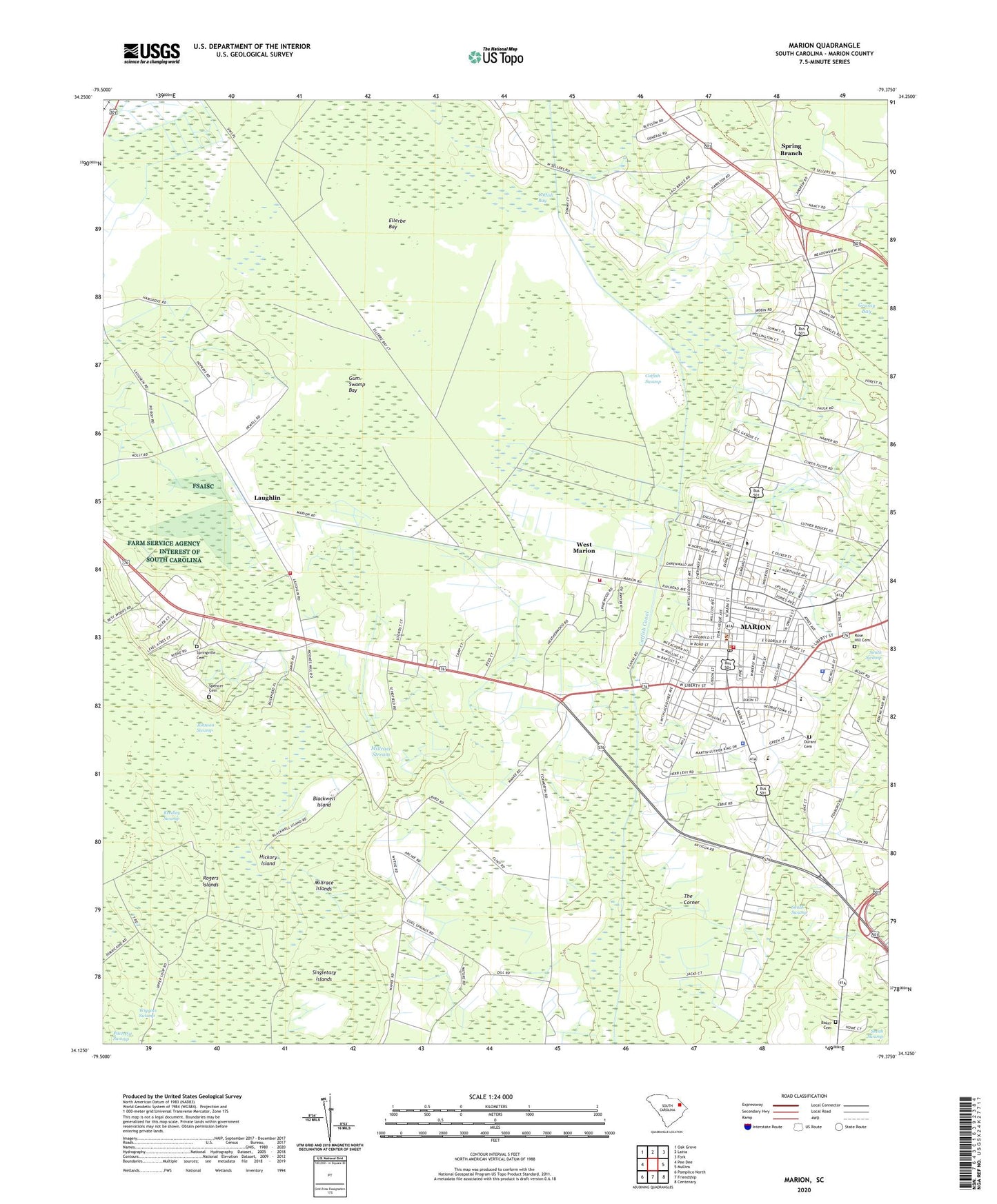
2024 topographic map quadrangle Marion in the state of South Carolina. Scale: 1:24000. Based on the newly updated USGS 7.5' US Topo map series, this map is in the following counties: Marion. The map contains contour data, water features, and other items you are used to seeing on USGS maps, but also has updated roads and other features. This is the next generation of topographic maps. Printed on high-quality waterproof paper with UV fade-resistant inks.
Quads adjacent to this one:
West: Pee Dee
Northwest: Oak Grove
North: Latta
Northeast: Fork
East: Mullins
Southeast: Centenary
South: Friendship
Southwest: Pamplico North
This map covers the same area as the classic USGS quad with code o34079b4.
Contains the following named places: Baker Cemetery, Bethel United Methodist Church, Bethlehem Baptist Church, Blackwell Island, Blessed Hope Baptist Church, Camp Number Five, Catfish Bay, Catfish Canal, Catfish Swamp, Catholic Church of the Infant Jesus, Church of the Advent, City of Marion, Door of Hope Christian Church, Durant Cemetery, Easterling Primary School, Ellerbe Bay, Faith Apostolic Church of Jesus Christ, Finger Infirmary, First United Methodist Church, Forks Chapel, Greater Singletry African Methodist Episcopal Church, Gum Swamp Bay, Harmon Park, Hickory Island, Jesus Only Church, Johnakin Middle School, Johnson Swamp, Keedley Swamp, Laughlin, Marion, Marion Baptist Church, Marion Church of God, Marion City Hall, Marion County Courthouse, Marion County Emergency Medical Services, Marion County Jail, Marion County Library, Marion County Training School, Marion Division, Marion Elementary School, Marion Fire Department, Marion High School, Marion Historic District, Marion Mall Shopping Center, Marion Memorial Hospital, Marion Police Department, Marion Police Department Community Substation, Marion Post Office, Marion Presbyterian Church, Marion Rescue Squad, Marion Rural Fire Department, McMillan Memorial Baptist Church, Millrace Islands, Millrace Stream, Monument of Faith Evangelistic Church, Mount Olive Seventh Day Adventist Church, Mount Pisgah Baptist Church, Pee Dee Plaza Shopping Center, Pee Dee Rural Fire Department, Refuge Pentecostal Church, Rogers Islands, Rose Hill Cemetery, Saint Johns African Methodist Episcopal Church, Saint Phillips Church, Saint Stephens Baptist Church, Shiloh Church, Singletary Islands, Singletary School, Smith Swamp, South Carolina Law Enforcement Division, South Main Street Wastewater Treatment Facility, Southside Elementary School, Spencer Cemetery, Spring Branch, Spring Branch Church, Spring Branch School, Springville Cemetery, Springville Church, Springville School, The Church of Jesus Christ of Latter Day Saints, The Corner, The Greater Highway Church of Christ, The New Greater Deliverance Church for all People, Turner Place, Walkers Chapel, West Marion, West Marion Baptist Church, Wiggins Swamp, Word of Faith Christian Center, ZIP Code: 29571