MyTopo
Plum Branch South Carolina US Topo Map
Couldn't load pickup availability
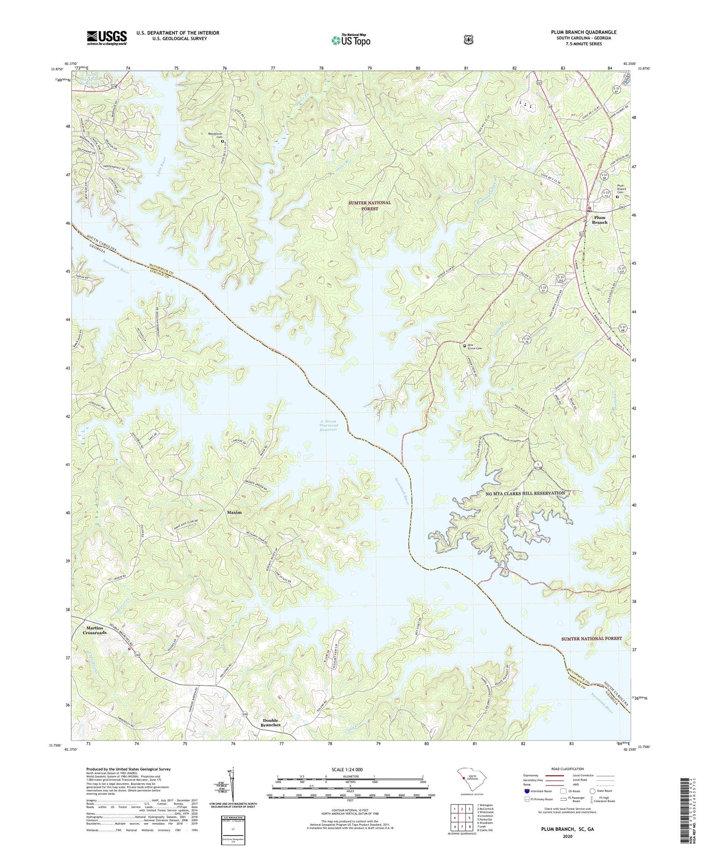
2020 topographic map quadrangle Plum Branch in the states of South Carolina, Georgia. Scale: 1:24000. Based on the newly updated USGS 7.5' US Topo map series, this map is in the following counties: McCormick, Lincoln. The map contains contour data, water features, and other items you are used to seeing on USGS maps, but also has updated roads and other features. This is the next generation of topographic maps. Printed on high-quality waterproof paper with UV fade-resistant inks.
Quads adjacent to this one:
West: Lincolnton
Northwest: Willington
North: McCormick
Northeast: Winterseat
East: Parksville
Southeast: Clarks Hill
South: Leah
Southwest: Woodlawn
Contains the following named places: Benningsfield Creek, Branch School, Camp Creek, Camp Daniel Marshall, Chamberlain Ferry Picnic Area, Chamberlains Ferry, Clark Hill Marina, Dordon Creek, Double Branches, Ferguson Island, Geyer Springs School, Hawe Creek, Hawe Creek Camping Area, Holiness Church, Jester Branch, Landam Branch, Little River, Marthas Chapel, Martin Island, Martins Crossroad Volunteer Fire Department, Martins Crossroads, Maxim, McCoys Ferry, Mulberry Church, New Hope Church, Parks Grove Church, Pine Grove Cemetery, Pine Grove Church, Pine Grove School, Plum Branch, Plum Branch Baptist Church, Plum Branch Cemetery, Plum Branch Volunteer Fire Department Station 50, Republican Cemetery, Republican Church, Searle Island, Searle Mill, Searles School, Shriver Creek, Soap Creek, Springfield Church, Springfield School, Sturkeys Ferry, Town of Plum Branch, Wallace Landing, Wells Creek