MyTopo
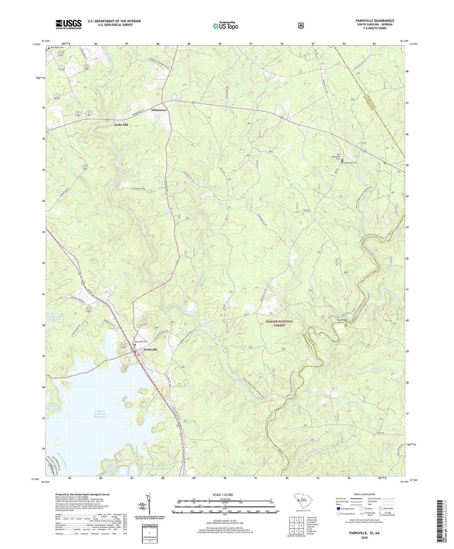
Parksville South Carolina US Topo Map
Couldn't load pickup availability
Also explore the Parksville Forest Service Topo of this same quad for updated USFS data
2024 topographic map quadrangle Parksville in the state of South Carolina. Scale: 1:24000. Based on the newly updated USGS 7.5' US Topo map series, this map is in the following counties: McCormick, Edgefield, Lincoln. The map contains contour data, water features, and other items you are used to seeing on USGS maps, but also has updated roads and other features. This is the next generation of topographic maps. Printed on high-quality waterproof paper with UV fade-resistant inks.
Quads adjacent to this one:
West: Plum Branch
Northwest: McCormick
North: Winterseat
Northeast: Limestone
East: Red Hill
Southeast: Colliers
South: Clarks Hill
Southwest: Leah
This map covers the same area as the classic USGS quad with code o33082g2.
Contains the following named places: Beaverdam Creek, Bethany, Blue Branch, Busseys Ferry, Byrd Creek, Byrd Creek Rifle Range, Callihams Mill Church, Cedar Springs Church, Cedar Springs School, Church Branch, Coon Creek, Goff Branch, Hamilton Branch Campground, Hamilton Branch State Park, Key Bridge, Key Bridge Hunt Camp, Mack Branch, Mims School Number 2, Mount Lebanon Church, Mount Lebanon School, Mount Moriah Church, Mount Moriah School, New Hope Cemetery, Old Rohoboth Cemetery, Parks Mill, Parksville, Parksville Baptist Church, Parksville Cemetery, Parksville Division, Parksville Methodist Church, Parksville Recreation Area, Parksville Volunteer Fire Deptartment Station 40, Parksville Wayside Park, Prices Mill, Rehoboth Church, Ritchentown School, Rock Creek, Rock Grove School, Rohoboth Cemetery, Town of Parksville, Turkey Creek, Turkey Creek Hiking Trail, Upper Price Mill, Whitetown, Whitetown School, Wine Creek, ZIP Codes: 29844, 29845