
MyTopo
Pomaria South Carolina US Topo Map
Couldn't load pickup availability
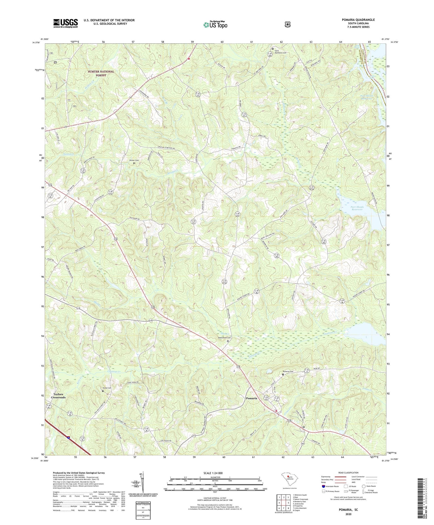
2020 topographic map quadrangle Pomaria in the state of South Carolina. Scale: 1:24000. Based on the newly updated USGS 7.5' US Topo map series, this map is in the following counties: Newberry, Fairfield. The map contains contour data, water features, and other items you are used to seeing on USGS maps, but also has updated roads and other features. This is the next generation of topographic maps. Printed on high-quality waterproof paper with UV fade-resistant inks.
Quads adjacent to this one:
West: Newberry East
Northwest: Whitmire South
North: Blair
Northeast: Salem Crossroads
East: Jenkinsville
Southeast: Chapin
South: Little Mountain
Southwest: Prosperity
Contains the following named places: Bethlehem Cemetery, Bethlehem Lutheran Church, Broad River School, Buck Branch, Buck Shoals, Consolidated 5 Volunteer Fire Department, Cravenhill, Fairview Church, Fairview School, Garmany School, Griffins Shoal, Hayne, Hunter Dewalt School, Kerr Creek, Morris Chapel, Mud Creek, New Hope Church, New Hope School, Parr Shoals Reservoir, Pomaria, Pomaria Cemetery, Pomaria Division, Pomaria Elementary School, Pomaria Fire Department and Rescue Squad, Pomaria High School, Pomaria Lutheran Church, Presley School, Reuben, Saint James Church, Saint Lukes School, Saint Marks Church, Saint Matthews Cemetery, Saint Matthews Lutheran Church, Second Creek, Sondleys, Stone Cemetery, Taylors Crossroads, Terrible Creek, Town of Pomaria, Victory Church, Walton, Wicker Cemetery, ZIP Code: 29126


