MyTopo
Cross South Carolina US Topo Map
Couldn't load pickup availability
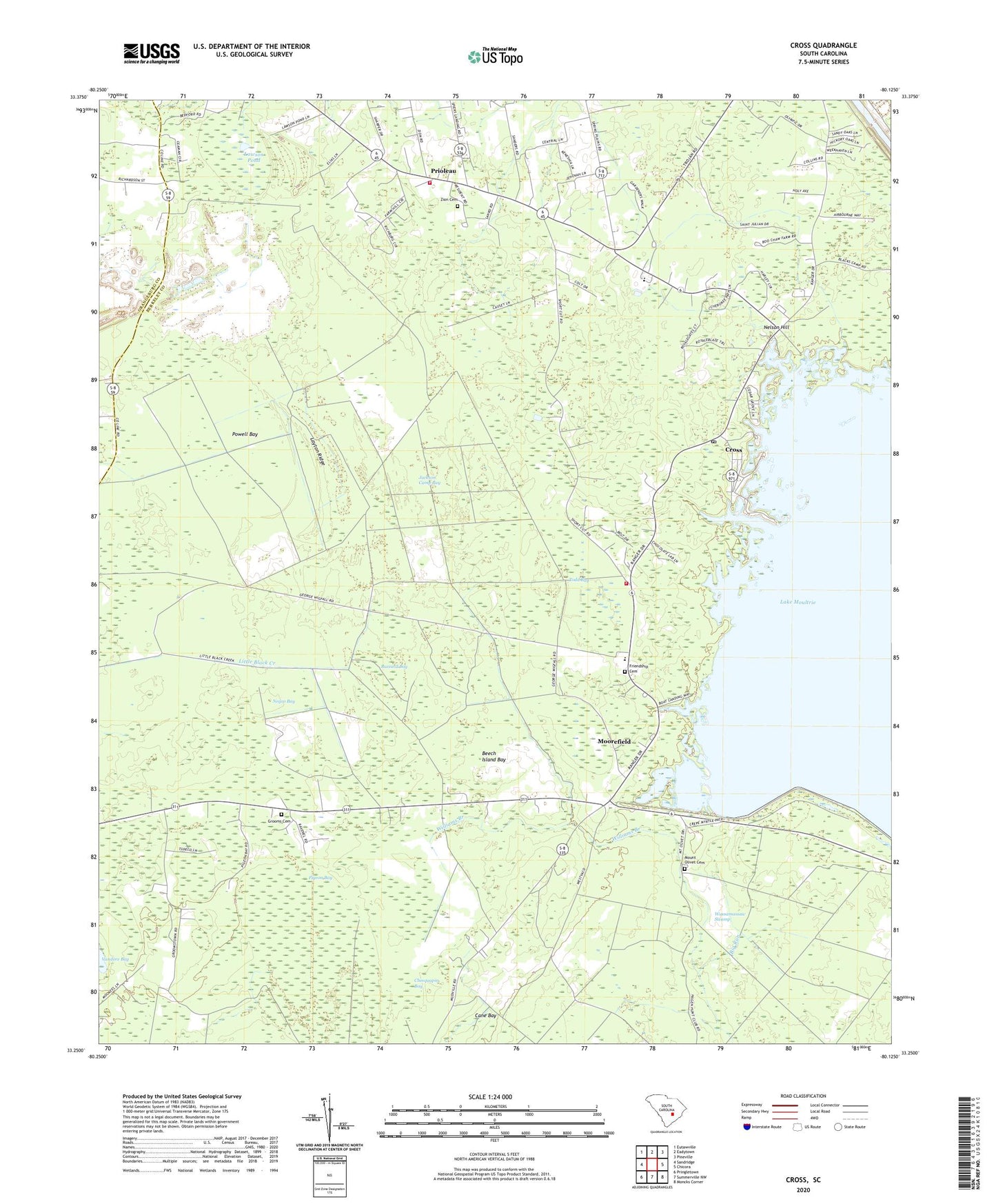
2024 topographic map quadrangle Cross in the state of South Carolina. Scale: 1:24000. Based on the newly updated USGS 7.5' US Topo map series, this map is in the following counties: Berkeley, Orangeburg. The map contains contour data, water features, and other items you are used to seeing on USGS maps, but also has updated roads and other features. This is the next generation of topographic maps. Printed on high-quality waterproof paper with UV fade-resistant inks.
Quads adjacent to this one:
West: Sandridge
Northwest: Eutawville
North: Eadytown
Northeast: Pineville
East: Chicora
Southeast: Moncks Corner
South: Summerville NW
Southwest: Pringletown
This map covers the same area as the classic USGS quad with code o33080c2.
Contains the following named places: Antioch Church, Beech Island Bay, Berkeley Quarry, Black Creek Church, Buzzard Bay, Calamus Pond School, Cane Bay, Chinquapin Bay, Cross, Cross Cross Roads, Cross Division, Cross Elementary School, Cross Fire Department Station 1, Cross Fire Department Station 2, Cross High School, Cross Lookout Tower, Cross Post Office, Cross School, Friendship Cemetery, Friendship Church, Galilee Church, Grooms Cemetery, Immanuel Church, Jackson Camp Bay, Jehovah Church, Jerusalem Church, Lawson Pond, Layton Ridge, Legare, Legare Church, Legare School, Lesesne Airport, Moorefield, Moss Grove, Moss Grove Christian Church, Mount Olivet Baptist Church, Mount Olivet Cemetery, Mudville, Negro Bay, Nelson Hill, Pigeon Bay, Plantation Church, Powell Bay, Prioleau, Saint Pauls Church, Stutch School, Todd Bay, Ward Swamp, Wassamassaw Swamp, White Swamp School, Williams Branch, Zion Cemetery, Zion Church, Zion School, ZIP Code: 29436