MyTopo
Privateer South Carolina US Topo Map
Couldn't load pickup availability
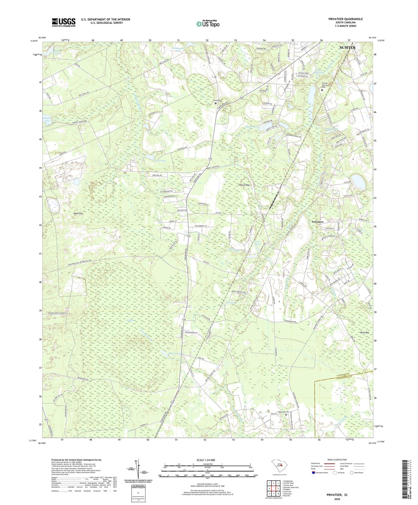
2024 topographic map quadrangle Privateer in the state of South Carolina. Scale: 1:24000. Based on the newly updated USGS 7.5' US Topo map series, this map is in the following counties: Sumter, Clarendon. The map contains contour data, water features, and other items you are used to seeing on USGS maps, but also has updated roads and other features. This is the next generation of topographic maps. Printed on high-quality waterproof paper with UV fade-resistant inks.
Quads adjacent to this one:
West: Poinsett State Park
Northwest: Wedgefield
North: Sumter West
Northeast: Sumter East
East: Brogdon
Southeast: Paxville
South: Pinewood
Southwest: Lone Star
This map covers the same area as the classic USGS quad with code o33080g4.
Contains the following named places: Ballard School, Bethel Church, Beulah Church, Beulah School, Big Bay, Briarcliff Estates, Burnt Gin Camp, Burnt Gin Lake Dam D-1450, Bush Bay, Bush Branch, Cain Millpond, Cain Mills Club, Cain Pond, Cain Pond Dam D-2058, Cains Mill Pond Dam D-1578, Camp Miller, Elliots Lake Dam D-1448, Elliott Lake, Enon Church, Forest Lake Estates, Frisco Branch, Furman High School, Harvin Bay, Harvins Crossroads, Hillside Memorial Park, Ingram School, Jones Pond, Jones Pond Dam D-1575, Korn Pond, Korn Pond Dam D-2059, Legare School, Monoghan Auxiliary Airfield, Monoghan School, Montagues Pond, Privateer, Privateer Census Designated Place, Privateer Church, Privateer Division, Privateer School, Red Oak Branch, Reynolds Cemetery, Rose School, Sand Hills, Shuler Pond Dam D-1577, Shulers Pond, Smith Cemetery, Southgate, Stubbs Pond, Sumter Calvary Church, Thomas Sumter Academy, Weeks Pond