MyTopo
Richtex South Carolina US Topo Map
Couldn't load pickup availability
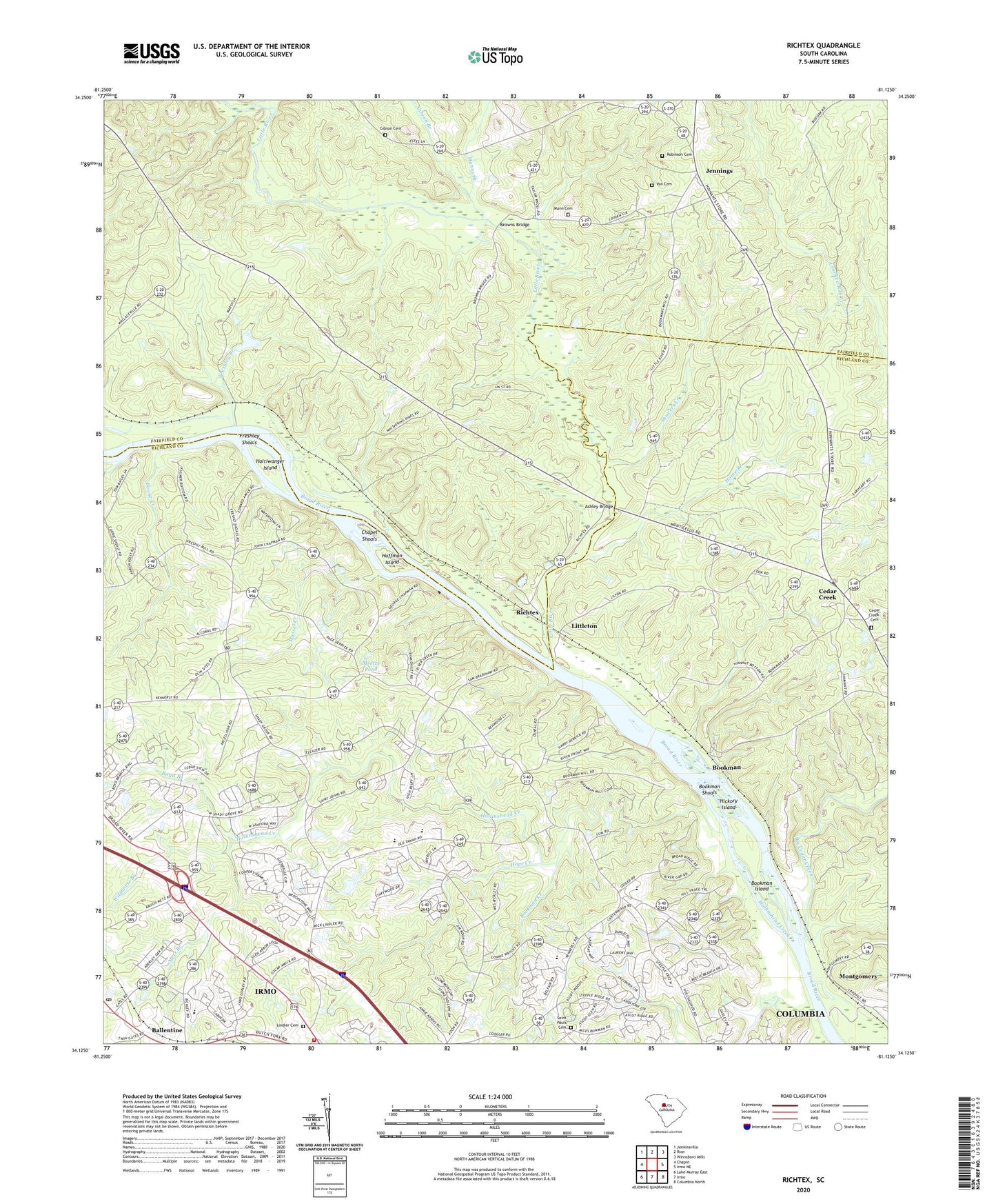
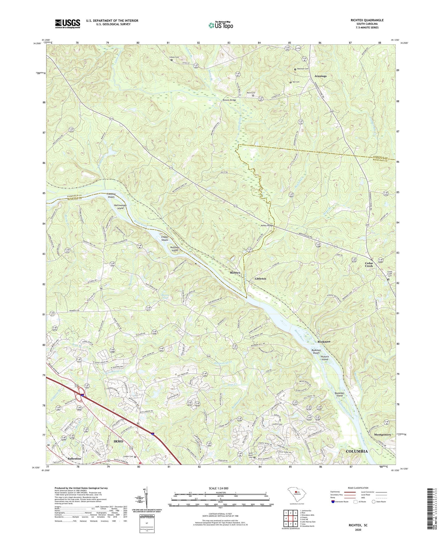
2020 topographic map quadrangle Richtex in the state of South Carolina. Scale: 1:24000. Based on the newly updated USGS 7.5' US Topo map series, this map is in the following counties: Richland, Fairfield. The map contains contour data, water features, and other items you are used to seeing on USGS maps, but also has updated roads and other features. This is the next generation of topographic maps. Printed on high-quality waterproof paper with UV fade-resistant inks.
Quads adjacent to this one:
West: Chapin
Northwest: Jenkinsville
North: Rion
Northeast: Winnsboro Mills
East: Irmo NE
Southeast: Columbia North
South: Irmo
Southwest: Lake Murray East
Contains the following named places: Ashley Bridge, Ballentine Post Office, Big Cedar Creek, Bookman, Bookman Creek, Bookman Island, Bookman Shoals, Boone Creek, Boyd Branch, Browns Bridge, Calla, Cedar Creek, Cedar Creek Cemetery, Cedar Creek Church, Cedar Creek School, Chapel Shoals, Columbia - Richland Fire Station Dutch Fork Ballentine, County Grove Church, Crooked Run Church, Dutch Fork Division, Freshley Branch, Freshley Shoals, Gibson Branch, Gibson Cemetery, Haltiwanger Island, Hawkins Pond D-1569 Dam, Hickory Island, Hollinshead Creek, Home Branch, Hope Creek, Huffman Island, Jennings, Leitner Grove School, Lindler Cemetery, Line School, Little River, Littleton, Mann Cemetery, Manns Branch, Meetze Pond, Metz Branch, Montgomery, Mussel Creek, Nicholas School, Piedmont School, Richtex, Robinson Cemetery, Saint Johns Church, Saint Johns School, Saint Pauls Cemetery, Shady Grove Church, Shavers Creek, Shiloh Church, Shiloh School, South Carolina Noname 24007 D-1263 Dam, Van Cemetery, Wallaceville School, Wateree Creek, Wayside School, Wetze Pond D-0540 Dam, Wildhorse Branch, Zion Pilgrim Church, ZIP Code: 29063