MyTopo
Salley South Carolina US Topo Map
Couldn't load pickup availability
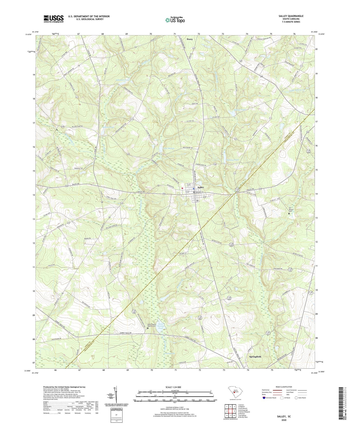
2020 topographic map quadrangle Salley in the state of South Carolina. Scale: 1:24000. Based on the newly updated USGS 7.5' US Topo map series, this map is in the following counties: Aiken, Orangeburg. The map contains contour data, water features, and other items you are used to seeing on USGS maps, but also has updated roads and other features. This is the next generation of topographic maps. Printed on high-quality waterproof paper with UV fade-resistant inks.
Quads adjacent to this one:
West: Kitchings Mill
Northwest: Seivern
North: Wagener
Northeast: Pond Branch
East: Harleys Millpond
Southeast: Norway West
South: Springfield
Southwest: Williston
Contains the following named places: Abrams Branch, Bachelor Branch School, Baileys Pond, Beaver Creek State Designated Tribal Statistical Area, Bratcher Branch, Capers Mill Pond, Capers Mill Pond Dam D-0672, Dean Swamp Baptist Cemetery, Dean Swamp Baptist Church, Dean Swamp Pond, First Baptist Church, Gin Branch, Gin Branch Cemetery, Hartley Pond, Hartley Pond D-2035 Dam, Jerusalem Branch School, Johnsons Pond, Jordan Creek, Lake Maxine, Millers Pond, Oak Branch Church, Oak Spring School, Oakland School, Rocky Grove Baptist Church, Salley, Salley Division, Salley Police Department, Salley Post Office, Salley Volunteer Fire Department, Samaria Baptist Church, Sanctified Church, Smythes School, South Carolina Noname 02019 D-2034 Dam, South Carolina Noname 02064 D-2144 Dam, South Carolina Noname 02086 D-2131 Dam, South Carolina Noname 02110 D-2133 Dam, South Carolina Noname 38005 D-3726 Dam, Springfield Rosenwall School, Town of Salley, Union Academy, Wagener Fire Tower, ZIP Codes: 29137, 29146