MyTopo
Norway West South Carolina US Topo Map
Couldn't load pickup availability
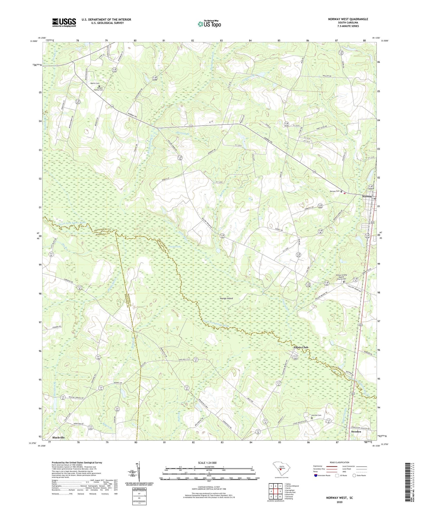
2024 topographic map quadrangle Norway West in the state of South Carolina. Scale: 1:24000. Based on the newly updated USGS 7.5' US Topo map series, this map is in the following counties: Orangeburg, Bamberg, Barnwell. The map contains contour data, water features, and other items you are used to seeing on USGS maps, but also has updated roads and other features. This is the next generation of topographic maps. Printed on high-quality waterproof paper with UV fade-resistant inks.
Quads adjacent to this one:
West: Springfield
Northwest: Salley
North: Harleys Millpond
Northeast: North
East: Norway East
Southeast: Bamberg
South: Denmark
Southwest: Blackville
This map covers the same area as the classic USGS quad with code o33081d2.
Contains the following named places: Bull Branch, Bushy Pond Church, Campbell Branch, Campbell Branch School, Cedar Grove Church, Collums Pond D-3071 Dam, Creco, Dry Branch, Duncans Bridge, Edisto Club, Good Will School, Goodland Creek, Hairs Pond D-3060 Dam, Holman Bridge, Hunter-Kinard-Tyler High School, Jericho Cemetery, Jericho Church, Jericho School, Kittrell Landing, Little Ponderosa Lake Dam D-3748, Little River, Martin Cemetery, Morgan Family Cemetery, Nicks Lake, Norway, Norway Cemetery, Norway Fire Department, Norway Post Office, Oak Ridge School, Oakland School, Pardees Pond Dam D-3747, Pleasant Branch, Pleasant Branch Church, Pleasant Branch School, Rocky Swamp Creek, Rocky Swamp School, Rogers Branch, Sheepford Branch, Slaughter Field, Snake Branch, South Carolina Noname 38068 D-3764 Dam, Sunshine Baptist Church, Sunshine School, Sweden, Sykes Swamp, Tampa Creek, Town of Norway, Tylers Landing, Waynor, West Willow School, Willow Swamp Baptist Church, Willow Swamp Baptist Church Cemetery, Windy Hill Creek, Youngs Island, ZIP Code: 29113