MyTopo
Sheldon South Carolina US Topo Map
Couldn't load pickup availability
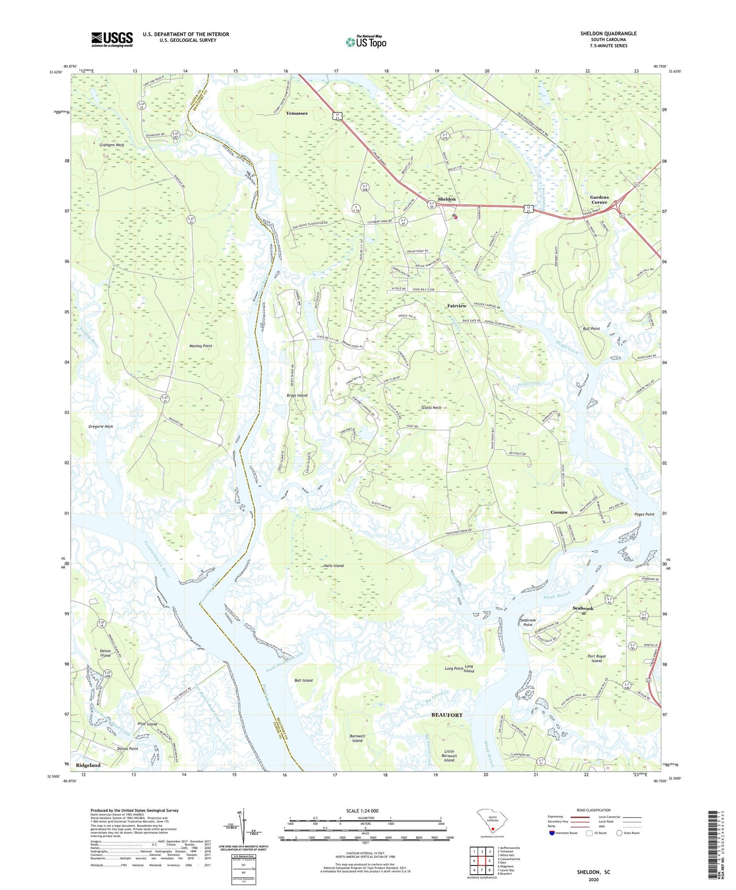
2020 topographic map quadrangle Sheldon in the state of South Carolina. Scale: 1:24000. Based on the newly updated USGS 7.5' US Topo map series, this map is in the following counties: Beaufort, Jasper. The map contains contour data, water features, and other items you are used to seeing on USGS maps, but also has updated roads and other features. This is the next generation of topographic maps. Printed on high-quality waterproof paper with UV fade-resistant inks.
Quads adjacent to this one:
West: Coosawhatchie
Northwest: McPhersonville
North: Yemassee
Northeast: White Hall
East: Dale
Southeast: Beaufort
South: Laurel Bay
Southwest: Ridgeland
Contains the following named places: Ball Island, Barnwell Island, Brays Island, Brays Island Plantation, Bull Point, Clarendon Plantation, Coosaw, Coosawhatchie River, Deloss Island, Fairview, Field Creek, Gardens Corner, Gregorie Neck, Halls Island, Haulover Creek, Huspa Creek, Huspah Church, Huspah Plantation, Jerusalem School, Knowles, Little Barnwell Island, Long Island, Long Point, Mackay Point, Mackays Point School, Oak Grove Plantation, Pages Point, Paige Point School, Pilot Island, Pocotaligo River, Prescot School, Scotts Neck, Seabrook, Seabrook Census Designated Place, Seabrook Point, Seabrook Post Office, Seabrook School, Sheldon, Sheldon Census Designated Place, Sheldon Church Ruins, Sheldon Fire Department Station 40, Sheldon Lookout Tower, Sheldon School, South Haulover Creek, Tomotley Plantation, Town of Yemassee, Tulifiny River, ZIP Code: 29941