MyTopo
Dale South Carolina US Topo Map
Couldn't load pickup availability
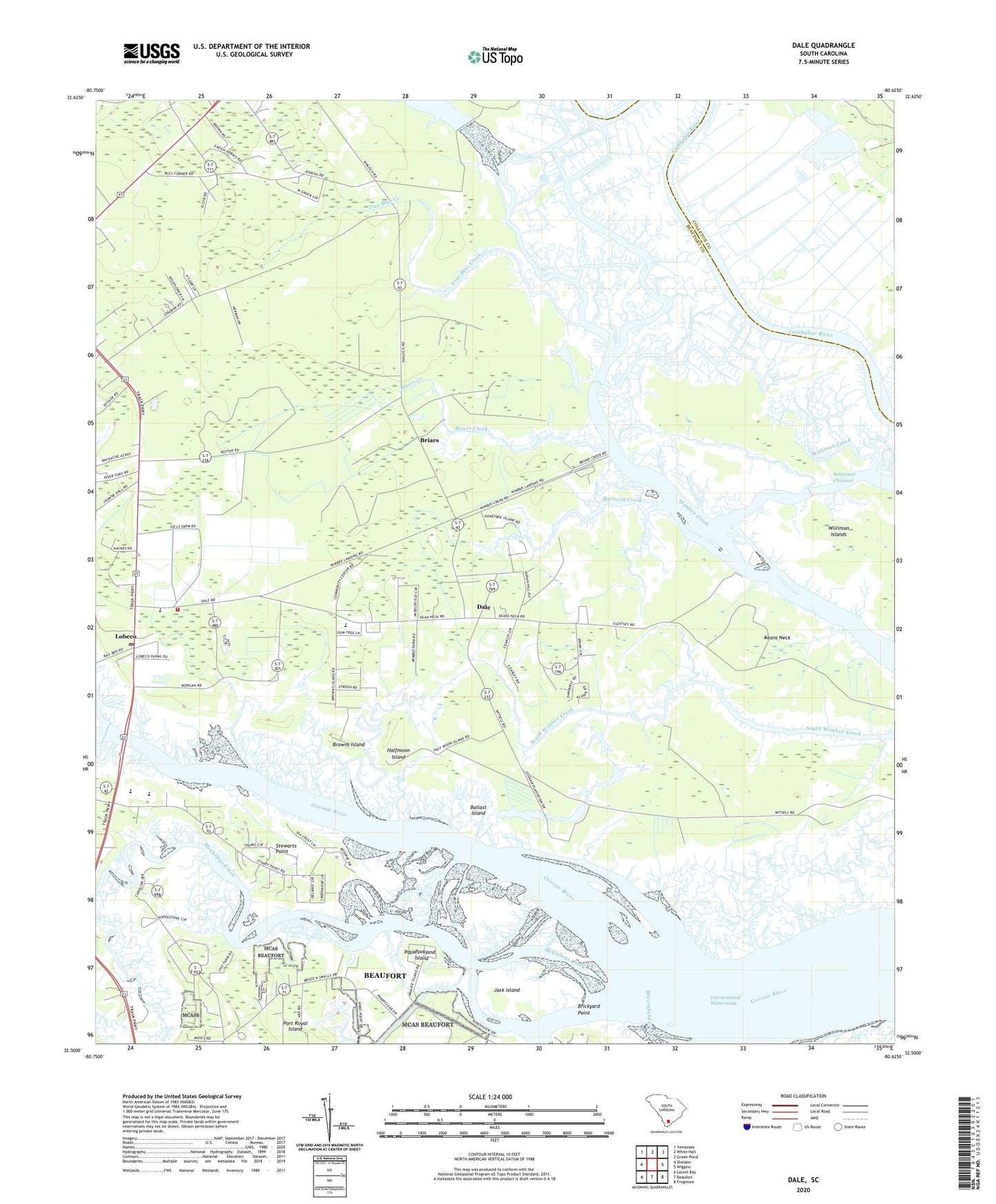
2024 topographic map quadrangle Dale in the state of South Carolina. Scale: 1:24000. Based on the newly updated USGS 7.5' US Topo map series, this map is in the following counties: Beaufort, Colleton. The map contains contour data, water features, and other items you are used to seeing on USGS maps, but also has updated roads and other features. This is the next generation of topographic maps. Printed on high-quality waterproof paper with UV fade-resistant inks.
Quads adjacent to this one:
West: Sheldon
Northwest: Yemassee
North: White Hall
Northeast: Green Pond
East: Wiggins
Southeast: Frogmore
South: Beaufort
Southwest: Laurel Bay
This map covers the same area as the classic USGS quad with code o32080e6.
Contains the following named places: Ballast Island, Barnwell Creek, Branford Creek, Briars, Briars Church, Briars Creek, Briars School, Brickyard Point, Browns Island, Chisolms, Clay Hall Plantation, Coosaw Plantation, Dale, Dale Census Designated Place, Dale Station, Gaza, Gethsemane Church, Halfmoon Island, Jack Island, James J Davis Elementary School, Jerusalem Church, Keans Neck, Keans Neck School, Lebeco Methodist Episcopal Church South, Lobeco, Lobeco Census Designated Place, Lobeco Post Office, McCalleys Creek, Oak Point Landing, Paukie Island, Porky Island, Port Royal Ferry, School for Exceptional Children, Schooner Channel, Sheldon Division, Sheldon Fire Department Station 41, South Carolina Noname 07003 D-2931 Dam, Stewarts Point, True Blue Creek, Whale Branch Elementary School, Whale Branch Middle School, Williman Islands, ZIP Code: 29940