MyTopo
Laurel Bay South Carolina US Topo Map
Couldn't load pickup availability
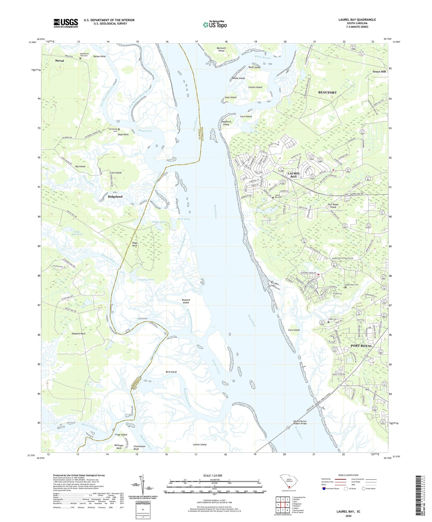
2024 topographic map quadrangle Laurel Bay in the state of South Carolina. Scale: 1:24000. Based on the newly updated USGS 7.5' US Topo map series, this map is in the following counties: Beaufort, Jasper. The map contains contour data, water features, and other items you are used to seeing on USGS maps, but also has updated roads and other features. This is the next generation of topographic maps. Printed on high-quality waterproof paper with UV fade-resistant inks.
Quads adjacent to this one:
West: Ridgeland
Northwest: Coosawhatchie
North: Sheldon
Northeast: Dale
East: Beaufort
Southeast: Parris Island
South: Spring Island
Southwest: Jasper
This map covers the same area as the classic USGS quad with code o32080d7.
Contains the following named places: Bethlehem Church, Big Island, Big Island Creek, Big Pond, Bird Island, Bird Island Creek, Bluff Island, Bolon Hall, Bolon Hall Landing, Boyd Creek, Boyd Neck, Broad River Bluff, Broad River Elementary School, Burton Fire Department Habersham, Burton Fire Department Pinewood, Buzzard Island, Buzzard Island Creek, Canaan Church, Capehart Housing Project, Chechessee Bluff, Chesterfield, Cole Island, Cole Island Fish Camp, Coles Creek, Corn Island, Cotton Island, Deloss Point, East Branch Boyd Creek, Edward Burton Rodgers Bridge, Euhaw Creek, Fripp Cemetery, Fripp Island, Goat Island, Gregory Pond, Habersham Cemetery, Habersham Creek, Hazzard Creek, Hazzard Neck, Hogs Neck, Irongate, Joseph S Shanklin Elementary School, Kern Pond Dam D-2938, Laurel Bay, Laurel Bay Cemetery, Laurel Bay Census Designated Place, Laurel Bay Church, Laurel Bay Shopping Center, Lawson Bay Church, Lemon Island, Little Laurel Bay Church, Macedonia Church, Marine Corp Air Station Beaufort, Middle Pond, Murad, Oakmont, Pine Grove Church, Pinewood, Pleasant Farm, Porter School, Quail Ridge, Republican Hall Cemetery, River Pond, River Reach, Riverdale, Rose Hill Church, Salvesbarg Cemetery, Salvesbarg Landing, School Number 1, School Number 2, Shepherd Island, West Branch Boyd Creek, Whale Branch, Whale Island, White Hall Pond, White Oaks, ZIP Code: 29906