MyTopo
McPhersonville South Carolina US Topo Map
Couldn't load pickup availability
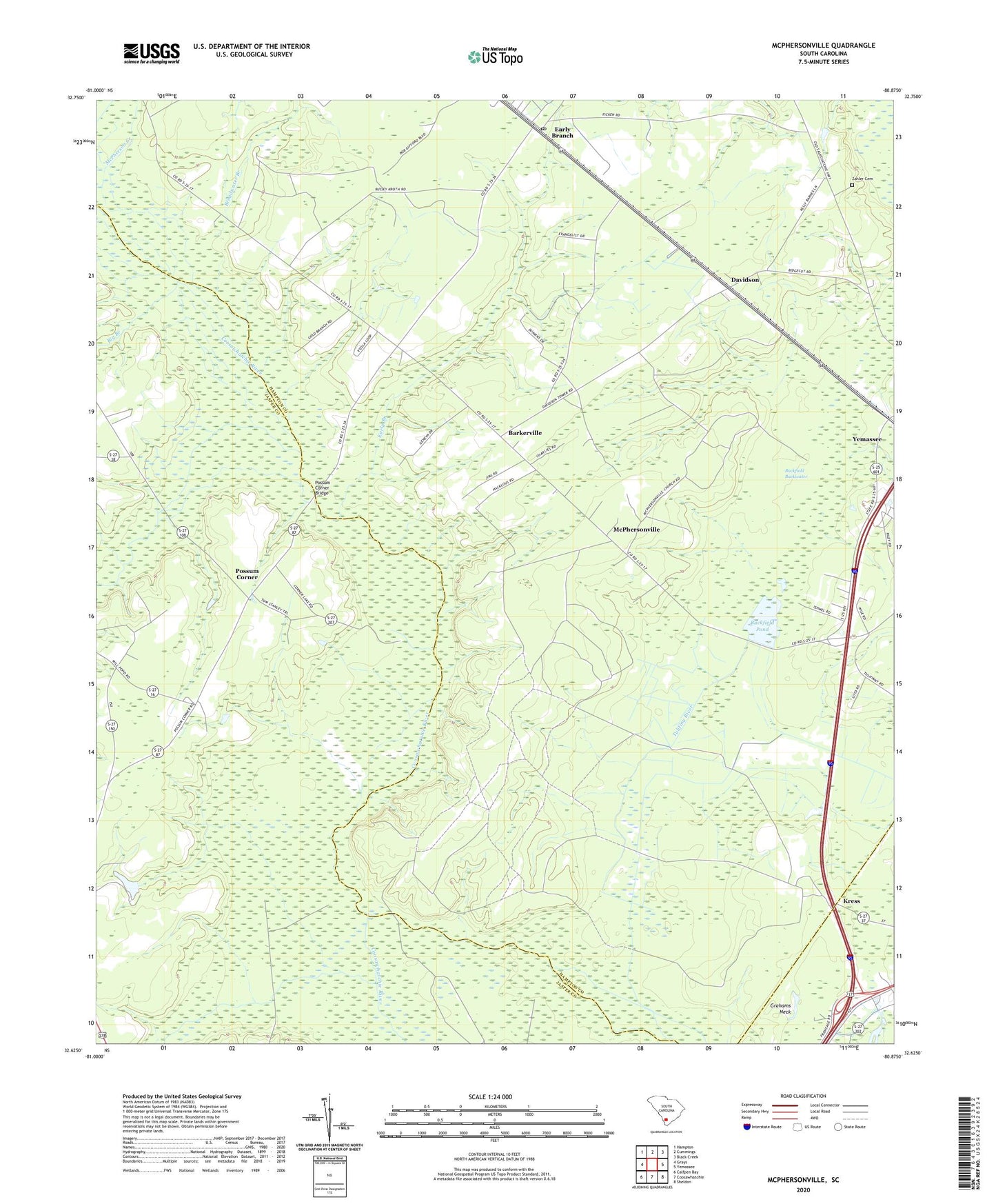
2024 topographic map quadrangle McPhersonville in the state of South Carolina. Scale: 1:24000. Based on the newly updated USGS 7.5' US Topo map series, this map is in the following counties: Hampton, Jasper. The map contains contour data, water features, and other items you are used to seeing on USGS maps, but also has updated roads and other features. This is the next generation of topographic maps. Printed on high-quality waterproof paper with UV fade-resistant inks.
Quads adjacent to this one:
West: Grays
Northwest: Hampton
North: Cummings
Northeast: Black Creek
East: Yemassee
Southeast: Sheldon
South: Coosawhatchie
Southwest: Calfpen Bay
This map covers the same area as the classic USGS quad with code o32080f8.
Contains the following named places: Bakersville Church, Barkerville, Big Branch, Broadwater Branch, Buckfield Backwater, Buckfield Plantation, Buckfield Pond, Davidson, Early Branch, Early Branch Post Office, Kress, Kress School, Lowcountry Regional Industrial Park, McPherson Creek, McPhersonville, McPhersonville Church, McPhersonville School, Possum Corner, Possum Corner Bridge, Ridgeville Church, Rock Spring Church, Rock Spring School, South Carolina Noname 25002 D-2602 Dam, Wilkerson Church, Yemassee Division, Zahler Cemetery, ZIP Code: 29916