
MyTopo
Stover South Carolina US Topo Map
Couldn't load pickup availability
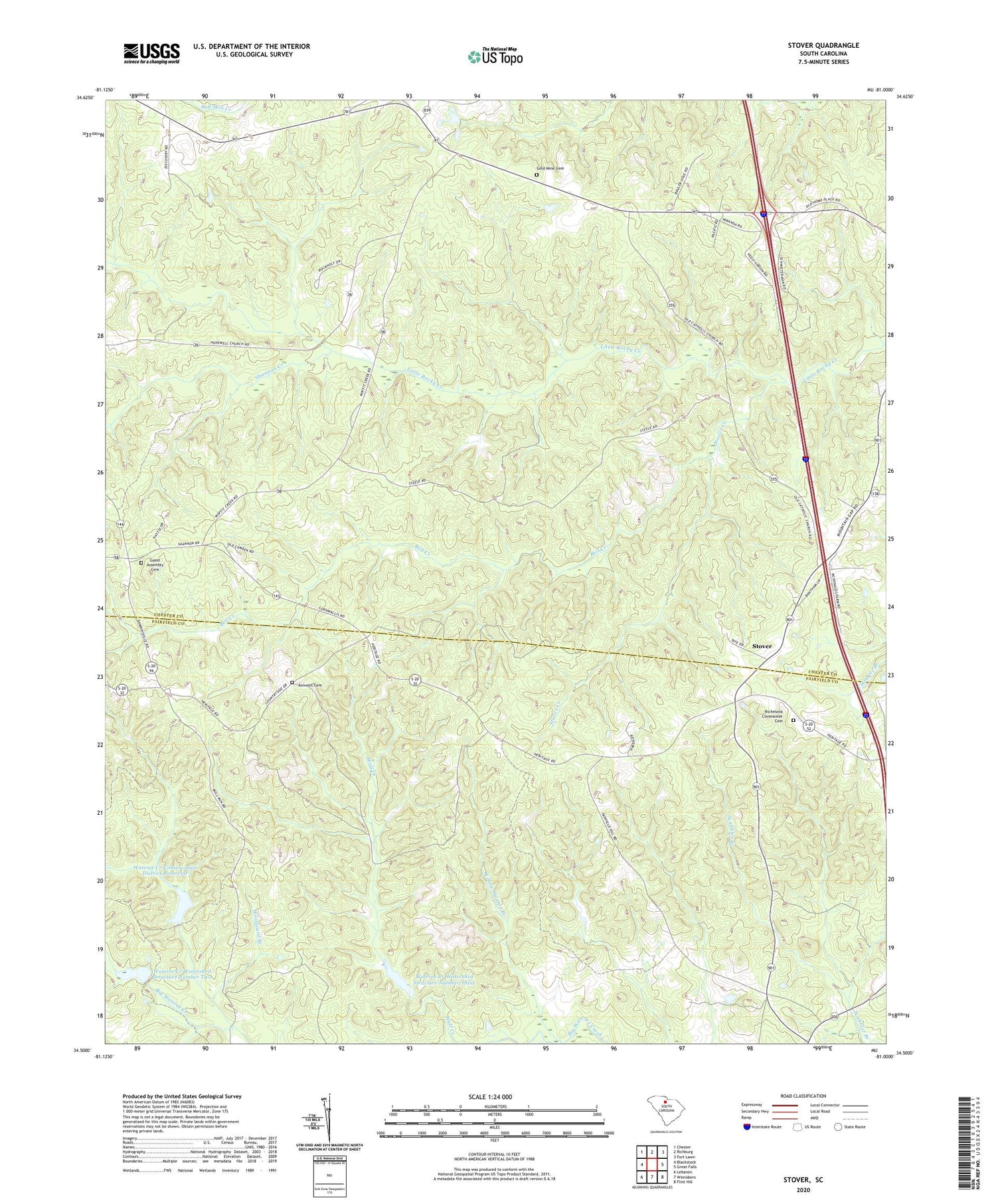
2020 topographic map quadrangle Stover in the state of South Carolina. Scale: 1:24000. Based on the newly updated USGS 7.5' US Topo map series, this map is in the following counties: Chester, Fairfield. The map contains contour data, water features, and other items you are used to seeing on USGS maps, but also has updated roads and other features. This is the next generation of topographic maps. Printed on high-quality waterproof paper with UV fade-resistant inks.
Quads adjacent to this one:
West: Blackstock
Northwest: Chester
North: Richburg
Northeast: Fort Lawn
East: Great Falls
Southeast: Flint Hill
South: Winnsboro
Southwest: Lebanon
Contains the following named places: Aimwell Cemetery, Aimwell Church, Aimwell School, Bell Creek, Gladden Grove, Gladden Grove Church, Gladden Grove School, Gold Mine Cemetery, Gold Mine Church, Guest Assembly Cemetery, Hebron Church, New Zion Church, New Zion School, Old Catholic Church, Richmond Covenanter Cemetery, Shannon Creek, Stover, Stover Creek, Wateree Creek Conservation District Reservoir, Wateree Creek Watershed Structure Number Three, Wateree Creek Watershed Structure Number Two, Wateree Creek WCD Dam Number One D-0536, Wateree Creek WCD Dam Number Three D-0538, Wateree Creek WCD Dam Number Two D-0537, Wellridge, Wellridge School, White Chapel, Willow Swamp Branch, Woodward Branch, ZIP Code: 29014


