MyTopo
Fort Lawn South Carolina US Topo Map
Couldn't load pickup availability
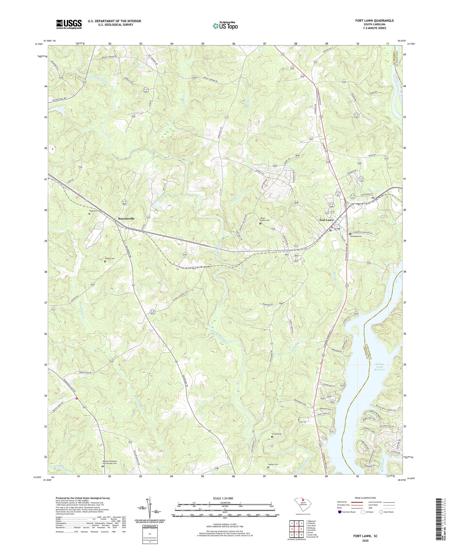
2024 topographic map quadrangle Fort Lawn in the state of South Carolina. Scale: 1:24000. Based on the newly updated USGS 7.5' US Topo map series, this map is in the following counties: Chester, Lancaster. The map contains contour data, water features, and other items you are used to seeing on USGS maps, but also has updated roads and other features. This is the next generation of topographic maps. Printed on high-quality waterproof paper with UV fade-resistant inks.
Quads adjacent to this one:
West: Richburg
Northwest: Edgemoor
North: Catawba
Northeast: Van Wyck
East: Lancaster
Southeast: Lancaster SE
South: Great Falls
Southwest: Stover
This map covers the same area as the classic USGS quad with code o34080f8.
Contains the following named places: Ararat Cemetery, Ararat Church, Ararat School, Bascomville, Blakles Caldwells and Strouds Cemetery, Cedar Shoals Church, Courtney Island, Dairy Branch, Elmwood Cemetery, Fort Lawn, Fort Lawn Elementary School, Fort Lawn Fire Department Station 2, Fort Lawn Police Department, Fort Lawn Post Office, Fudges, Hopewell Cemetery, Howze Cemetery, Lake View, Love-Charity Church, McDonalds Ferry, McDonalds Ford, Mount Nebo Church, Mount Prospect Church, Mount Vernon Church, Nero School, Reaves Creek, Rocky Creek WCD Dam Number One D-0212, Rossville Fire Department Station 2, Shepherds Pond D-1437 Dam, Stroud Cemetery, Taylors Island, Tinkers Creek, Town of Fort Lawn, Union Ezella Cemetery, Zion Church, ZIP Code: 29714