MyTopo
Richburg South Carolina US Topo Map
Couldn't load pickup availability
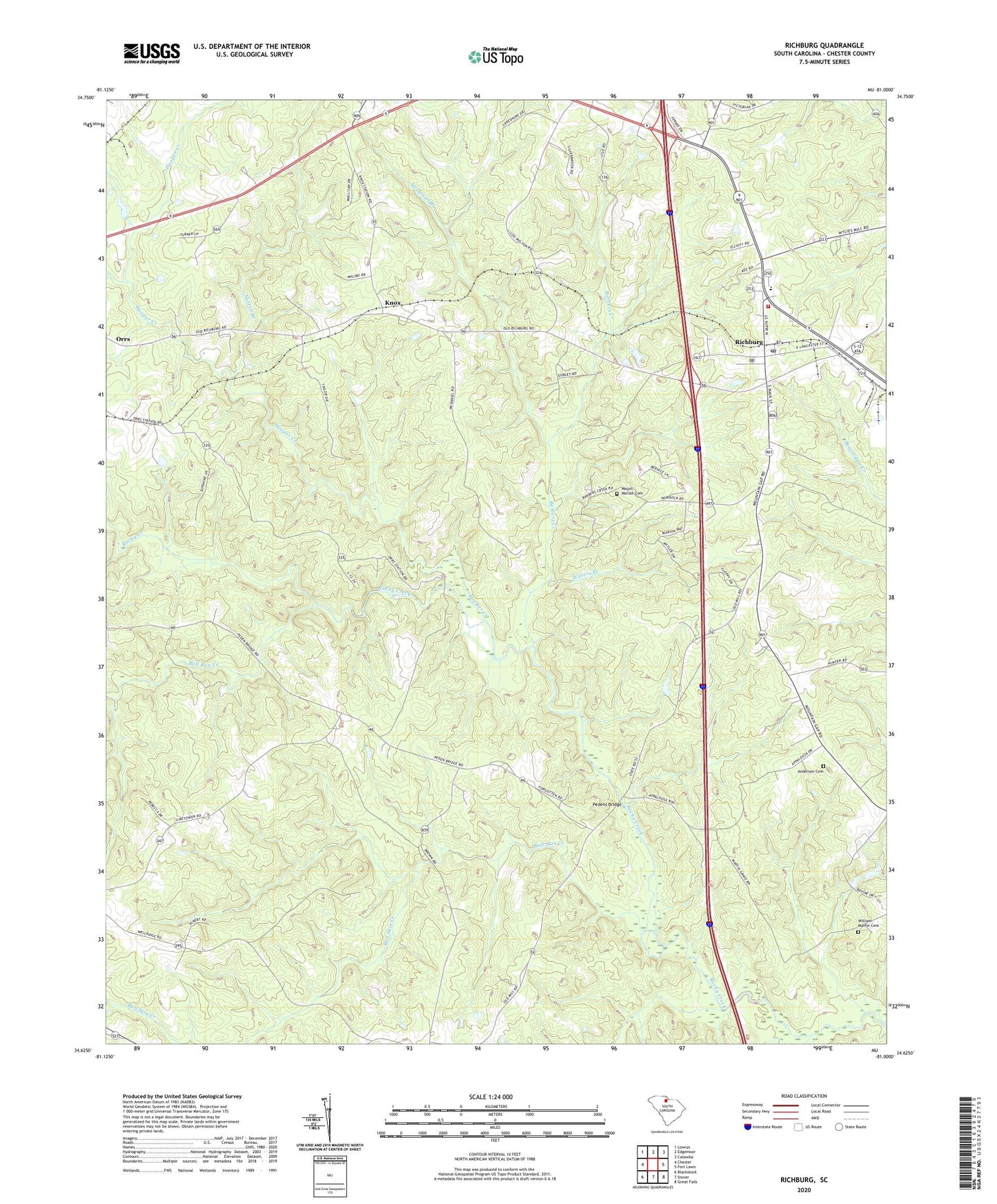
2024 topographic map quadrangle Richburg in the state of South Carolina. Scale: 1:24000. Based on the newly updated USGS 7.5' US Topo map series, this map is in the following counties: Chester. The map contains contour data, water features, and other items you are used to seeing on USGS maps, but also has updated roads and other features. This is the next generation of topographic maps. Printed on high-quality waterproof paper with UV fade-resistant inks.
Quads adjacent to this one:
West: Chester
Northwest: Lowrys
North: Edgemoor
Northeast: Catawba
East: Fort Lawn
Southeast: Great Falls
South: Stover
Southwest: Blackstock
This map covers the same area as the classic USGS quad with code o34081f1.
Contains the following named places: Anderson Cemetery, Barbers Creek, Binghamtown, Black Rock Baptist Church, Black Rock School, Brick Church, Bull Run Creek, Bull Skin Creek, Chester Lookout Tower, Counterman Farm, Crisler Pond D-1438 Dam, Goldmine School, Hooper Creek, Knox, Lewisville, Lewisville High School, McDaniel Branch, Melton Branch, Mount Moriah Cemetery, Mount Pleasant Church, Orrs, Pedens Bridge, Pryor Church, Richburg, Richburg Division, Richburg Fire Department, Saint Philips Church, Stevens Farms, Tip Top, Town of Richburg, Union Church, Waters Branch, Well Ridge Church, William Martin Cemetery, ZIP Code: 29729