MyTopo
Tillman South Carolina US Topo Map
Couldn't load pickup availability
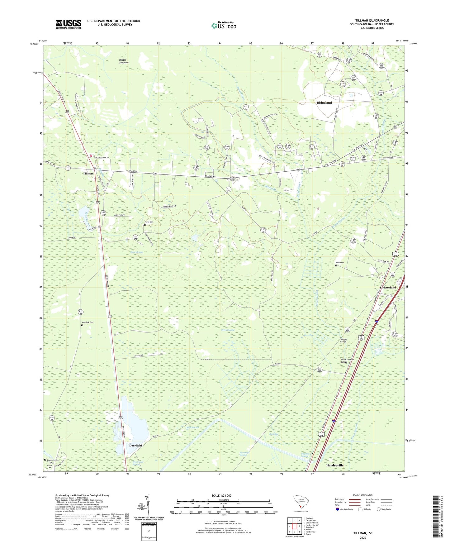
2020 topographic map quadrangle Tillman in the state of South Carolina. Scale: 1:24000. Based on the newly updated USGS 7.5' US Topo map series, this map is in the following counties: Jasper. The map contains contour data, water features, and other items you are used to seeing on USGS maps, but also has updated roads and other features. This is the next generation of topographic maps. Printed on high-quality waterproof paper with UV fade-resistant inks.
Quads adjacent to this one:
West: Hardeeville NW
Northwest: Pineland
North: Calfpen Bay
Northeast: Coosawhatchie
East: Ridgeland
Southeast: Jasper
South: Hardeeville
Southwest: Rincon
Contains the following named places: Arm Oak Cemetery, Arm Oak Church, Bagshaw Swamp, Broad Water, Buck Bay, Burton School, Darn Swamp, Deerfield, Ellis Community School, Floyd Cemetery, Great Swamp Bridge, Great Swamp Church, Green Swamp, Hectic Savannas, House of Prayer, Humberts Cemetery, Jasper County, Jasper County Fire Department Station 47, Mew Cemetery, Mount Zion Church, Okatee Club, Porter Cemetery, Rhoden Ward Cemetery, Saint Johns Church, Saint Matthews Church, Sand Branch, Sevenmile Swamp, South Carolina Noname 27009 D-2590 Dam, Switzerland, Switzerland Canal, Tillman, Tillman School, Wagon Branch, WCOG-AM (Ridgeland), Wiggins Bridge, Zion Ritter Church