MyTopo
Pineland South Carolina US Topo Map
Couldn't load pickup availability
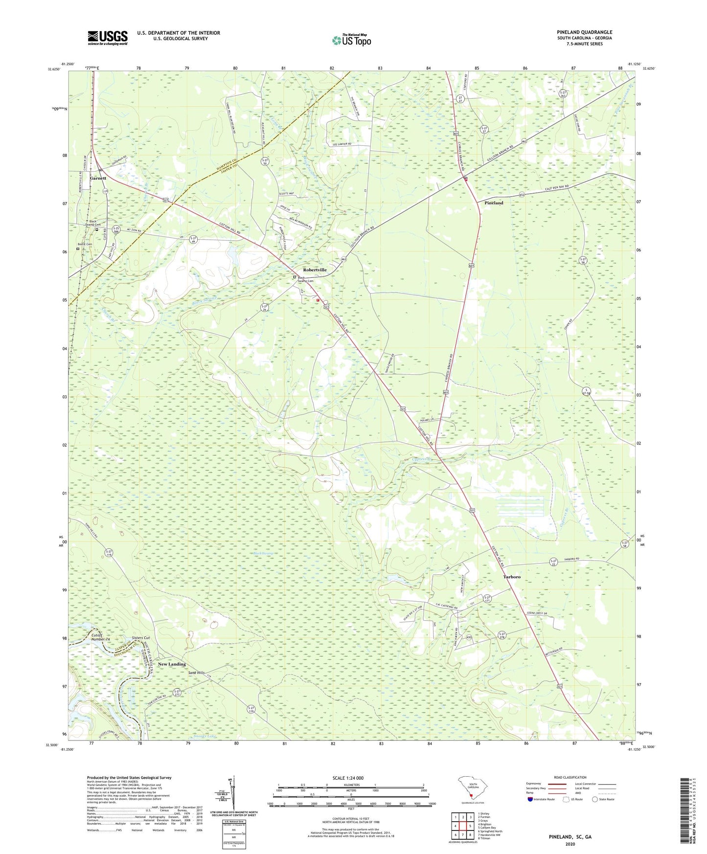
2024 topographic map quadrangle Pineland in the states of South Carolina, Georgia. Scale: 1:24000. Based on the newly updated USGS 7.5' US Topo map series, this map is in the following counties: Jasper, Hampton, Effingham. The map contains contour data, water features, and other items you are used to seeing on USGS maps, but also has updated roads and other features. This is the next generation of topographic maps. Printed on high-quality waterproof paper with UV fade-resistant inks.
Quads adjacent to this one:
West: Brighton
Northwest: Shirley
North: Furman
Northeast: Grays
East: Calfpen Bay
Southeast: Tillman
South: Hardeeville NW
Southwest: Springfield North
This map covers the same area as the classic USGS quad with code o32081e2.
Contains the following named places: Antioch Church, Antioch School, Baxter Pond, Bethel Church, Black Swamp, Black Swamp Baptist Church, Black Swamp Cemetery, Bostic Cemetery, Bowdens Hunting Lodge, Cedar Grove School, Church Branch, Cosby, Cutoff Number 7A, Cypress Branch, Cypress Plantation, Cypress School, Dupies Ferry, Garnett, Garnett Church, Garnett Post Office, Garnett School, Good Hope Church, Good Hope School, Highsmiths Sawmill, Jasper County Fire Department Station 43, Jasper Fire Department Station 44, Kennedy Lake, Long Branch, Long Branch School, Mount Zion African Methodist Episcopal Church, New Landing, Pine Land Hunting Club, Pine Savannah Branch, Pineland, Robertsville Baptist Church, Robertsville School, Robertville, Saint Johns Church, Saint Mariah Church, Saint Marys Church, Sand Hills, Sisters Cut, Solomon Temple, South Carolina Noname 27001 D-2587 Dam, Tarboro, Tarboro School, Tarboro Station, Titi School, Two Sisters Ferry